MyTopo
Wentworth New Hampshire US Topo Map
Couldn't load pickup availability
Also explore the Wentworth Forest Service Topo of this same quad for updated USFS data
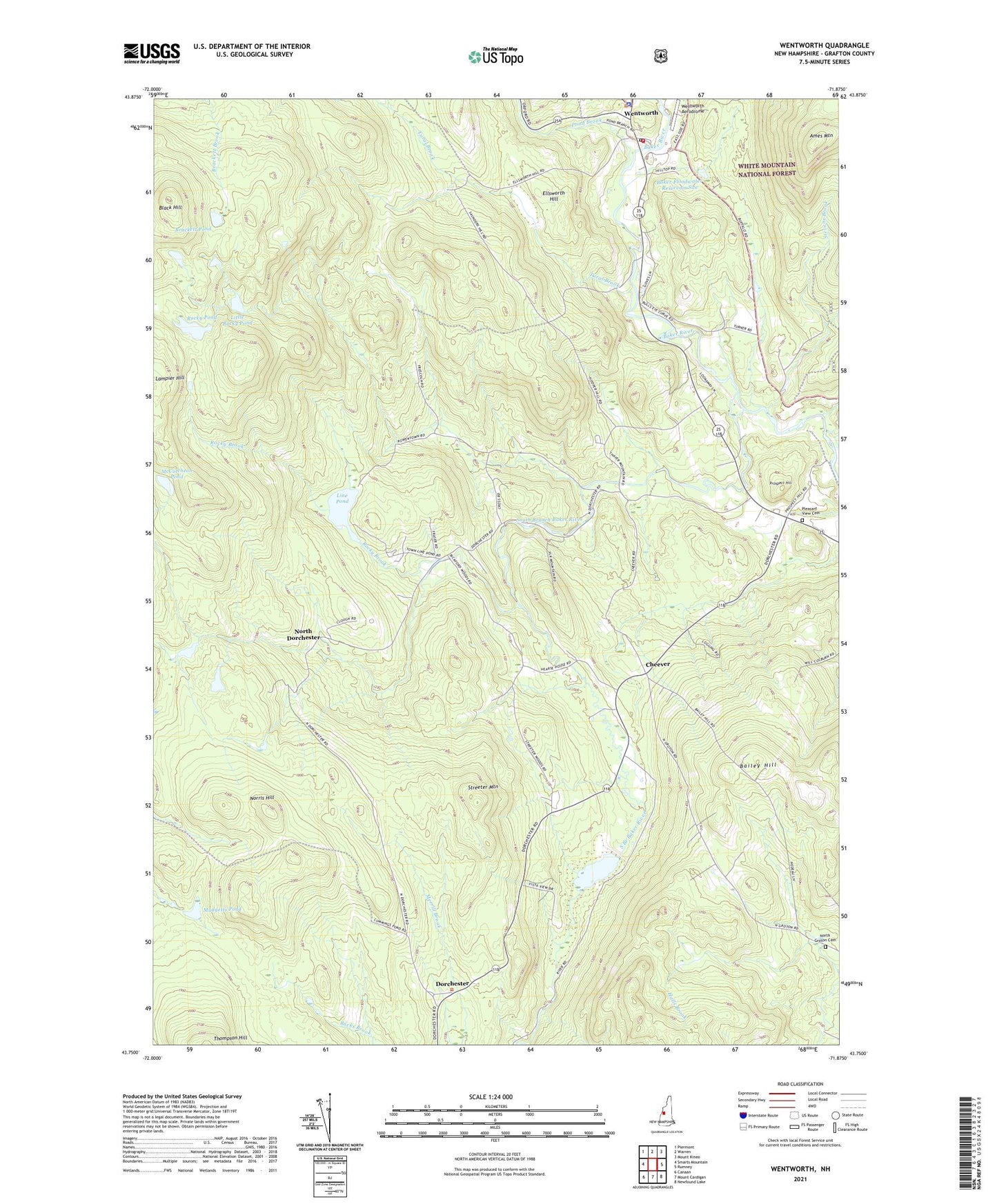
2024 topographic map quadrangle Wentworth in the state of New Hampshire. Scale: 1:24000. Based on the newly updated USGS 7.5' US Topo map series, this map is in the following counties: Grafton. The map contains contour data, water features, and other items you are used to seeing on USGS maps, but also has updated roads and other features. This is the next generation of topographic maps. Printed on high-quality waterproof paper with UV fade-resistant inks.
Quads adjacent to this one:
West: Smarts Mountain
Northwest: Piermont
North: Warren
Northeast: Mount Kineo
East: Rumney
Southeast: Newfound Lake
South: Mount Cardigan
Southwest: Canaan
This map covers the same area as the classic USGS quad with code o43071g8.
Contains the following named places: Ames Mountain, Atwell Brook, Bailey Hill, Baker Floodwater Reservoir Site, Baker Floodwater Reservoir Site 11 Dam, Baker Floodwater Reservoir Site 11a Dam, Baker Floodwater Reservoir Site 6A Dam, Baker Floodwater Reservoir Site 8 Dam, Black Hill, Brackett Pond, Buffalo School, Cheever, Dorchester, Dorchester Common Historic District, Dorchester Community Church, Ellsworth Hill, Higher Ground Camp, Line Pond, Little Rocky Pond, McCutcheon Pond, Mudgetts Pond, Norris Hill, North Dorchester, North Groton Cemetery, Pleasant View Cemetery, Pond Brook, Prospect Hill, Rocky Brook, Rocky Pond, South Branch Baker River, South Branch Baker River Reservoir, Stevens Brook, Streeter Mountain, Swainboro Station, Town of Dorchester, Town of Wentworth, Tural Brook, Wentworth, Wentworth Aerodrome, Wentworth Congregational Church, Wentworth Police Dept, Wentworth Post Office, Wentworth Volunteer Fire Department, West Rumney Post Office, ZIP Codes: 03266, 03282