MyTopo
Derry New Hampshire US Topo Map
Couldn't load pickup availability
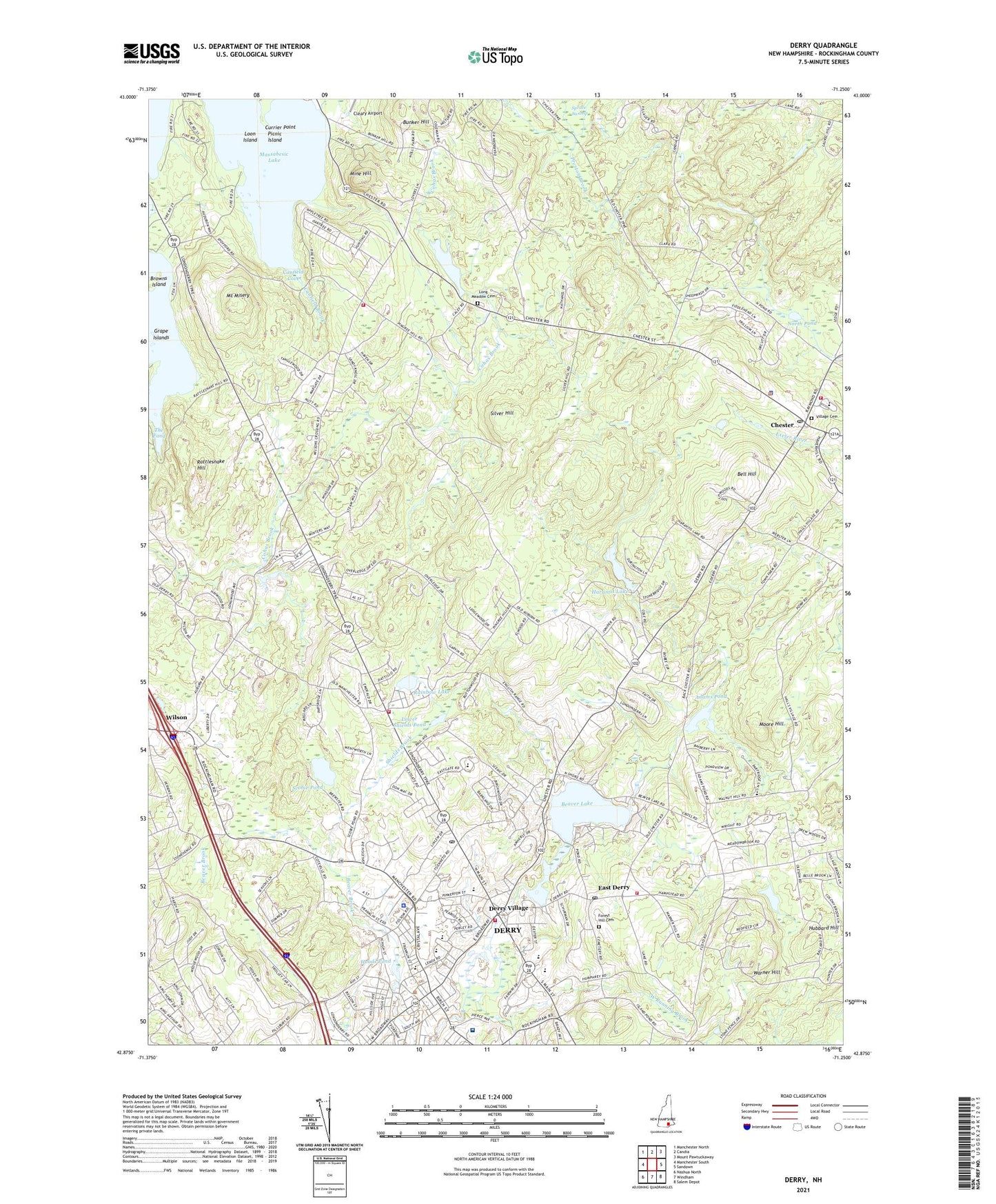
2021 topographic map quadrangle Derry in the state of New Hampshire. Scale: 1:24000. Based on the newly updated USGS 7.5' US Topo map series, this map is in the following counties: Rockingham. The map contains contour data, water features, and other items you are used to seeing on USGS maps, but also has updated roads and other features. This is the next generation of topographic maps. Printed on high-quality waterproof paper with UV fade-resistant inks.
Quads adjacent to this one:
West: Manchester South
Northwest: Manchester North
North: Candia
Northeast: Mount Pawtuckaway
East: Sandown
Southeast: Salem Depot
South: Windham
Southwest: Nashua North
Contains the following named places: Adams Pond, Adams Pond Dam, Adventures In Learning Child Care Center, Alexander-Carr Playground, Auburn Fire Department Station 1, Auburn Village School, Beaver Brook Dam, Beaver Lake, Beaver Lake Dam, Bell Hill, Benjamin Adams Pond, Benjamin C Adams Dam, Boys and Girls Club, Bunker Hill, Calef Pond, Calvary Bible Church, Calvary Chapel Merrimack, Calvary Christian School, Canfield Brook, Canfield Cove, Carr Playground, Central Congregational Church, Chester, Chester Academy, Chester College of New England, Chester Congregational Church, Chester Fire Department, Chester Police Department, Chester Post Office, Chester Preschool and Kindergarten, Chester Public Library, Chester Self - Education Center, Childrens House of Derry Child Care Center, Church of the Transfiguration, Circle of Friends School, Currier Point, Derry, Derry Census Designated Place, Derry Fire Department Station 1, Derry Fire Department Station 3, Derry Fire Department Station 4, Derry Montessori School, Derry Police Department, Derry Post Office, Derry Public Library, Derry Town Hall, Derry Village, Derry Village School, Devils Den Lookout Tower, East Derry, East Derry Historic District, East Derry Post Office, Ernest P Barka Elementary School, First Baptist Church, First Church of Christ Scientist, First Parish Church, Forest Hill Cemetery, Gilbert H Hood Middle School, Grape Islands, Greater Derry Chamber of Commerce, Greater Derry Church of Christ, Grinnell School, Harantis Dam, Harantis Lake, Hood Commons Shopping Center, Hood Park, Hood Shopping Plaza Shopping Center, Hoodkroft Country Club, Hoods Pond, Hoods Pond Dam, Horns Pond, Hubbard Hill, Long Meadow Cemetery, Long Meadow Church, Loon Island, Lower Shields Pond, MacGregor Park, Massabesic Lake, Mine Hill, Moonscape Playground, Moore Hill, Mount Misery, North Pond, Nutfield Cooperative School, Nutfield Surgicenter, Parkland Medical Center, Parkland Medical Center Library, Picnic Island, Pinkerton Academy, Rainbow Lake, Rattlesnake Hill, Saint Lukes United Methodist Church, Saint Thomas Aquinas Parish Church, Saint Thomas Aquinas School, Scobie Pond, Shields Brook, Silver Hill, Sonshine Preschool and Daycare, Spruce Swamp, Stepping Stones School, Taylor Library, The Fang, The Meadow Reservoir, Tiny Tots Preschool and Kindergarten, Town of Auburn, Town of Chester, Town of Derry, Trinity Assembly of God Church, Trinity Christian Assembly, Village Cemetery, Wadleigh Library, Warner Hill, West Running Brook, West Running Brook Middle School, West Side Community Center, Wilson, ZIP Codes: 03032, 03036, 03038