MyTopo
Sandown New Hampshire US Topo Map
Couldn't load pickup availability
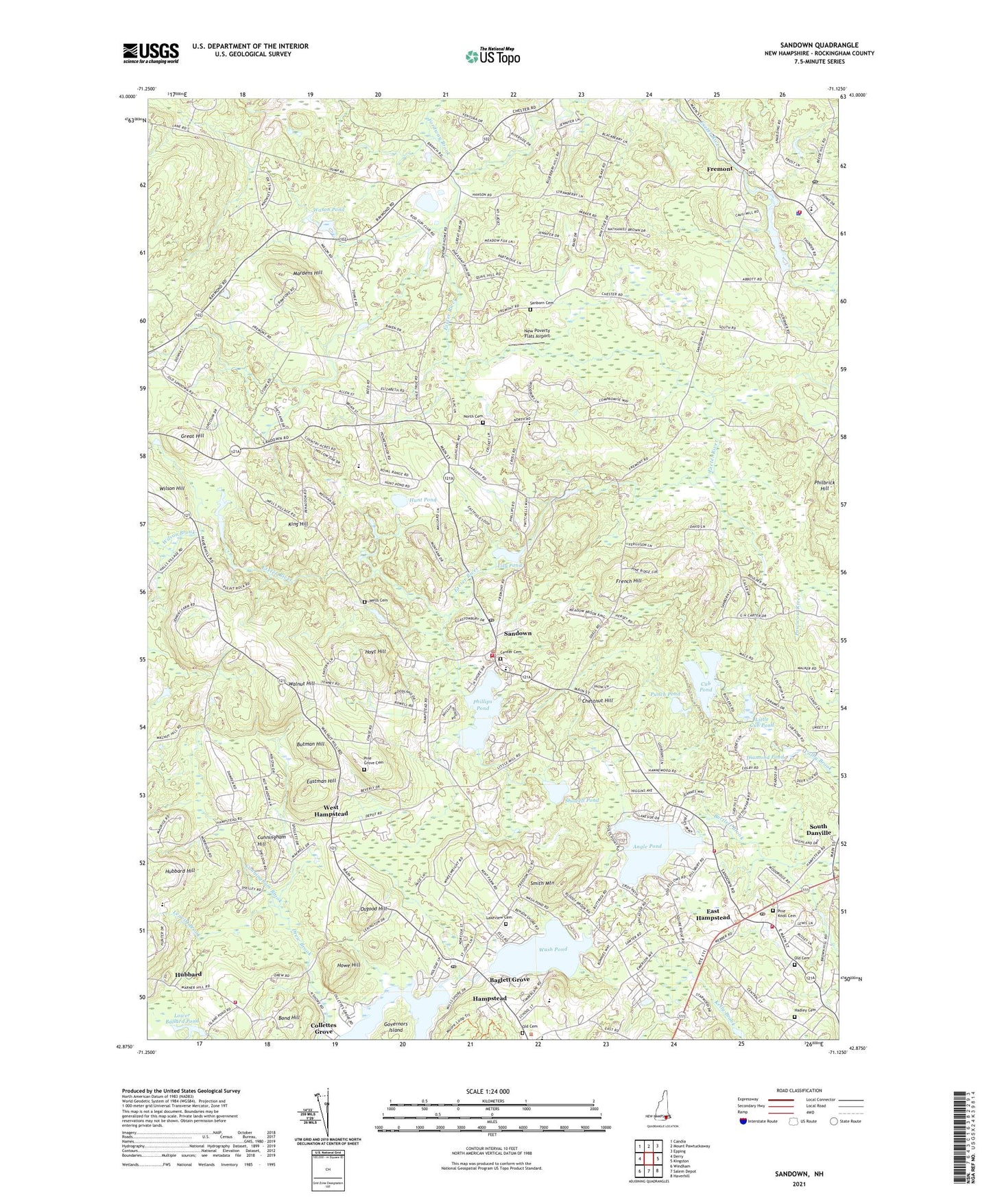
2024 topographic map quadrangle Sandown in the state of New Hampshire. Scale: 1:24000. Based on the newly updated USGS 7.5' US Topo map series, this map is in the following counties: Rockingham. The map contains contour data, water features, and other items you are used to seeing on USGS maps, but also has updated roads and other features. This is the next generation of topographic maps. Printed on high-quality waterproof paper with UV fade-resistant inks.
Quads adjacent to this one:
West: Derry
Northwest: Candia
North: Mount Pawtuckaway
Northeast: Epping
East: Kingston
Southeast: Haverhill
South: Salem Depot
Southwest: Windham
This map covers the same area as the classic USGS quad with code o42071h2.
Contains the following named places: Ages and Stages Learning Center, Angle Pond, Angle Pond Campground, Angle Pond Dam, Baglett Grove, Ballard Pond Dam Omitted, Ballard Pond Upper Dam, Bond Hill, Butman Hill, Center Cemetery, Chestnut Hill, Collettes Grove, Cub Pond, Cunningham Brook, Cunningham Hill, Danville Elementary School, Derry Fire Department Station 2, Diamond Pond, East Derry Memorial Elementary School, East Hampstead, East Hampstead Post Office, Eastman Hill, Ellis School, Emersons Camping Area, Fellowship In His Love Church, Fordway Brook, Fremont, Fremont Early Learning Environment Child Care Center, Fremont Fire Rescue Department, Fremont Police Department, Fremont Post Office, French Hill, Great Hill, Hadley Cemetery, Hampstead Congregational Church, Hampstead Fire Rescue East Hampstead Station, Hampstead Middle School, Hampstead Post Office, Hidden Valley Campground, Howe Hill, Hoyt Hill, Hubbard, Hunt Pond, King Hill, Lakeview Cemetery, Leavitt Brook, Lily Pond, Little Cub Pond, Little Cub Pond Dam, Lower Ballard Pond, Main Street Friends Child Care Center, Mardens Hill, New Poverty Flats Airport, North Cemetery, Old Cemetery, Osgood Hill, Phillips Pond, Pine Grove Cemetery, Pine Knoll Cemetery, Playmates Learning Center, Punch Pond, Saint Annes Church, Saint Matthews United Methodist Church, Sanborn Cemetery, Sandown, Sandown Central School, Sandown Fire and Rescue, Sandown Fire and Rescue Substation, Sandown North Elementary School, Sandown Police Department, Sandown Post Office, Sandown Town Hall, Shoppers Village Shopping Center, Showell Pond, Smith Mountain, South Danville, Stepping Stones School, Sunset Park Campground, Taylor Mill, The Preschool Learning Center, Town of Hampstead, Town of Sandown, Walnut Hill, Wash Pond, Wash Pond Dam, Wason Pond, Wason Pond Dam, Wells Cemetery, West Hampstead, Wilson Brook, Wilson Hill, ZIP Codes: 03826, 03841, 03873