MyTopo
Manchester North New Hampshire US Topo Map
Couldn't load pickup availability
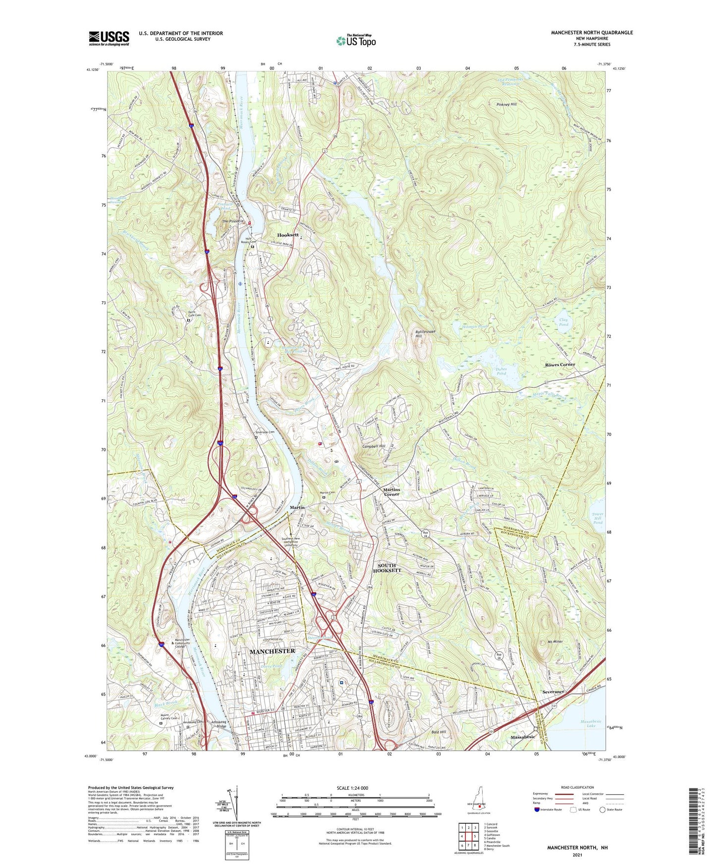
2024 topographic map quadrangle Manchester North in the state of New Hampshire. Scale: 1:24000. Based on the newly updated USGS 7.5' US Topo map series, this map is in the following counties: Merrimack, Hillsborough, Rockingham. The map contains contour data, water features, and other items you are used to seeing on USGS maps, but also has updated roads and other features. This is the next generation of topographic maps. Printed on high-quality waterproof paper with UV fade-resistant inks.
Quads adjacent to this one:
West: Goffstown
Northwest: Concord
North: Suncook
Northeast: Gossville
East: Candia
Southeast: Derry
South: Manchester South
Southwest: Pinardville
This map covers the same area as the classic USGS quad with code o43071a4.
Contains the following named places: Allenstown Elementary School, Allenstown Police Department, Amoskeag Bridge, Amoskeag Cemetery, Amoskeag Dam, Amoskeag Presbyterian Church, Auburn Montessori School, Bald Hill, Black Brook, Black Brook Dam, Black Brook Park, Black Brook Pond, Breaults River Side Seaplane Base, Brickyard Brook, Brookside Congregational Church, Brookside Congregational Church Library, Browns Brook, Campbell Hill, Campbell House, Clay Pond, Cullerot Park, Dalton Brook, David R Cawley Middle School, Davis-Cate Cemetery, Department of Veterans Affairs Medical Center Library, Derryfield School, Donati Memorial Field, Dorrs Pond, Dorrs Pond Dam, Dubes Pond, Dubes Pond Dam, Fred C Underhill School, Germaine C Shapiro Library, Gethsemane Lutheran Church, Goldfish Pond, Goldfish Pond Dam, Greeby House, Hannah-Ho-Hee Pond, Heads Pond, Heads Pond Dam, HEAR in New Hampshire Preschool, High Service Distribution Reservoir Dam, Hinman Pond, Holy Rosary Catholic Church, Holy Rosary Cemetery, Hooksett, Hooksett Census Designated Place, Hooksett Church of the Nazarene, Hooksett Congregational Church, Hooksett Dam, Hooksett Fire Rescue Department, Hooksett Fire Rescue Department Station 114, Hooksett Memorial School, Hooksett Plaza Shopping Center, Hooksett Police Department, Hooksett Post Office, Hooksett Village School, Hooksett-Manchester Airport, Intervale Country Club, Island Pond, Island Pond Dam, Little Angels Learning Center, Livingston Park, Manchester Fire Department Station 4, Manchester Fire Department Station 5, Manchester Veterans Affairs Medical Center, Martin, Martin Cemetery, Martins Corner, Massabesic, McIntyre Ski Area, Merrimack House, Merrimack River Reservoir, Messer Brook, Milestone Brook, Mont Blanc Academy, Mont Blanc Academy Neuro Development Institute, Moose Meadow Brook, Mount Calvary Cemetery, Mount Miner, Mount Saint Mary Academy, Mount Saint Mary College, New Hampshire College North Campus, New Hampshire State Armory, New Hampshire Technical College Learning Resource Center, New Hampshire Vocational-Technical College, New Hampshire Youth Development Center, Notre Dame College, Oak Hill Reservoir, Oak Hill Reservoir Dam, Old Pembroke Reservoir, Paul Harvey Library, Peters Brook, Pinkney Hill, Pinnacle Pond, Public Service Company Manchester Heliport, Rattlesnake Hill, Riverside Cemetery, Rowes Corner, Saint Catherine Roman Catholid Church, Saint Catherine School, Saint Pauls United Methodist Church, Samuel Blodget Park, Severance, Smyth Road School, South Hooksett, South Hooksett Census Designated Place, Southern New Hampshire University, Spaulding House, Stark Hall, Stark Park, Stark School, State Teachers School, Stevens Pond, Temple Israel, The Church of Jesus Christ of Latter Day Saints, The Pinnacle, Tower Village Mall Shopping Center, Town of Hooksett, Trinity Full Gospel Church, University of New Hampshire at Manchester Library, University of New Hampshire-Manchester, Webster School, Weston Observatory, WGIR-AM (Manchester), Whittier House, Winnipesaukee House, Winnisquam Hall, Youngsville Park, ZIP Codes: 03102, 03104, 03106


