MyTopo
Diamond Pond New Hampshire US Topo Map
Couldn't load pickup availability
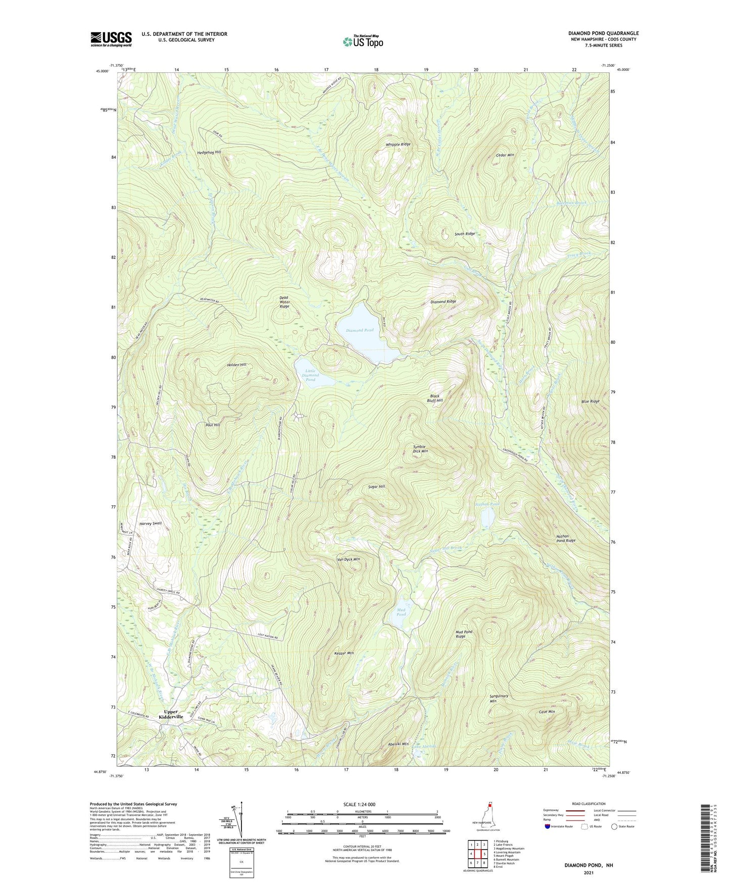
2021 topographic map quadrangle Diamond Pond in the state of New Hampshire. Scale: 1:24000. Based on the newly updated USGS 7.5' US Topo map series, this map is in the following counties: Coos. The map contains contour data, water features, and other items you are used to seeing on USGS maps, but also has updated roads and other features. This is the next generation of topographic maps. Printed on high-quality waterproof paper with UV fade-resistant inks.
Quads adjacent to this one:
West: Lovering Mountain
Northwest: Pittsburg
North: Lake Francis
Northeast: Magalloway Mountain
East: Mount Pisgah
Southeast: Errol
South: Dixville Notch
Southwest: Bunnell Mountain
Contains the following named places: Abeniki Mountain, Alder Brook, Balsams Country Club, Bateman Brook, Black Bluff Hill, Camp E - Toh - Anee, Carr Camp, Cave Mountain, Cedar Mountain, Coleman State Park, Dead Water Ridge, Diamond Pond, Diamond Ridge, East Branch Mohawk River, Felton Camp, Ferguson Brook, Gulf Brook, Harvey Swell, Harvey Swell School, Hedgehog Hill, Hix Brook, Holden Hill, Horn Brook, Hurlbert Camp, Keazer Mountain, Keyser Brook, Kidder Brook, Lake Abeniki, Little Diamond Pond, Moose Brook Dam, Moose Pond, Mud Pond, Mud Pond Dam, Mud Pond Ridge, Nathan Pond, Nathan Pond Ridge, Old Ramsay Camp, Paul Hill, Ramsay Camp, Sanguinary Mountain, South Ridge, Sugar Hill, Sugar Hill Brook, Township of Dixville, Tracy Brook, Tumble Dick Mountain, Upper Kidderville, Van Dyck Mountain, West Branch Mohawk River, Whipple Ridge