MyTopo
Magalloway Mountain New Hampshire US Topo Map
Couldn't load pickup availability
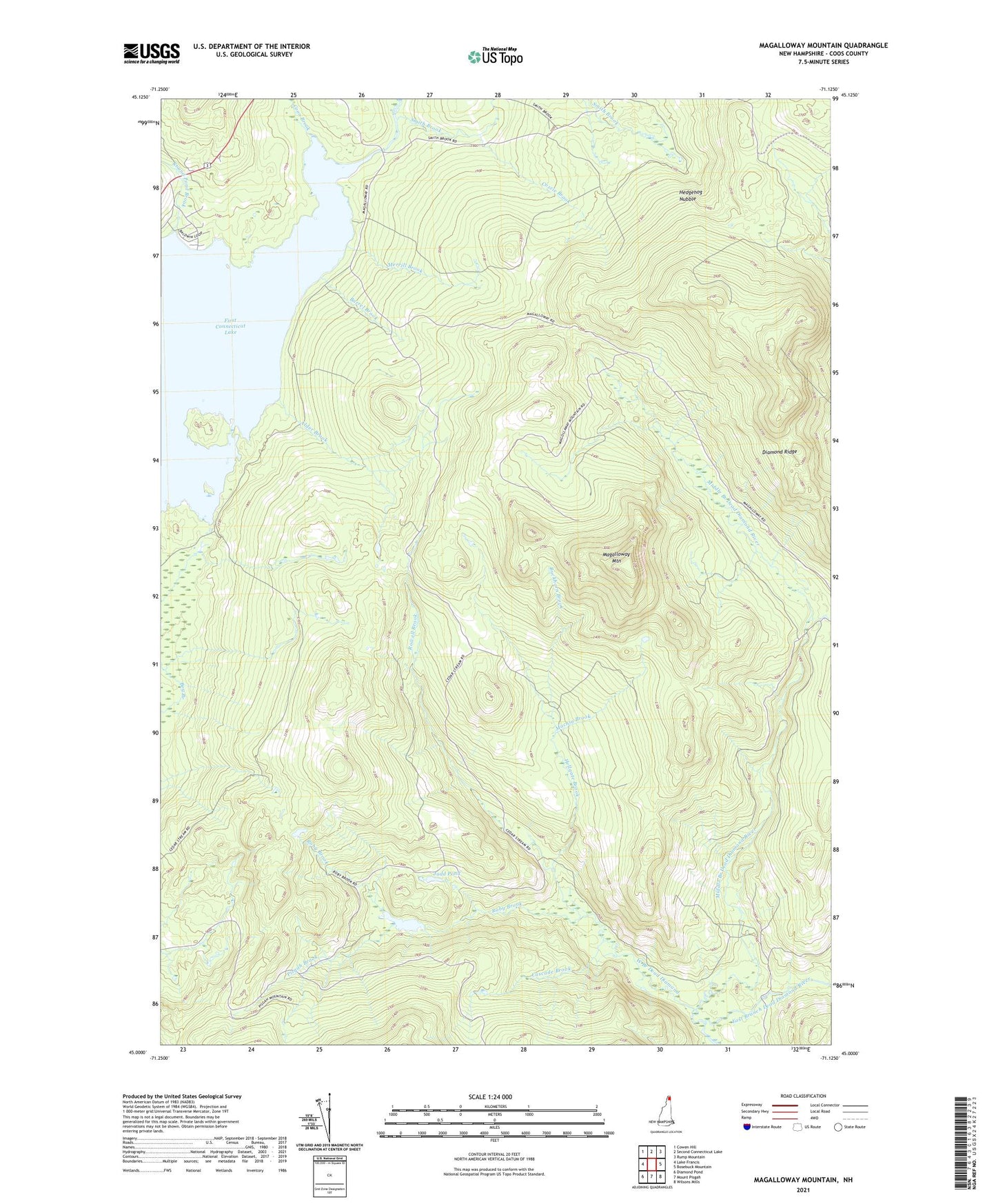
2024 topographic map quadrangle Magalloway Mountain in the state of New Hampshire. Scale: 1:24000. Based on the newly updated USGS 7.5' US Topo map series, this map is in the following counties: Coos. The map contains contour data, water features, and other items you are used to seeing on USGS maps, but also has updated roads and other features. This is the next generation of topographic maps. Printed on high-quality waterproof paper with UV fade-resistant inks.
Quads adjacent to this one:
West: Lake Francis
Northwest: Cowen Hill
North: Second Connecticut Lake
Northeast: Rump Mountain
East: Bosebuck Mountain
South: Mount Pisgah
Southwest: Diamond Pond
This map covers the same area as the classic USGS quad with code o45071a2.
Contains the following named places: Alder Brook, Barrel Brook, Beaver Pond, Buckhorn Brook, Camp Number 8, Camp Number 9, Camp Otter, Cascade Brook, Connecticut Lakes, Coon Brook, Cozzie Brook, Diamond Ridge, First Connecticut Lake, Hedgehog Nubble, Hellgate Brook, Judd Pond, Judds Ponds, Machia Brook, Magalloway Mountain, Merrill Brook, Middle Branch Dead Diamond River, Pisgah Brook, Roby Brook, Round Pond Brook, Rowell Brook, Shehan Camp, Shehan Pond, Shehan Pond Dam, Smith Brook, West Branch Dead Diamond