MyTopo
Lake Francis New Hampshire US Topo Map
Couldn't load pickup availability
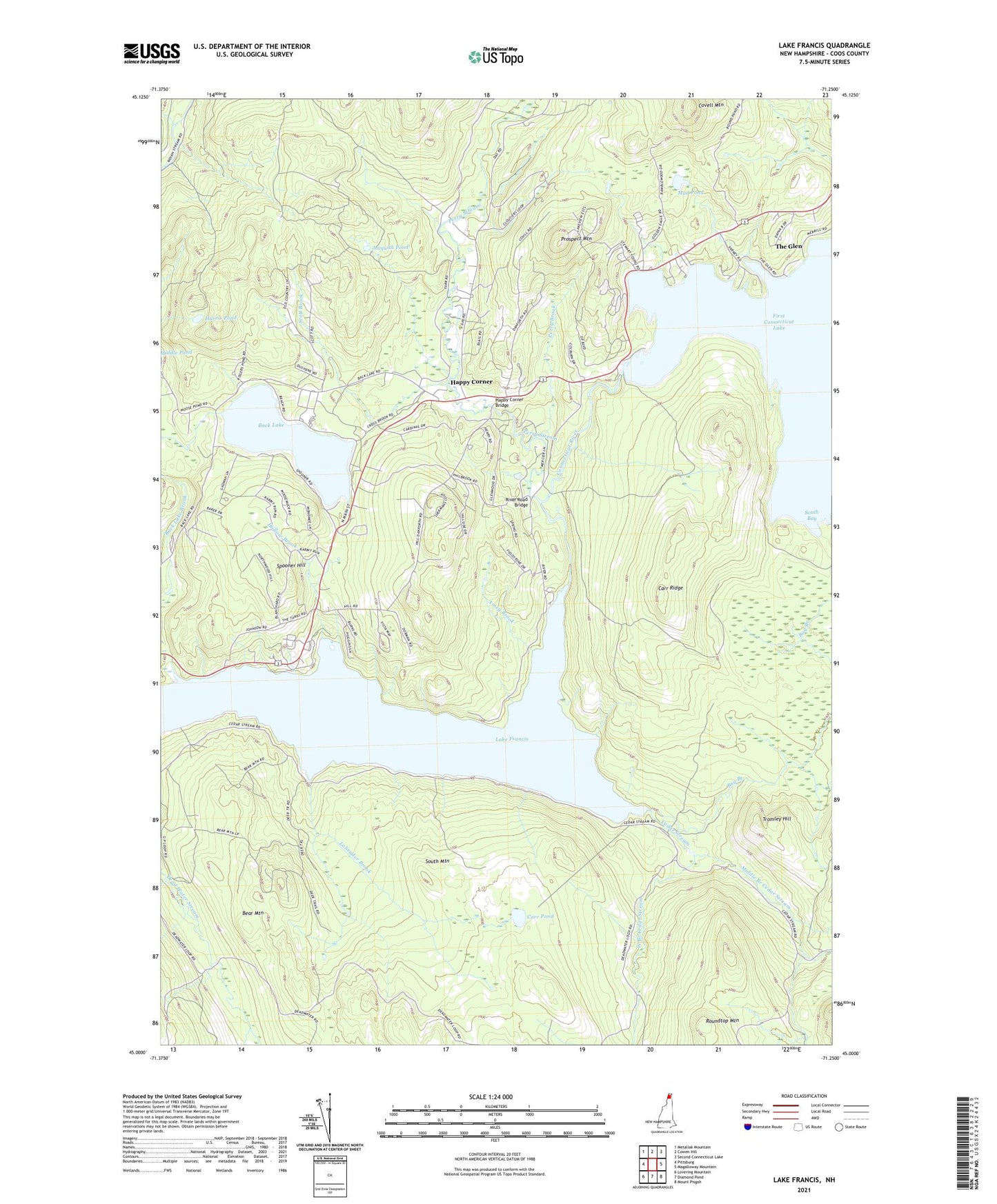
2024 topographic map quadrangle Lake Francis in the state of New Hampshire. Scale: 1:24000. Based on the newly updated USGS 7.5' US Topo map series, this map is in the following counties: Coos. The map contains contour data, water features, and other items you are used to seeing on USGS maps, but also has updated roads and other features. This is the next generation of topographic maps. Printed on high-quality waterproof paper with UV fade-resistant inks.
Quads adjacent to this one:
West: Pittsburg
Northwest: Metallak Mountain
North: Cowen Hill
Northeast: Second Connecticut Lake
East: Magalloway Mountain
Southeast: Mount Pisgah
South: Diamond Pond
Southwest: Lovering Mountain
This map covers the same area as the classic USGS quad with code o45071a3.
Contains the following named places: Amey Brook, Back Lake, Back Lake Dam, Bear Mountain, Bog Branch, Brown Company Lots State Wildlife Management Area, Carr Pond, Carr Ridge, Cedar Stream, Covell Mountain, Crystal Brook, Currier Camp, East Branch Dead Water Stream, First Connecticut Lake Dam, Gray Lot State Wildlife Management Area, Happy Corner, Happy Corner Bridge, Harris Pond, Harry Davis Camp, Hollow Brook, Jacquith Pond, Labrador Brook, Lake Francis, Lake Francis State Park, Lake Francis Wildlife Area, Middle Branch Cedar Stream, Mud Pond, Perry Brook, Perry Stream, Prospect Mountain, River Road Bridge, Roby Brook, Roundtop Mountain, Scott Brook, South Bay, South Mountain, Spooner Hill, The Glen, Town of Clarksville, Tromley Hill, Varney Camp, West Branch Cedar Stream, ZIP Code: 03592