MyTopo
Pittsburg New Hampshire US Topo Map
Couldn't load pickup availability
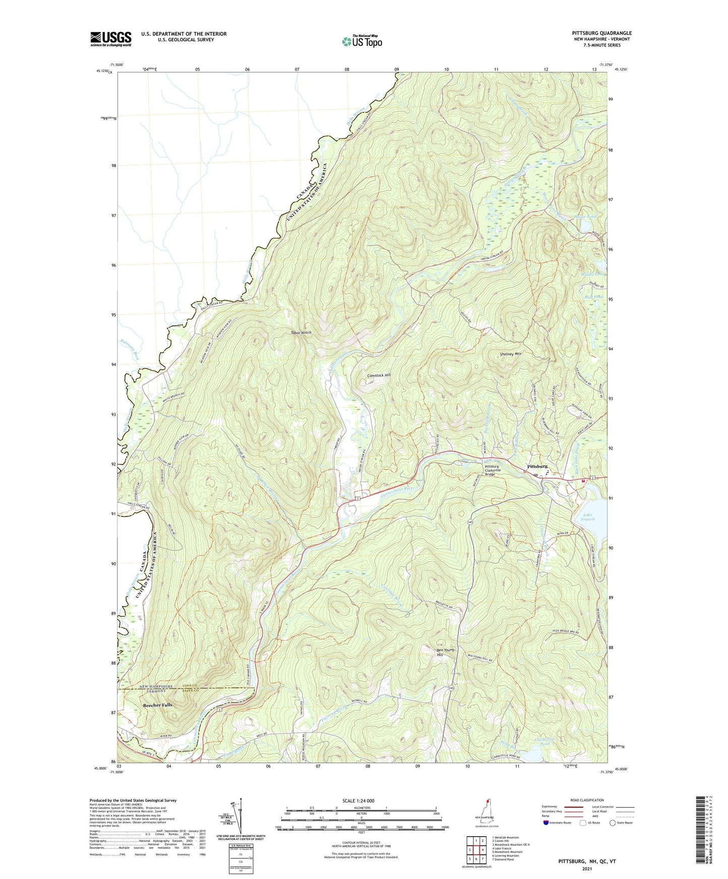
2024 topographic map quadrangle Pittsburg in the states of New Hampshire, Vermont. Scale: 1:24000. Based on the newly updated USGS 7.5' US Topo map series, this map is in the following counties: Coos, Essex. The map contains contour data, water features, and other items you are used to seeing on USGS maps, but also has updated roads and other features. This is the next generation of topographic maps. Printed on high-quality waterproof paper with UV fade-resistant inks.
Quads adjacent to this one:
North: Metallak Mountain
Northeast: Cowen Hill
East: Lake Francis
Southeast: Diamond Pond
South: Lovering Mountain
Southwest: Monadnock Mountain
Contains the following named places: Ad Chase Brook, Back Lake Brook, Backfield Brook, Beecher Falls Census Designated Place, Ben Young Hill, Bishop Brook, Camp Brook, Clarksville Pond, Clarksville Town Hall, Comstock Hill, Coolidge Brook, Crawford Brook, Dead Water Stream, Favreau Brook, Halls Stream School, Indian Stream, Indian Stream School, Kim Day Dam, Middle Pond, Moose Pond, Moose Pond Brook, Mud Pond, Murphy Dam, Perry School, Pittsburg, Pittsburg Elementary School, Pittsburg Fire Department, Pittsburg High School, Pittsburg Police Department, Pittsburg Post Office, Pittsburg-Clarksville Bridge, Potash Brook, Shatney Mountain, Stanton School, Tabor Notch, Wheeler School, Young School, ZIP Code: 05902