MyTopo
Dummer Ponds New Hampshire US Topo Map
Couldn't load pickup availability
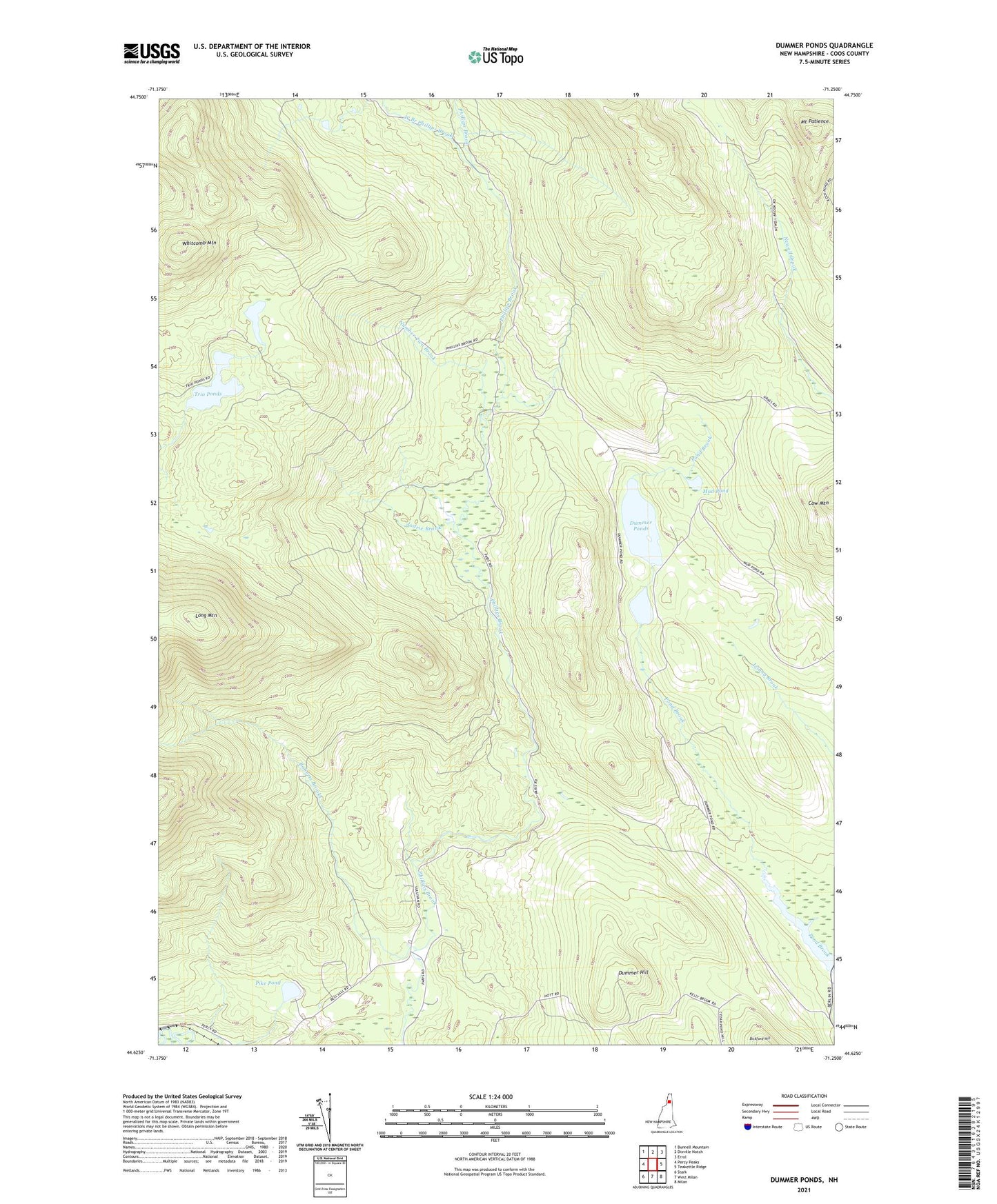
2021 topographic map quadrangle Dummer Ponds in the state of New Hampshire. Scale: 1:24000. Based on the newly updated USGS 7.5' US Topo map series, this map is in the following counties: Coos. The map contains contour data, water features, and other items you are used to seeing on USGS maps, but also has updated roads and other features. This is the next generation of topographic maps. Printed on high-quality waterproof paper with UV fade-resistant inks.
Quads adjacent to this one:
West: Percy Peaks
Northwest: Bunnell Mountain
North: Dixville Notch
Northeast: Errol
East: Teakettle Ridge
Southeast: Milan
South: West Milan
Southwest: Stark
Contains the following named places: Coos County, Cow Mountain, Dummer Hill, Dummer Ponds, Jodrie Brook, Mount Patience, Mud Pond, Number Two Brook, Paris, Pike Pond, Pond Brook, Roberts Brooks, Town of Dummer, Trio Pond, Trio Pond Western Dam, Trio Ponds, West Branch Phillips Brook, Whitcomb Mountain