MyTopo
Percy Peaks New Hampshire US Topo Map
Couldn't load pickup availability
Also explore the Percy Peaks Forest Service Topo of this same quad for updated USFS data
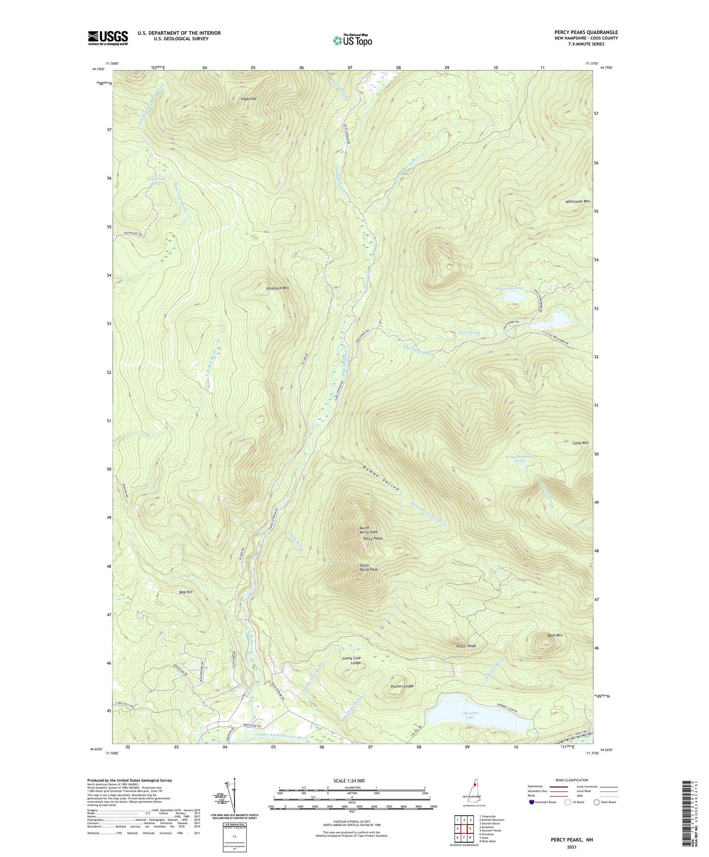
2024 topographic map quadrangle Percy Peaks in the state of New Hampshire. Scale: 1:24000. Based on the newly updated USGS 7.5' US Topo map series, this map is in the following counties: Coos. The map contains contour data, water features, and other items you are used to seeing on USGS maps, but also has updated roads and other features. This is the next generation of topographic maps. Printed on high-quality waterproof paper with UV fade-resistant inks.
Quads adjacent to this one:
West: Stratford
Northwest: Tinkerville
North: Bunnell Mountain
Northeast: Dixville Notch
East: Dummer Ponds
Southeast: West Milan
South: Stark
Southwest: Groveton
This map covers the same area as the classic USGS quad with code o44071f4.
Contains the following named places: Bag Hill, Bald Mountain, Boman Valley, Christine Lake, Doctor George S Emerson Elementary School, East Branch Nash Stream, Jimmy Cole Brook, Jimmy Cole Ledge, Little Bog Pond, Little Bog Pond Dam, Long Mountain, Long Mountain Brook, Long Mountain Pond, Nash Stream, North Percy Peak, Percy Peaks, Pond Brook, Potters Ledge, Roaring Brook, Silver Brook, Slide Brook, South Percy Peak, Stratford Mountain, Sugarloaf, Sugarloaf Pond, Township of Odell, Victor Head, Waterhole Brook, Whitcomb Pond, ZIP Codes: 03590, 03597