MyTopo
Teakettle Ridge New Hampshire US Topo Map
Couldn't load pickup availability
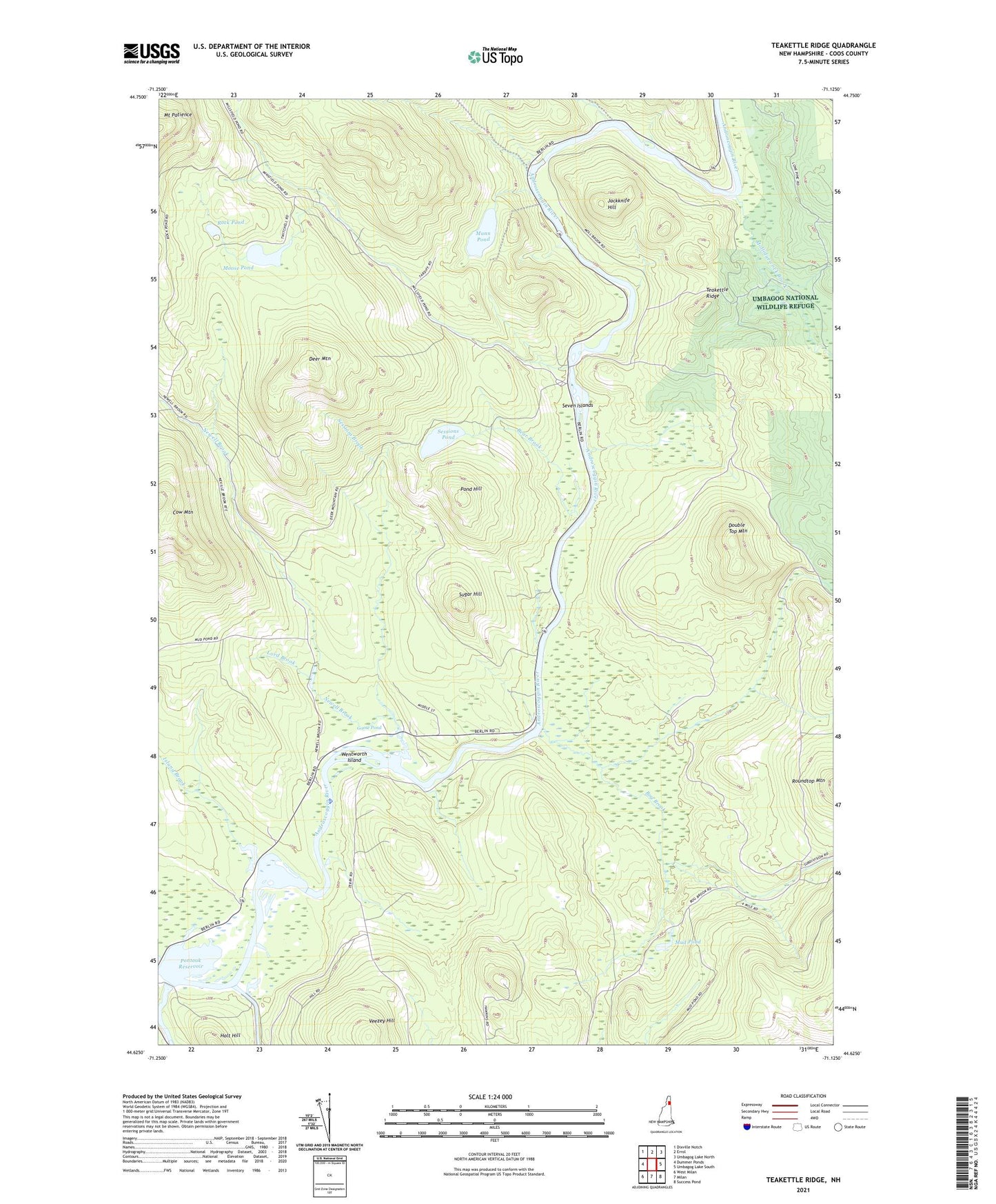
2024 topographic map quadrangle Teakettle Ridge in the state of New Hampshire. Scale: 1:24000. Based on the newly updated USGS 7.5' US Topo map series, this map is in the following counties: Coos. The map contains contour data, water features, and other items you are used to seeing on USGS maps, but also has updated roads and other features. This is the next generation of topographic maps. Printed on high-quality waterproof paper with UV fade-resistant inks.
Quads adjacent to this one:
West: Dummer Ponds
Northwest: Dixville Notch
North: Errol
Northeast: Umbagog Lake North
East: Umbagog Lake South
Southeast: Success Pond
South: Milan
Southwest: West Milan
This map covers the same area as the classic USGS quad with code o44071f2.
Contains the following named places: Androscoggin Wayside Park, Bear Brook, Bog Brook, Deer Mountain, Double Top Mountain, Goose Pond, Holt Hill, Island Brook, Jackknife Hill, Lord Brook, Mollidgewock Brook, Mollidgewock Campground, Moose Pond, Mud Pond, Munn Pond, Newell Brook, Pond Hill, Pontook Reservoir, Pontook Reservoir Dam, Rock Pond, Sessions Brook, Sessions Pond, Seven Islands, Smoky Camp Brook, Sugar Hill, Teakettle Ridge, Thirteen Mile Woods, Veezey Hill, Wentworth Island