MyTopo
Enfield New Hampshire US Topo Map
Couldn't load pickup availability
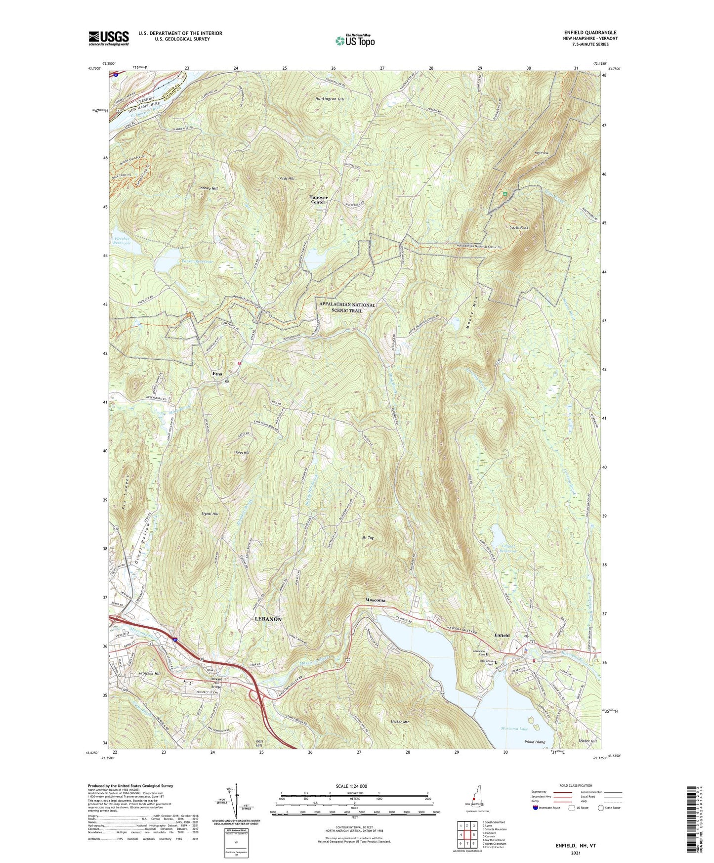
2021 topographic map quadrangle Enfield in the state of New Hampshire. Scale: 1:24000. Based on the newly updated USGS 7.5' US Topo map series, this map is in the following counties: Grafton, Windsor. The map contains contour data, water features, and other items you are used to seeing on USGS maps, but also has updated roads and other features. This is the next generation of topographic maps. Printed on high-quality waterproof paper with UV fade-resistant inks.
Quads adjacent to this one:
West: Hanover
Northwest: South Strafford
North: Lyme
Northeast: Smarts Mountain
East: Canaan
Southeast: Enfield Center
South: North Grantham
Contains the following named places: Arvin School, Baltic Mills Dam, Blodgett Brook, College for Lifelong Learning, Curriers Mobile Home Park, Enfield, Enfield Census Designated Place, Enfield City Hall, Enfield Fire Department Union Street Station, Enfield First Aid Stabilization Team Squad, Enfield Police Department, Enfield Post Office, Enfield Reservoir, Enfield Reservoir Dam, Enfield Village School, Etna, Etna Highlands, Etna Post Office, Etna Road Industrial Park, Fletcher Reservoir, Goss Neighborhood School, Great Hollow, Hanover Center, Hanover Center Reservoir Dam, Hanover Fire Department Etna Station, Hanover Reservoir, Hanover Reservoirs, Hardy Hill Brook, Hardy Hill School, Hayes Hill, Huntington Hill, Lebanon High School, Lebanon Junior High School, Lebanon Memorial Pool, LeBruns Mobile Home Park, Lords Hill, Lower Reservoir Dam, Mascoma, Mascoma Lake, Mascoma Lake Dam, Montessori Childrens School, Moose Mountain, Mount Tug, North Neighborhood School, North Peak, Oak Grove Cemetery, Olympic Mobile Home Park, Packard Hill Bridge, Parker Reservoir, Pinneo Hill, Pinneo School, Prospect Hill, Rix Ledges, Ruddsboro School, Runnemede School, Scales Brook, Signal Hill, South Peak, Stony Brook, Town of Hanover, Upper Reservoir Dam, Walhowdon Orchard, WHED-TV (Hanover), Wood Island, ZIP Codes: 03750, 03755, 03766