MyTopo
South Strafford Vermont US Topo Map
Couldn't load pickup availability
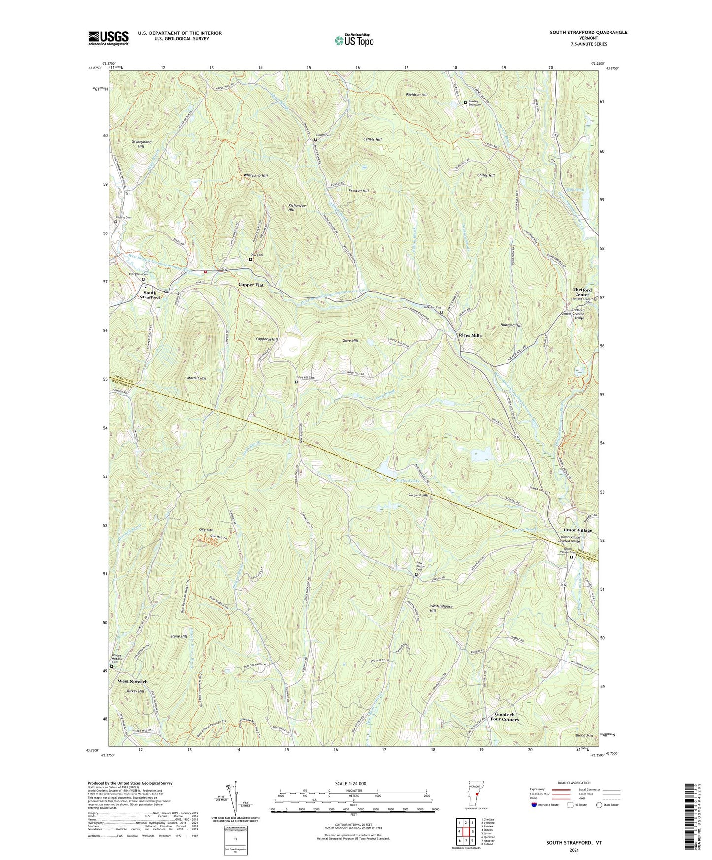
2024 topographic map quadrangle South Strafford in the state of Vermont. Scale: 1:24000. Based on the newly updated USGS 7.5' US Topo map series, this map is in the following counties: Orange, Windsor. The map contains contour data, water features, and other items you are used to seeing on USGS maps, but also has updated roads and other features. This is the next generation of topographic maps. Printed on high-quality waterproof paper with UV fade-resistant inks.
Quads adjacent to this one:
West: Sharon
Northwest: Chelsea
North: Vershire
Northeast: Fairlee
East: Lyme
Southeast: Enfield
South: Hanover
Southwest: Quechee
This map covers the same area as the classic USGS quad with code o43072g3.
Contains the following named places: Abbott Brook, Alger Brook, Avery Brook, Barker Brook, Beaver Meadow Cemetery, Blood Mountain, Campbell Corner, Center Hill, Childs Hill, Clough Cemetery, Copper Flat, Copperas Brook, Copperas Hill, Davidson Hill, Dow Cemetery, Elizabeth Mine, Evergreen Cemetery, Forsythe Pond Dam, Fullon Brook, Gile Mountain, Goodrich Four Corners, Gove Hill, Gove Hill Cemetery, Grannyhand Hill, Hubbard Hill, Jackman Cemetery, Jackson Brook, Justin Smith Morrill Homestead State Historic Site, Kibling Cemetery, Lord Brook, Morrill Mountain, Mud Pond, New Boston Cemetery, Newton Elementary School, Norford Lake, Norford Lake Dam, Norwich Town Forest, Payson Dam, Preston Hill, Rices Mills, Richardson Hill, Sargent Hill, Sawnee Bean Cemetery, South Strafford, South Strafford Post Office, Stone Hill, Strafford Firemen's Association, Swaney Bean School, Thetford Center Cemetery, Thetford Center Covered Bridge, Town of Norwich, Town of Strafford, Turkey Hill, Union Village, Union Village Cemetery, Union Village Covered Bridge, Union Village Dam, Union Village Dam Recreation Area, West Branch Ompompanoosuc River, West Norwich, West Norwich Church, Westinghouse Hill, Whitcomb Hill, ZIP Codes: 05055, 05070, 05075