MyTopo
Farmington New Hampshire US Topo Map
Couldn't load pickup availability
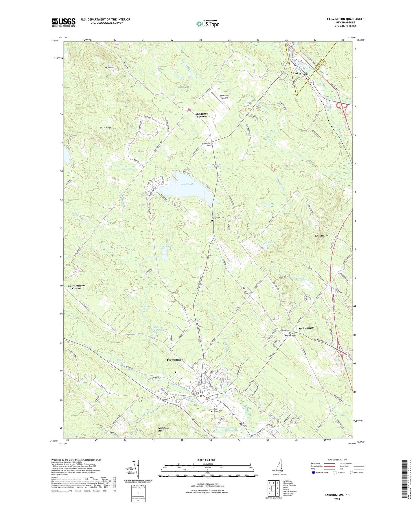
2021 topographic map quadrangle Farmington in the state of New Hampshire. Scale: 1:24000. Based on the newly updated USGS 7.5' US Topo map series, this map is in the following counties: Strafford, Carroll. The map contains contour data, water features, and other items you are used to seeing on USGS maps, but also has updated roads and other features. This is the next generation of topographic maps. Printed on high-quality waterproof paper with UV fade-resistant inks.
Quads adjacent to this one:
West: Alton
Northwest: Wolfeboro
North: Sanbornville
Northeast: Great East Lake
East: Milton
Southeast: Rochester
South: Baxter Lake
Southwest: Parker Mountain
Contains the following named places: Birch Ridge, Branch River Dam Number 1, Branch River Reservoir, Currier Dam, Currier Pond, Dames Brook, Ela River, Farmington, Farmington Census Designated Place, Farmington Country Club, Farmington Fire Rescue, Farmington Pentecostal Church, Farmington Police Department, Farmington Post Office, Farmington Senior High School, Goodwin Library, Gould Pond, Hart Brook, Hayes Brook, Hayes Cemetery, Hayes Corner, Henry Wilson Memorial School, Horn Brook, Jones Brook, Lyman Brook, Mad River, Main Street School, Memorial Drive School, Middleton Corners, Middleton Fire and Rescue, Middleton Police Department, Mount Jesse, New Durham Corner, Nute Ridge, Nute Ridge School, Nutes Ridge Cemetery, Pine Grove Cemetery, Pokamoonshine Brook, Saint Peters School, Sunrise Lake, Sunrise Lake Dam, Teneriffe Mountain, Therriaults Landing, Town of Middleton, Town of Milton, Union, Union Census Designated Place, Union Meadows Dam, Union Post Office, Valley View Community Elementary School, Wakefield Fire and Rescue Station 3, Waldron Mill Pond, Wentworth Cemetery, Whitehouse Cemetery, ZIP Codes: 03851, 03887