MyTopo
Milton New Hampshire US Topo Map
Couldn't load pickup availability
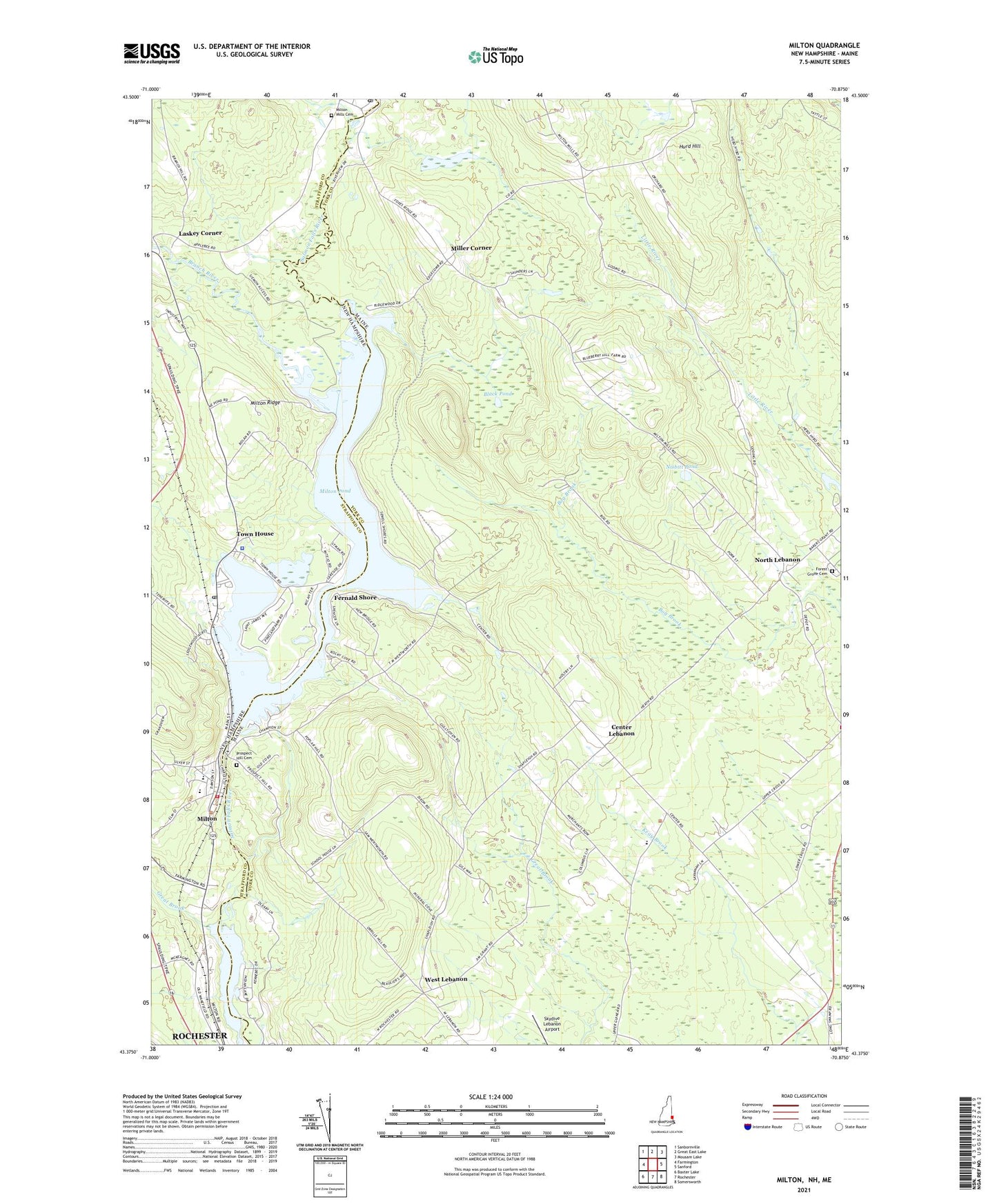
2024 topographic map quadrangle Milton in the states of Maine, New Hampshire. Scale: 1:24000. Based on the newly updated USGS 7.5' US Topo map series, this map is in the following counties: Strafford, York. The map contains contour data, water features, and other items you are used to seeing on USGS maps, but also has updated roads and other features. This is the next generation of topographic maps. Printed on high-quality waterproof paper with UV fade-resistant inks.
Quads adjacent to this one:
West: Farmington
Northwest: Sanbornville
North: Great East Lake
Northeast: Mousam Lake
East: Sanford
Southeast: Somersworth
South: Rochester
Southwest: Baxter Lake
This map covers the same area as the classic USGS quad with code o43070d8.
Contains the following named places: Black Pond, Branch River, Bridge Street Dam, Center Lebanon, Fernald Shore, Forest Grove Cemetery, Great Brook, Hurd Hill, Laskey Corner, Lebanon Area Library, Lebanon Elementary School, Maple Stone School, Martha Sawyer Community Library, Miller Brook, Miller Corner, Milton, Milton Census Designated Place, Milton Elementary School, Milton Fire Rescue Central Station, Milton Learning Center, Milton Leather Board Dam, Milton Mills Cemetery, Milton Mills Post Office, Milton Police Department, Milton Pond, Milton Post Office, Milton Ridge, Milton Three Ponds, Milton Three Ponds Dam, Mousam River Reservoir, New Hampshire Farm Museum, Nisbitt Pond, North Lebanon, North Lebanon Second Baptist Church, Northeast Pond, Nute High School and Middle School, Potters Place Adult Park Campground, Prospect Hill Cemetery, Salmon Falls River Reservoir, Spaulding Dam, Spaulding Pond, Stewarts Field, Town House, Town House Pond, Town of Lebanon, West Lebanon, West Lebanon Historic District, ZIP Codes: 03852, 04027