MyTopo
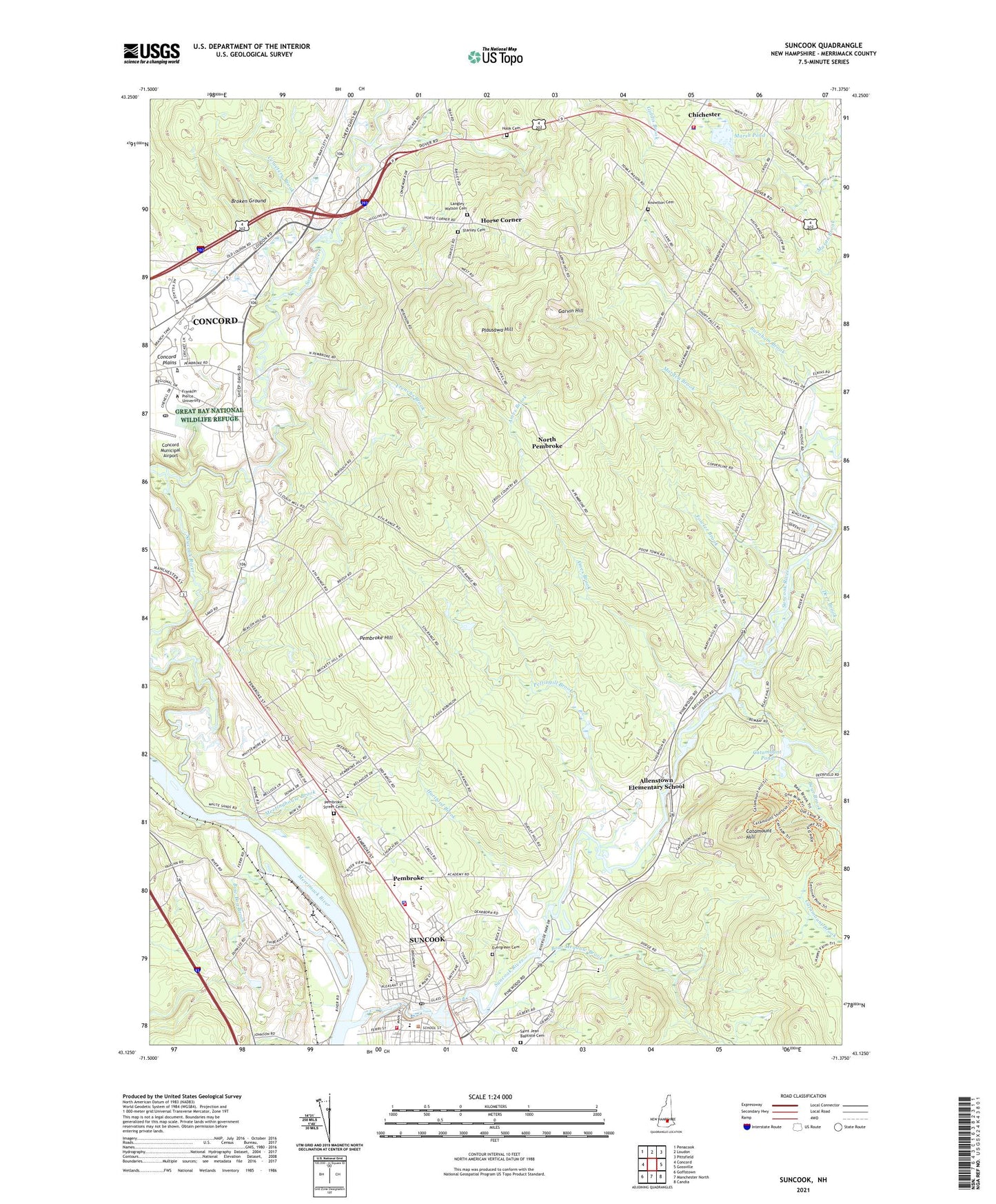
Suncook New Hampshire US Topo Map
Couldn't load pickup availability
2024 topographic map quadrangle Suncook in the state of New Hampshire. Scale: 1:24000. Based on the newly updated USGS 7.5' US Topo map series, this map is in the following counties: Merrimack. The map contains contour data, water features, and other items you are used to seeing on USGS maps, but also has updated roads and other features. This is the next generation of topographic maps. Printed on high-quality waterproof paper with UV fade-resistant inks.
Quads adjacent to this one:
West: Concord
Northwest: Penacook
North: Loudon
Northeast: Pittsfield
East: Gossville
Southeast: Candia
South: Manchester North
Southwest: Goffstown
This map covers the same area as the classic USGS quad with code o43071b4.
Contains the following named places: Allenstown Elementary School, Allenstown Fire Department, Ames Brook, Armand R Dupont School, Bear Brook, Bear Brook Park Pond, Bear Brook State Park Dam, Boat Meadow Brook, Bow Bog Brook, Brigham Heliport, Broken Ground, Buck Street East Dam, Buck Street West Dam, Burnham Brook, Capital Christian School, Careplus Ambulance Services Station 4 - Bow, Catamount Brook, Catamount Hill, Catamount Pond, Cemetery Brook, Chichester, Chichester Congregational Church, Chichester Fire and Rescue, Chichester Police Department, Chichester United Methodist Church, China Dam, Congregational Center, Deer Brook, Early Enrichment Center, Epsom Valley Campground, Evergreen Cemetery, Family Tree Child Care Center, First Choice for Children Child Care Center, First Church, Fowler Brook, Franklin Pierce University at Concord, Frenchs Brook, Garvin Hill, Green Valley School Montessori Learning Center, Hartford Brook, Hayes Swamp, Hillside Baptist Church, Hook Cemetery, Horse Corner, Institute for Learning Child Care Center, Knowlton Cemetery, Langley - Watson Cemetery, Little Bear Brook, Marden Brook, Marsh Pond, Meetinghouse Brook, New Hampshire Fire Academy Emergency Response Team, New Hampshire Office of Vocation and Travel, North Pembroke, Old Reservoir Dam, Onemile Trail, Pembroke, Pembroke Academy, Pembroke Dam, Pembroke Fire Department, Pembroke Hill, Pembroke Hill School, Pembroke Place School, Pembroke Police Department, Pembroke Post Office, Pembroke Street Cemetery, Pembroke Town Hall, Pembroke Town Library, Pembroke Town Offices, Pembroke Village School, Pettingill Brook, Pine Haven Boys Center, Plausawa Hill, Plausawa Valley Country Club, PSNH Heliport, River Road School, Saint Jean Baptiste Cemetery, Saint Michaels Church, Saw Mill Dam Breeched, Saw Mill Pond, Soucook River, Spectacle Ponds, Stanley Cemetery, Steeplegate Mall Shopping Center, Strong Foundations Charter School, Suncook, Suncook Census Designated Place, Suncook River, Suncook River Reservoir, Sunrise Baptist Church, Taylor State Forest, The Tender Years Childcare and Learning Center, Three Rivers School, Town of Allenstown, Town of Pembroke, Tri - Town Volunteer Emergency Ambulance Service, Tri State Ambulance, Waste Heliport, Webster Dam, Webster Park, ZIP Code: 03275


