MyTopo
Mount Cardigan New Hampshire US Topo Map
Couldn't load pickup availability
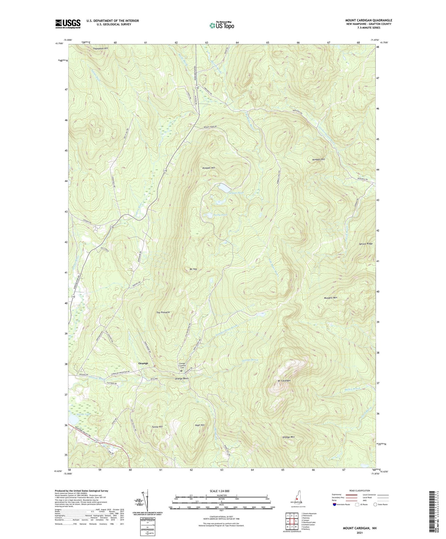
2021 topographic map quadrangle Mount Cardigan in the state of New Hampshire. Scale: 1:24000. Based on the newly updated USGS 7.5' US Topo map series, this map is in the following counties: Grafton. The map contains contour data, water features, and other items you are used to seeing on USGS maps, but also has updated roads and other features. This is the next generation of topographic maps. Printed on high-quality waterproof paper with UV fade-resistant inks.
Quads adjacent to this one:
West: Canaan
Northwest: Smarts Mountain
North: Wentworth
Northeast: Rumney
East: Newfound Lake
Southeast: Danbury
South: Grafton
Southwest: Enfield Center
Contains the following named places: Atwell Brook, Bryant Pond, Bucks Brook, Bucks Corner, Clark Trail, Derby Pond, Holt Trail, Hoyt Hill, Kimball Hill, Manning Trail, Merrill Brook, Mirror Lake, Mount Cardigan, Mount Cardigan State Park, Mount Tug, Mowglis Mountain, Mowglis Trail, Number Seven Brook, Orange, Orange Basin, Orange Common Cemetery, Orange Mountain, Province Road State Forest, Spruce Ridge, The Pinnacle, Thompson Hill, Town of Orange, Tuttle Hill, West Ridge Trail