MyTopo
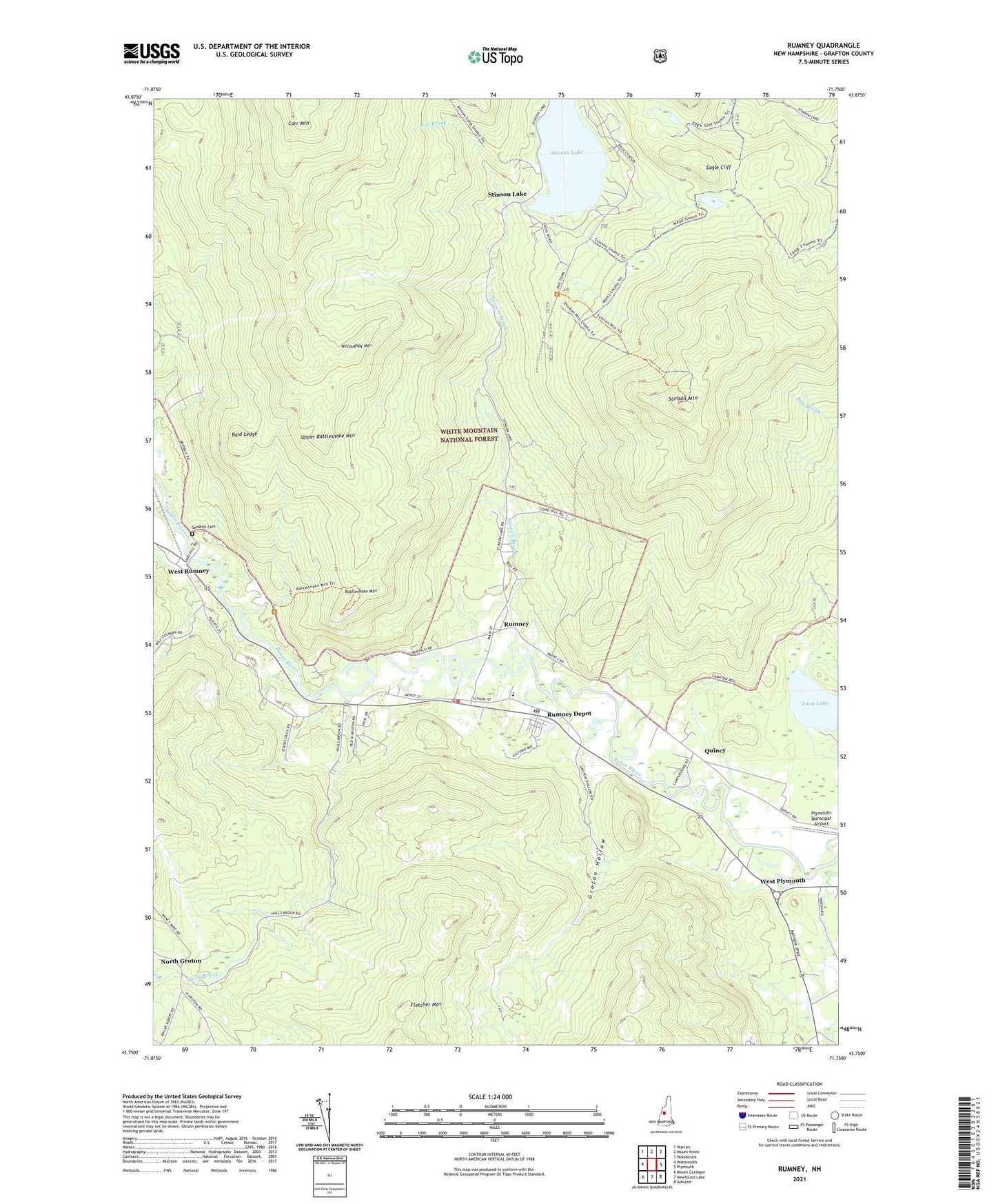
Rumney New Hampshire US Topo Map
Couldn't load pickup availability
Also explore the Rumney Forest Service Topo of this same quad for updated USFS data
2024 topographic map quadrangle Rumney in the state of New Hampshire. Scale: 1:24000. Based on the newly updated USGS 7.5' US Topo map series, this map is in the following counties: Grafton. The map contains contour data, water features, and other items you are used to seeing on USGS maps, but also has updated roads and other features. This is the next generation of topographic maps. Printed on high-quality waterproof paper with UV fade-resistant inks.
Quads adjacent to this one:
West: Wentworth
Northwest: Warren
North: Mount Kineo
Northeast: Woodstock
East: Plymouth
Southeast: Ashland
South: Newfound Lake
Southwest: Mount Cardigan
This map covers the same area as the classic USGS quad with code o43071g7.
Contains the following named places: Bald Ledge, Camp Eagle Cliff, Camp Raleigh, Eagle Cliff, Fletcher Mountain, Groton Hollow, Halls Brook, Loon Lake, Montview Nursery and Kindergarten School, North Groton, Plymouth Municipal Airport, Plymouth Sands Camping Area, Quincy, Rattlesnake Mountain, Rattlesnake Mountain Trail, Red Brook, Rumney, Rumney Baptist Church, Rumney Depot, Rumney Emergency Medical Services, Rumney Fire Department, Rumney Police Department, Rumney Post Office, Russell Elementary School, Sandhill Cemetery, Stevens Brook Trail, Stinson Brook, Stinson Lake, Stinson Lake Dam, Stinson Mountain, Stinson Mountain Trail, Town of Rumney, Upper Rattlesnake Mountain, West Plymouth, West Rumney, Willoughby Mountain, ZIP Code: 03241