MyTopo
Mount Pisgah New Hampshire US Topo Map
Couldn't load pickup availability
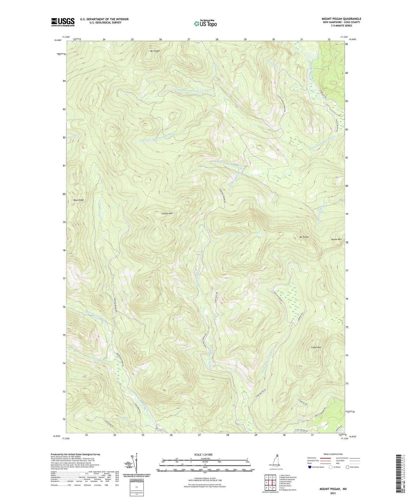
2021 topographic map quadrangle Mount Pisgah in the state of New Hampshire. Scale: 1:24000. Based on the newly updated USGS 7.5' US Topo map series, this map is in the following counties: Coos. The map contains contour data, water features, and other items you are used to seeing on USGS maps, but also has updated roads and other features. This is the next generation of topographic maps. Printed on high-quality waterproof paper with UV fade-resistant inks.
Quads adjacent to this one:
West: Diamond Pond
Northwest: Lake Francis
North: Magalloway Mountain
Northeast: Bosebuck Mountain
Southeast: Umbagog Lake North
South: Errol
Southwest: Dixville Notch
Contains the following named places: Blue Ridge, Chase Mountain, Crystal Mountain, Dixie Brook, Dixs Grant, Fourmile Brook, Lost Valley Brook, Mount Pisgah, Mount Tucker, Nathan Pond Brook, Pesky Brook, Roaring Brook, Round Mountain, South Branch Little Dead Diamond River, South Valley Brook, Swift Diamond Farm, Tracy Brook, West Branch Little Dead Diamond River