MyTopo
Umbagog Lake North New Hampshire US Topo Map
Couldn't load pickup availability
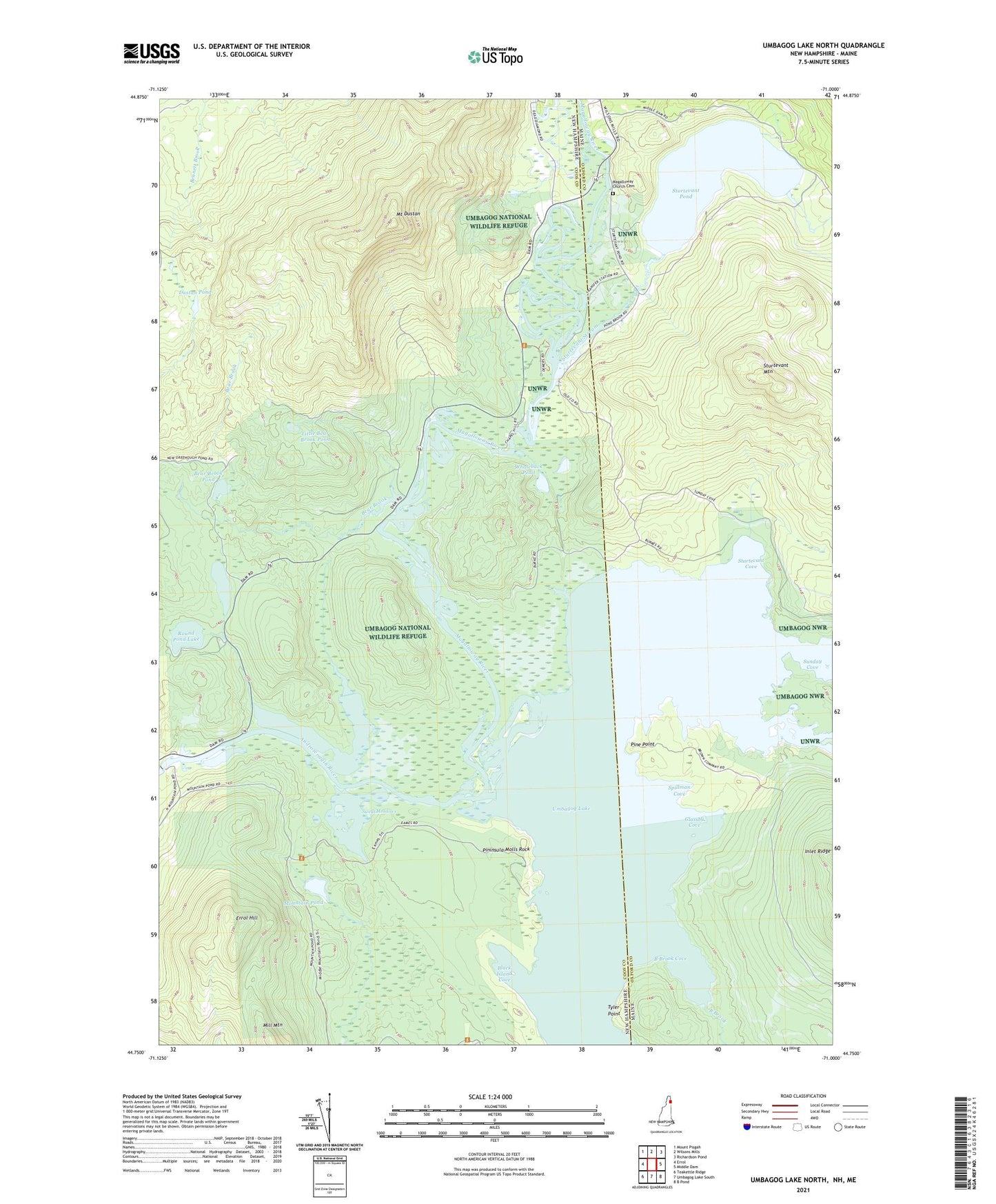
2024 topographic map quadrangle Umbagog Lake North in the states of New Hampshire, Maine. Scale: 1:24000. Based on the newly updated USGS 7.5' US Topo map series, this map is in the following counties: Coos, Oxford. The map contains contour data, water features, and other items you are used to seeing on USGS maps, but also has updated roads and other features. This is the next generation of topographic maps. Printed on high-quality waterproof paper with UV fade-resistant inks.
Quads adjacent to this one:
West: Errol
Northwest: Mount Pisgah
Northeast: Richardson Pond
East: Middle Dam
Southeast: B Pond
South: Umbagog Lake South
Southwest: Teakettle Ridge
This map covers the same area as the classic USGS quad with code o44071g1.
Contains the following named places: B Brook, B Brook Cove, Bear Brook, Bear Brook Pond, Black Island Cove, Dustan Pond, Errol Dam, Errol Hill, Glassby Cove, Lake Umbagog National Wildlife Refuge, Leonard Pond, Little Bear Brook Pond, Long Pond, Magalloway Church Cemetery, Magalloway River, Magalloway School, Mount Dustan, Mountain Pond, Pine Point, Pininsula Molls Rock, Rapid River, Round Pond Lake, Spillman Cove, Sturtevant Cove, Sturtevant Mountain, Sturtevant Pond, Sturtevant Stream, Sunday Cove, Sweat Meadows, Tyler Point, Umbagog Lake, Umbagog National Wildlife Refuge, Wentworth Location, Whaleback Pond