MyTopo
Northfield New Hampshire US Topo Map
Couldn't load pickup availability
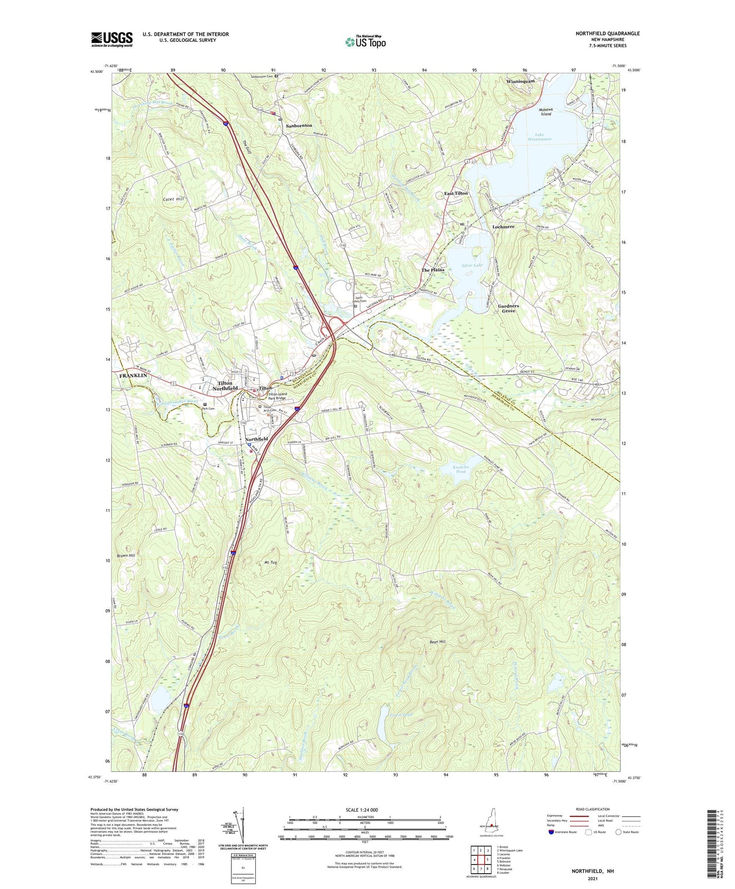
2021 topographic map quadrangle Northfield in the state of New Hampshire. Scale: 1:24000. Based on the newly updated USGS 7.5' US Topo map series, this map is in the following counties: Merrimack, Belknap. The map contains contour data, water features, and other items you are used to seeing on USGS maps, but also has updated roads and other features. This is the next generation of topographic maps. Printed on high-quality waterproof paper with UV fade-resistant inks.
Quads adjacent to this one:
West: Franklin
Northwest: Bristol
North: Winnisquam Lake
Northeast: Laconia
East: Belmont
Southeast: Loudon
South: Penacook
Southwest: Webster
Contains the following named places: Academy Hall, Adino Brackett Hall Memorial Library, Ayers State Forest, Bean Hill, Brown Hill, Calet Hill, Calvary Independent Baptist Church, Central New Hampshire Special Operations Unit, Durgin Brook, East Tilton, Forest Pond, Fred Andrew Small Chapel, Gardners Grove, Gulf Brook, Highland Mountain Bike Park, Highland Ski Area, Hunt Brook, Knowles Pond, Knowles Pond Dam, Lake Winnisquam Dam, Lakes Region Church of Christ, Lochmere, Lochmere Dam, Lochmere Post Office, Mohawk Island, Mount Tug, Mrs B's Day Care Center, Northfield, Northfield Census Designated Place, Northfield Police Department, Northfield Station, Northfield Tilton Congregational Church, Packer Brook, Park Cemetery, Praise Assembly of God Church, Saint Johns Cemetery, Saint Mary Assumption Church, Sanbornton, Sanbornton Cemetery, Sanbornton Central School, Sanbornton Congregational Church, Sanbornton Fire Department, Sanbornton Police Department, Sanbornton Post Office, Sanbornton Square Historic District, Sanbornton Town Hall, Silver Lake, Sondogardy Pond, Southwick School, Spaulding Youth Center, The Gulf, The Plains, The Terraces Building, Tilton, Tilton - Northfield Fire and EMS Station, Tilton Arch, Tilton Arch Cemetery, Tilton Census Designated Place, Tilton Downtown Historic District, Tilton Island Park, Tilton Island Park Bridge, Tilton Junior College, Tilton Northfield Census Designated Place, Tilton Northfield Fire and Emergency Medical Services Center Street, Tilton Police Station, Tilton Post Office, Tilton School, Tilton School Library, Tilton Town Dam, Tilton-Northfield United Methodist Church, Tioga River, Town of Northfield, Town of Tilton, Union Sanborn Preschool, Union Sanborn School, WCNH-FM (Belmont), WFTN-FM (Franklin), Williams Brook, Winding Hill Brook, Winnisquam Mill, Winnisquam Regional High School, Winnisquam Regional Middle School, Woodman Sanbornton Academy, ZIP Code: 03276