MyTopo
Webster New Hampshire US Topo Map
Couldn't load pickup availability
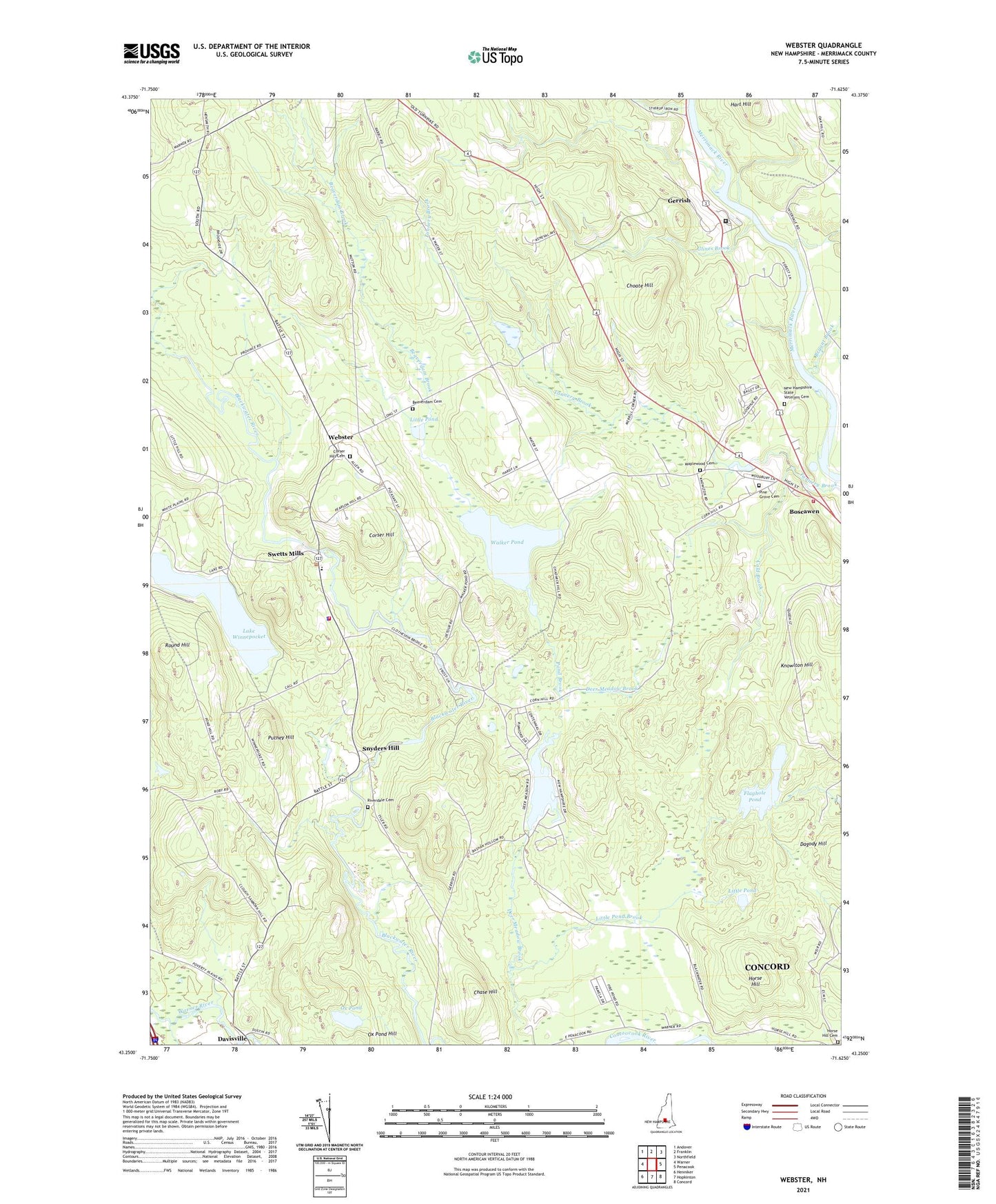
2024 topographic map quadrangle Webster in the state of New Hampshire. Scale: 1:24000. Based on the newly updated USGS 7.5' US Topo map series, this map is in the following counties: Merrimack. The map contains contour data, water features, and other items you are used to seeing on USGS maps, but also has updated roads and other features. This is the next generation of topographic maps. Printed on high-quality waterproof paper with UV fade-resistant inks.
Quads adjacent to this one:
West: Warner
Northwest: Andover
North: Franklin
Northeast: Northfield
East: Penacook
Southeast: Concord
South: Hopkinton
Southwest: Henniker
This map covers the same area as the classic USGS quad with code o43071c6.
Contains the following named places: Allen State Forest, Beaverdam Brook, Beaverdam Cemetery, Blackwater Dam, Boscawen Fire Department, Bryant Brook, Chase Hill, Choate Hill, Cold Brook, Corser Hill, Corser Hill Cemetery, Davisville, Dingit Corner, Flaghole Pond, Flaghole Pond Dam, Gerrish, Gerrish Corner, Glines Brook, Hart Hill, Hirst State Wildlife Management Area, Horse Hill, Horse Hill Cemetery, Jamie Welch Memorial Field, Knowlton Hill, Lake Winnepocket, Little Pond, Little Pond Brook, Maplewood Cemetery, Mast Yard, Merrimack County, Merrimack County Department of Corrections, Merrimack County Farm, Merrimack River State Forest, New Hampshire State Veterans Cemetery, Ox Pond, Pillsbury Lake, Pillsbury Lake Dam, Pine Grove Cemetery, Pond Brook, Puthey Hill, Richardson's Farm, Riverdale Cemetery, Round Hill, Snyders Hill, Stirrup Iron Brook, Swetts Mills, Town of Boscawen, Town of Webster, Walker Pond, Webster, Webster Congregational Church, Webster Elementary School, Webster Fire Department, Webster Police Dept, ZIP Code: 03303