MyTopo
Peterborough North New Hampshire US Topo Map
Couldn't load pickup availability
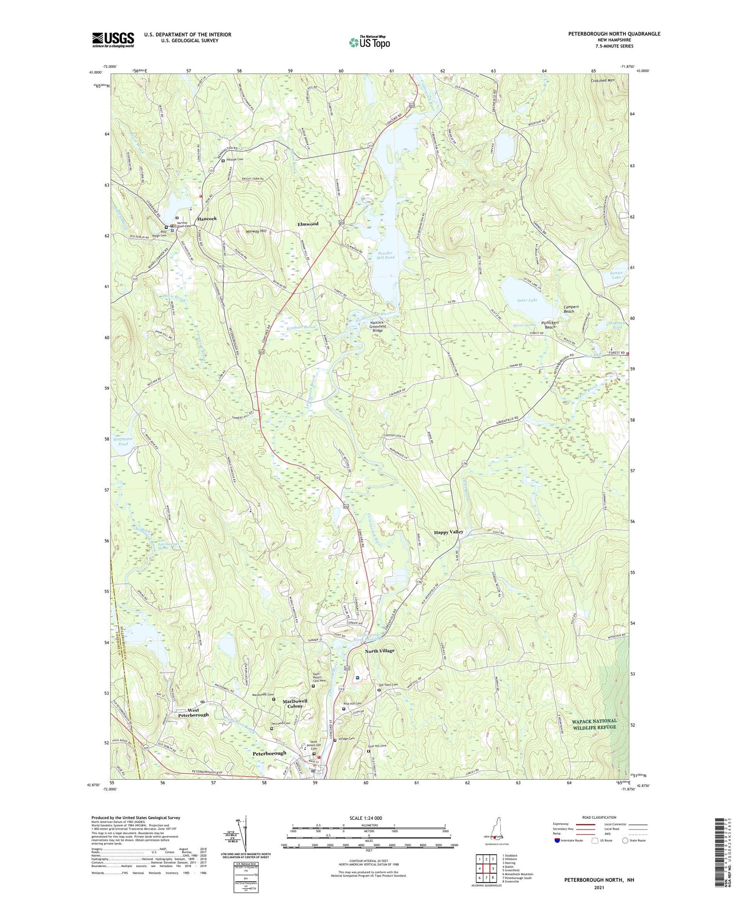
2021 topographic map quadrangle Peterborough North in the state of New Hampshire. Scale: 1:24000. Based on the newly updated USGS 7.5' US Topo map series, this map is in the following counties: Hillsborough, Cheshire. The map contains contour data, water features, and other items you are used to seeing on USGS maps, but also has updated roads and other features. This is the next generation of topographic maps. Printed on high-quality waterproof paper with UV fade-resistant inks.
Quads adjacent to this one:
West: Dublin
Northwest: Stoddard
North: Hillsboro
Northeast: Deering
East: Greenfield
Southeast: Greenville
South: Peterborough South
Southwest: Monadnock Mountain
Contains the following named places: All Saints Episcopal Church, Beaver Pond, Boston University Sargent Camp, Brush Brook, Campers Beach, Contoocook River Reservoir, ConVal Regional High School, Davis Brook, East Hill Cemetery, Edward MacDowell Dam, Edward MacDowell Reservoir, Elmwood, Evas Marsh State Wildlife Management Area, Ferguson Brook, First Church of Christ Scientist, Greenfield Fire Department, Greenfield State Park, Greenfield State Park Campground Office, Halfmoon Pond, Hancock, Hancock Census Designated Place, Hancock Congregational Church, Hancock Elementary School, Hancock Fire and Rescue, Hancock Meeting House, Hancock Post Office, Hancock Town Police Department, Hancock-Greenfield Bridge, Happy Valley, Hillside Cemetery, Hogback Pond, Hosley Brook, John Hancock Grange, Kimbatt Brook, MacDowell Cemetery, MacDowell Colony, Mill Race Dam, Monadnock Community Hospital, Monadnock Country Club, Moose Brook, Mud Pond, North Village, North Village Dam, Norway Hill, Norway Plain Cemetery, Norway Pond, Nubanusit Brook, Old Town Cemetery, Otter Brook, Otter Brook Pond, Otter Lake, Peterborough Census Designated Place, Peterborough Elementary School, Peterborough Fire and Rescue, Peterborough Historical Society Building, Peterborough Historical Society Library, Peterborough Post Office, Peterborough Town Hall, Peterborough Town Library, Peterborough Treatment Lagoons Dam, Petersborough Unitarian Church, Picnickers Beach, Pine Hill Cemetery, Pine Ridge Cemetery, Powder Mill Pond, Powder Mill Pond Dam, Saint Joseph Minor Seminary, Saint Peters Cemetery New, Saint Peters Old Cemetery, Scout Trail, Seccomb Cemetery, Shieling State Forest, South Meadow Middle School, Spruce Swamp, Sunset Lake, The Common, The Well School, Thomas H Eckfeldt Memorial Medical Library, Town of Hancock, Town of Peterborough, Trinity Christian Academy, Village Cemetery, West Peterborough, West Peterborough Marsh, West Peterborough Post Office, Whittemore Lake, Whittemore Lake Dam, ZIP Codes: 03047, 03449