MyTopo
Smarts Mountain New Hampshire US Topo Map
Couldn't load pickup availability
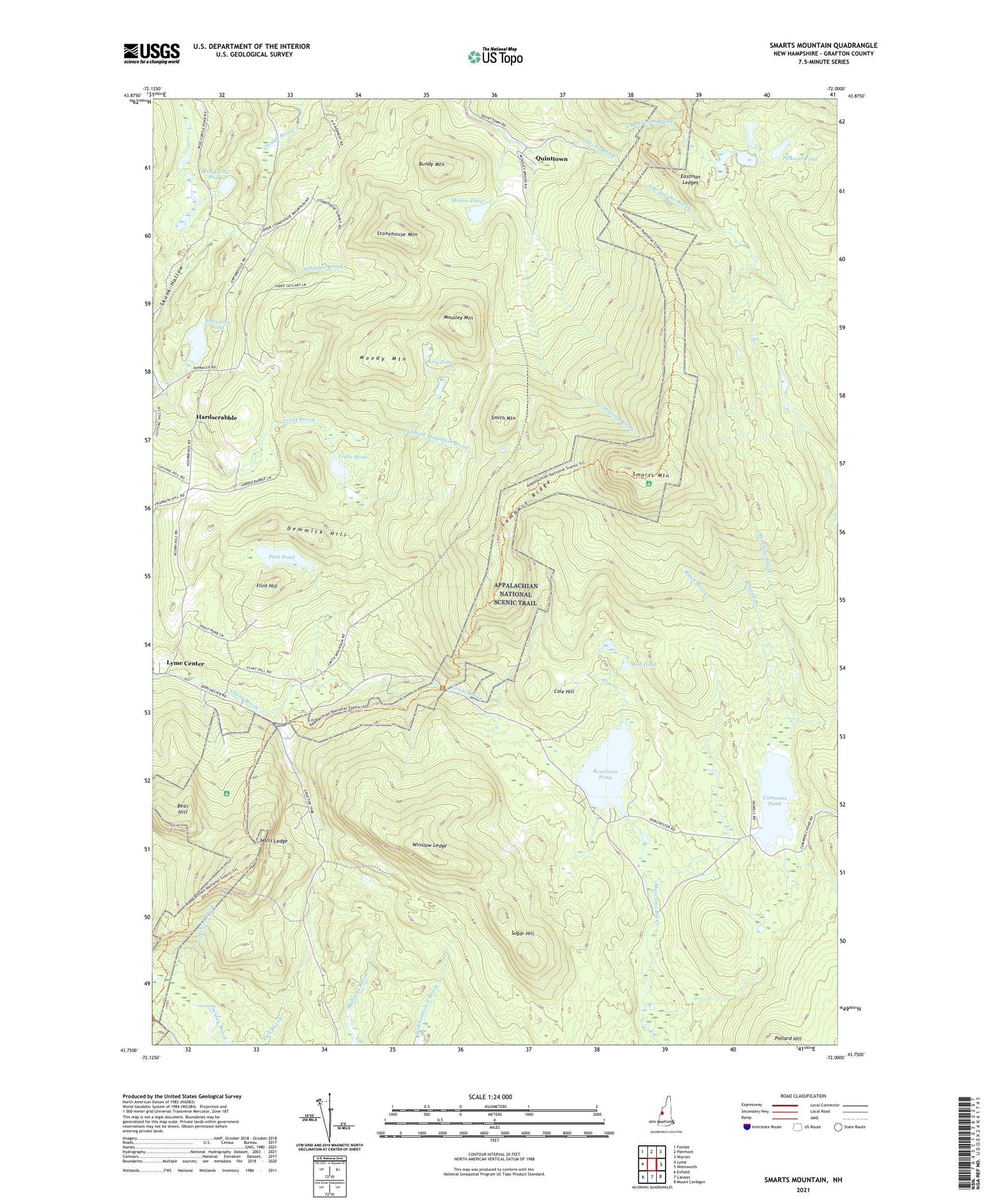
2021 topographic map quadrangle Smarts Mountain in the state of New Hampshire. Scale: 1:24000. Based on the newly updated USGS 7.5' US Topo map series, this map is in the following counties: Grafton. The map contains contour data, water features, and other items you are used to seeing on USGS maps, but also has updated roads and other features. This is the next generation of topographic maps. Printed on high-quality waterproof paper with UV fade-resistant inks.
Quads adjacent to this one:
West: Lyme
Northwest: Fairlee
North: Piermont
Northeast: Warren
East: Wentworth
Southeast: Mount Cardigan
South: Canaan
Southwest: Enfield
Contains the following named places: Bear Hill, Black Brook, Bundy Mountain, Clark Pond Loop, Clough Branch, Cole Hill, Cummins Pond, Cummins Pond Dam, Dartmouth Skiway, Demmick Hill, DOC Camp, Eastman Ledges, Flint Hill, Hardscrabble, Hermit Hill Farm Pond Dam, Holts Ledge, Lambert Ridge, Lampier Hill, Lily Pond, Lyme Center, Mason Pond, Meadow Brook, Moody Mountain, Mousley Brook, Mousley Mountain, Mud Pond, Mud Turtle Pond, North Branch Jacobs Brook, Pickerel Pond, Pout Pond, Quinttown, Reservoir Pond, Reservoir Pond Dam, Smarts Mountain, Smith Mountain, Smith Mountain Brook, South Branch Jacobs Brook, Stevenson Pond, Stonehouse Mountain, Sugar Hill, Town of Lyme, Trapper John Shelter, Trout Pond, Winslow Ledge, ZIP Code: 03768