MyTopo
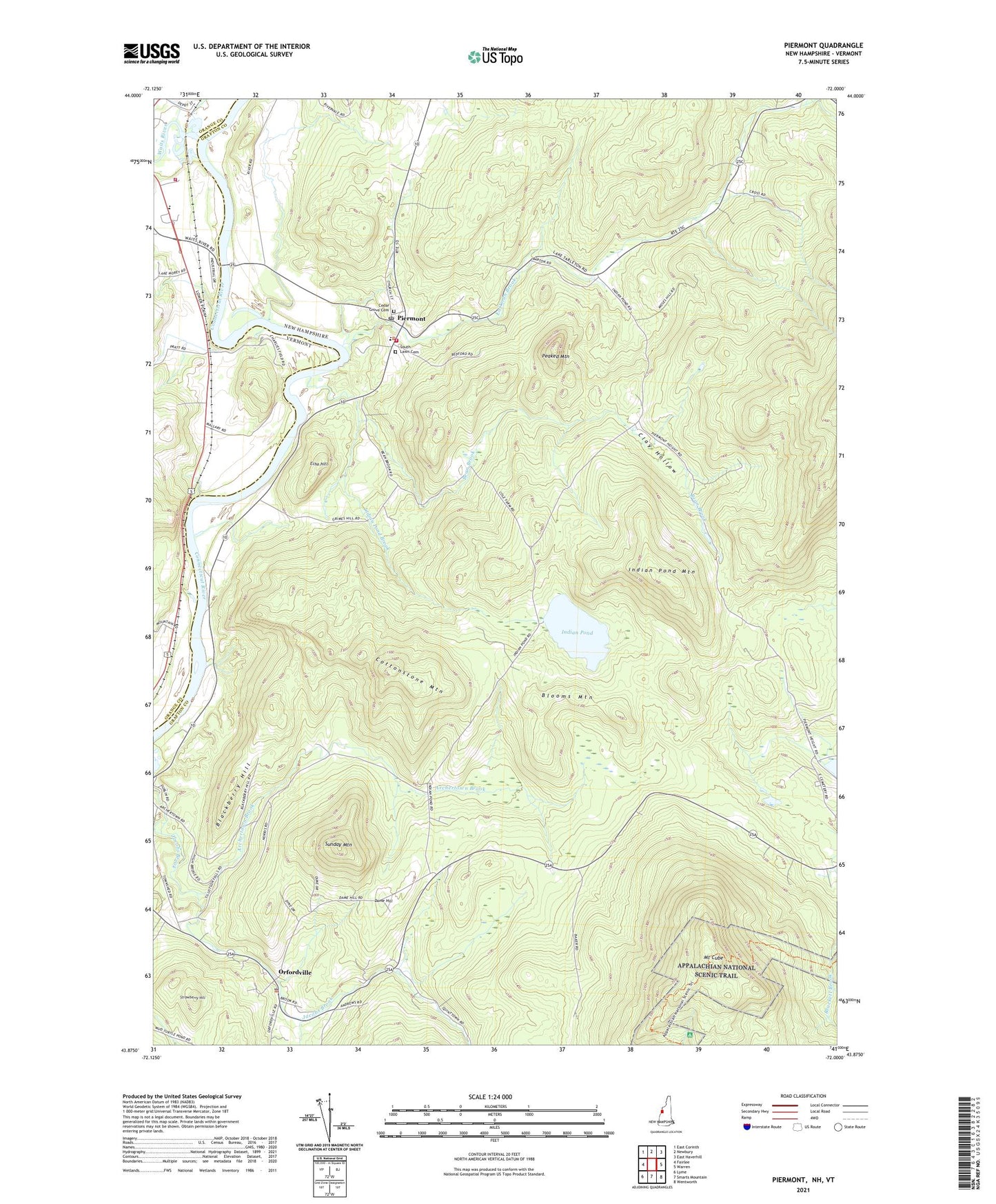
Piermont New Hampshire US Topo Map
Couldn't load pickup availability
Also explore the Piermont Forest Service Topo of this same quad for updated USFS data
2024 topographic map quadrangle Piermont in the states of New Hampshire, Vermont. Scale: 1:24000. Based on the newly updated USGS 7.5' US Topo map series, this map is in the following counties: Grafton, Orange. The map contains contour data, water features, and other items you are used to seeing on USGS maps, but also has updated roads and other features. This is the next generation of topographic maps. Printed on high-quality waterproof paper with UV fade-resistant inks.
Quads adjacent to this one:
West: Fairlee
Northwest: East Corinth
Northeast: East Haverhill
East: Warren
Southeast: Wentworth
South: Smarts Mountain
Southwest: Lyme
Contains the following named places: Archertown Brook, Bean Brook, Blackberry Hill, Blooms Mountain, Boynton School, Bradford Fire Department, Camp Weston, Cedar Grove Cemetery, Clay Hollow, Clough Brook, Cottonstone Mountain, Dame Hill, Dartmouth Outing Club Camp, Eastman Brook, Echo Hill, Grimes Hill Road, Indian Pond, Indian Pond Brook, Indian Pond Mountain, Lower Plain Piermont Station, Mount Cube, Mount Cube Ski Touring Center, Orford Police Department, Orfordville, Peaked Mountain, Piermont, Piermont Fire Department, Piermont First Aid Stabilization Team Squad, Piermont Post Office, Piermont Village School, South Lawn Cemetery, Strawberry Hill, Sunday Mountain, Town of Orford, Town of Piermont, Waits River, ZIP Codes: 03777, 03779