MyTopo
Stark New Hampshire US Topo Map
Couldn't load pickup availability
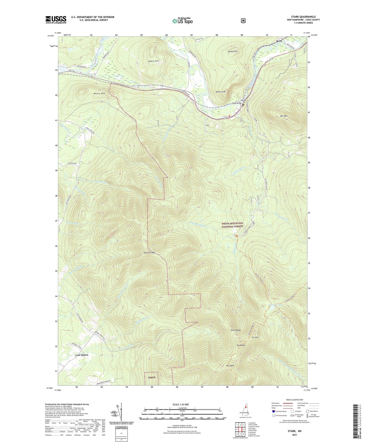
2021 topographic map quadrangle Stark in the state of New Hampshire. Scale: 1:24000. Based on the newly updated USGS 7.5' US Topo map series, this map is in the following counties: Coos. The map contains contour data, water features, and other items you are used to seeing on USGS maps, but also has updated roads and other features. This is the next generation of topographic maps. Printed on high-quality waterproof paper with UV fade-resistant inks.
Quads adjacent to this one:
West: Groveton
Northwest: Stratford
North: Percy Peaks
Northeast: Dummer Ponds
East: West Milan
Southeast: Mount Crescent
South: Jefferson
Southwest: Lancaster
Contains the following named places: Ames Brook, Beach Hill, Blake School, Cummings Brook, Cummings School, Devils Slide, Dickey Hill, East Branch Mill Brook, Fox Brook, Hickey Brook, Hutchins Mountain, Lost Nation, McCordick Brook, Mile Swamp, Mill Brook, Mill Mountain, Moore Mountain, Mount Cabot, Percy, Pilot Range, Rowells Brook, Stark, Stark Bridge, Stark Fire Department, Stark Police Department, Stark Union Church, Stark Village School, The Bulge, The Horn, Town of Stark, Unknown Pond, Village Cemetery, West Branch Mill Brook, ZIP Code: 03582