MyTopo
Stratford New Hampshire US Topo Map
Couldn't load pickup availability
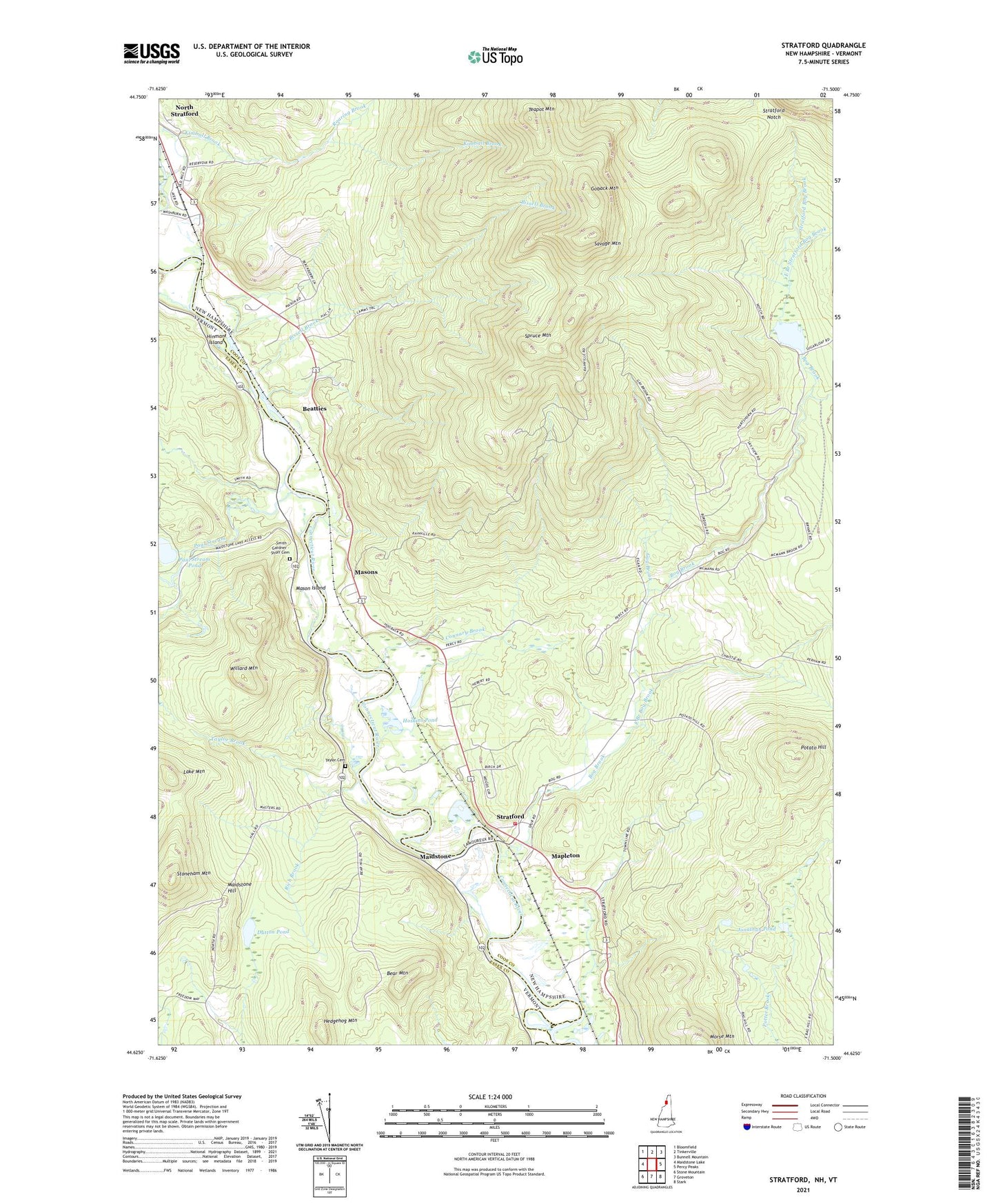
2024 topographic map quadrangle Stratford in the states of New Hampshire, Vermont. Scale: 1:24000. Based on the newly updated USGS 7.5' US Topo map series, this map is in the following counties: Coos, Essex. The map contains contour data, water features, and other items you are used to seeing on USGS maps, but also has updated roads and other features. This is the next generation of topographic maps. Printed on high-quality waterproof paper with UV fade-resistant inks.
Quads adjacent to this one:
Northwest: Bloomfield
North: Tinkerville
Northeast: Bunnell Mountain
East: Percy Peaks
Southeast: Stark
South: Groveton
Southwest: Stone Mountain
Contains the following named places: Bear Mountain, Beatties, Bissell Brook, Bog Brook, Connary Brook, Dutton Pond, East Branch Bog Brook, East Branch Stratford Bog Brook, Gay Brook, Goback Mountain, Hedgehog Mountain, Hinman Island, Hoskins Pond, Jonathan Pond, Kimball Brook, Lake Mountain, Maidstone, Maidstone Hill, Mapleton, Mason Island, Masons, Morse Mountain, Paul Stream, Paul Stream Pond, Potato Hill, Rich Brook, Roaring Brook, Savage Mountain, Smith - Gardner - Shoff Cemetery, Spruce Mountain, Stoneham Mountain, Stratford, Stratford Bog Brook, Stratford Bog Pond, Stratford Bog Pond Dam, Stratford Hollow Fire Department, Stratford Notch, Sugarloaf Brook, Taylor Brook, Taylor Cemetery, Teapot Mountain, Town of Maidstone, Town of Stratford, Wheeler Stream, Willard Mountain