MyTopo
Walpole New Hampshire US Topo Map
Couldn't load pickup availability
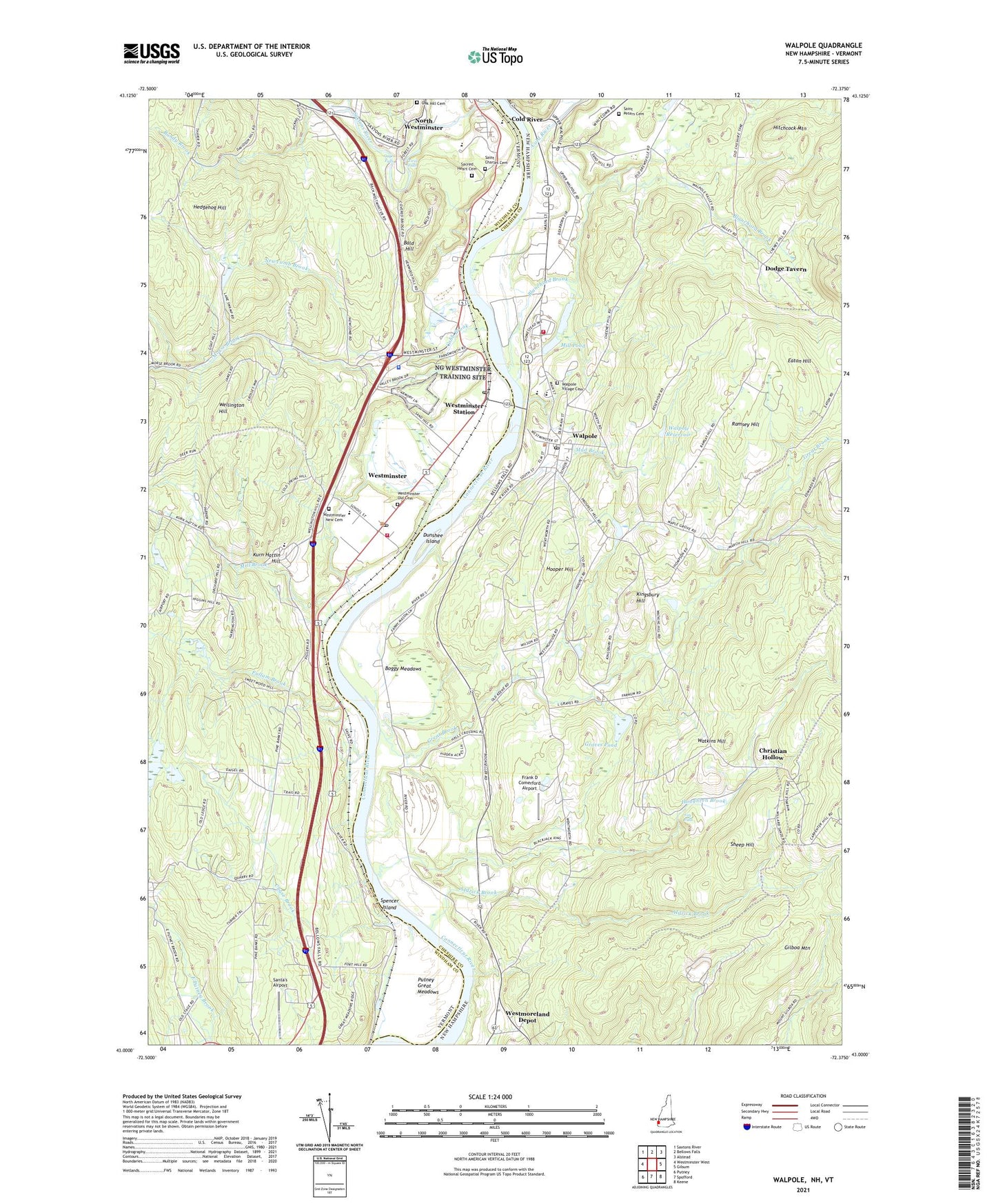
2021 topographic map quadrangle Walpole in the states of New Hampshire, Vermont. Scale: 1:24000. Based on the newly updated USGS 7.5' US Topo map series, this map is in the following counties: Cheshire, Windham. The map contains contour data, water features, and other items you are used to seeing on USGS maps, but also has updated roads and other features. This is the next generation of topographic maps. Printed on high-quality waterproof paper with UV fade-resistant inks.
Quads adjacent to this one:
West: Westminster West
Northwest: Saxtons River
Northeast: Alstead
East: Gilsum
Southeast: Keene
South: Spofford
Southwest: Putney
Contains the following named places: Aldrick Brook, Alexander Watkins Tavern, Bald Hill, Bazin Farm, Bellows Falls Union High School, Blanchard Brook, Boggy Meadows, Bridge Memorial Library, Bundy Brook, Butterfield Library, Chase Brook, Christian Hollow, Cobb Brook, Cold River, Dodge Tavern, Dunshee Island, Eaton Hill, Fay Falls, First Congregational Church, Frank D Comerford Airfield, Frank D Comerford Airport, Fullam Brook, Gages Falls, Gilboa Mountain, Golden Cross Ambulance Service, Graves Pond, Great Brook, Grout Station, Hadley Field, Hedgehog Hill, Hitchcock Mountain, Hooper Golf Club, Hooper Hill, Houghton Brook, Kingsbury Hill, Kurn Hattin Hill, Kurn Hattin Home, Kurn Hattin Homes School, Mad Brook, Major W Guth Airport, Mill Brook, Mill Pond, Mill Pond Dam, Morse Brook, Newcomb Brook, North Westminster, North Westminster Census Designated Place, Oak Hill Cemetery, Putney Great Meadows, Ramsey Hill, Sacred Heart Cemetery, Saint Charles Cemetery, Saint Johns Episcopal Church, Saint Peters Cemetery, Santa's Airport, Saxtons River, Sheep Hill, Spencer Island, The Compass School, Town of Walpole, Twin Falls, Vermont State Police Troop D - Westminster Barracks, Village of North Westminster, Village of Westminster, Walpole, Walpole Academy, Walpole Census Designated Place, Walpole Elementary School, Walpole Fire Department, Walpole Historical Society Building, Walpole Middle School, Walpole Post Office, Walpole Primary School, Walpole Reservoir, Walpole Town Hall, Walpole Village Cemetery, Watkins Hill, Wellington Hill, Westminster, Westminster Center School, Westminster Community Hall, Westminster Institute, Westminster New Cemetery, Westminster Old Cemetery, Westminster Post Office, Westminster Station, Westminster Station Post Office, Westminster Village Historic District, Westminster Volunteer Fire and Rescue Department, Westmoreland Depot, ZIP Codes: 03608, 05158