MyTopo
West Milan New Hampshire US Topo Map
Couldn't load pickup availability
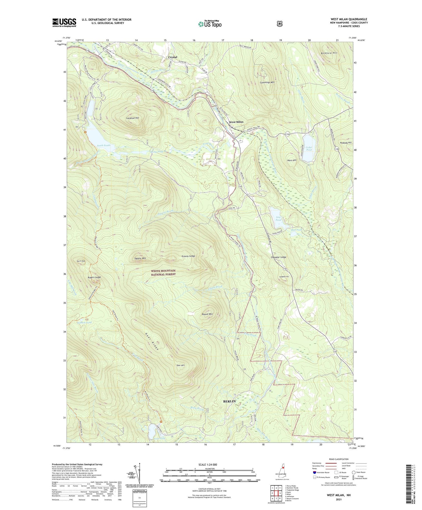
2021 topographic map quadrangle West Milan in the state of New Hampshire. Scale: 1:24000. Based on the newly updated USGS 7.5' US Topo map series, this map is in the following counties: Coos. The map contains contour data, water features, and other items you are used to seeing on USGS maps, but also has updated roads and other features. This is the next generation of topographic maps. Printed on high-quality waterproof paper with UV fade-resistant inks.
Quads adjacent to this one:
West: Stark
Northwest: Percy Peaks
North: Dummer Ponds
Northeast: Teakettle Ridge
East: Milan
Southeast: Berlin
South: Mount Crescent
Southwest: Jefferson
Contains the following named places: Betty Brook, Bickford Hill, Cedar Brook, Cedar Pond, Chandler Ledge, Cold Brook, Cold Stream, Crystal, Cummings Mountain, Deer Mountain, Deer Ridge, Devils Hopyard Stream, Dummer Plain School, Fifield Brook, Fogg Brook, Greens Ledge, Higgins Brook, Hodgdon Hill, Hodgdon Hill School, Horn Hill, Kilback Pond, Location Hill, Mud Pond, Nay Pond, North Branch Upper Ammonoosuc River, North Peak, One Mile Brook, Phillips Brook, Pond Brook, Rocky Pond, Rogers Ledge, Round Mountain, South Ponds, Square Mountain, West Milan, York Pond, York Pond Dam