MyTopo
Elmer New Jersey US Topo Map
Couldn't load pickup availability
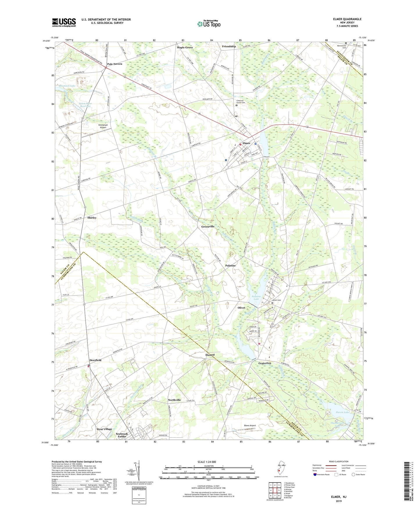
2019 topographic map quadrangle Elmer in the state of New Jersey. Scale: 1:24000. Based on the newly updated USGS 7.5' US Topo map series, this map is in the following counties: Salem, Cumberland, Gloucester. The map contains contour data, water features, and other items you are used to seeing on USGS maps, but also has updated roads and other features. This is the next generation of topographic maps. Printed on high-quality waterproof paper with UV fade-resistant inks.
Quads adjacent to this one:
West: Alloway
Northwest: Woodstown
North: Pitman West
Northeast: Pitman East
East: Newfield
Southeast: Millville
South: Bridgeton
Southwest: Shiloh
Contains the following named places: Arthur P Schalick High School, Blews Airport, Borough of Elmer, C F Seabrook Elementary School, Centerton, Centerton Fire Company, Centerton Park, Centerton Pond, Centerton Pond Dam, Chestnut Grove Cemetery, Coombs Airport, Deerfield, Deerfield Church, Deerfield Street Census Designated Place, Deerfield Street Post Office, Elizabeth F Moore Elementary School, Elmer, Elmer Ambulance Corps, Elmer Community Hospital Heliport, Elmer Elementary School, Elmer Lake, Elmer Police Department, Elmer Post Office, Elmer Volunteer Fire Department, Emmanuel Airport, Faith Church, Friendship, Greenville, HIG, Husted, Indian Run, Inspira Medical Center Elmer, Larchmont Farms, Lawrence Corner, Maple Grove, Monroeville Cemetery, Monroeville Synogogue, Northville, Olivet, Olivet Cemetery, Olivet Census Designated Place, Olivet Church, Olivet Elementary School, Palatine, Palatine Branch, Palatine Lake, Parvin Lake, Parvin Lake Dam, Parvin State Park, Pittsgrove Township Bureau of Fire Safety, Pittsgrove Township Middle School, Pole Tavern, Sadies Dam, Salem River Reservoir, Seabrook, Seabrook Farms, Seabrook Farms Census Designated Place, Seabrook House, Shirley, Steels Corner, Thundergust Brook, Thundergust Lake, Thundergust Pond Dam, Township of Pittsgrove, Township of Upper Pittsgrove, Upper Deerfield Township Fire Company Station 1 Deerfield Street, West Village, Woodruff Middle School, ZIP Code: 08318