MyTopo
Heislerville New Jersey US Topo Map
Couldn't load pickup availability
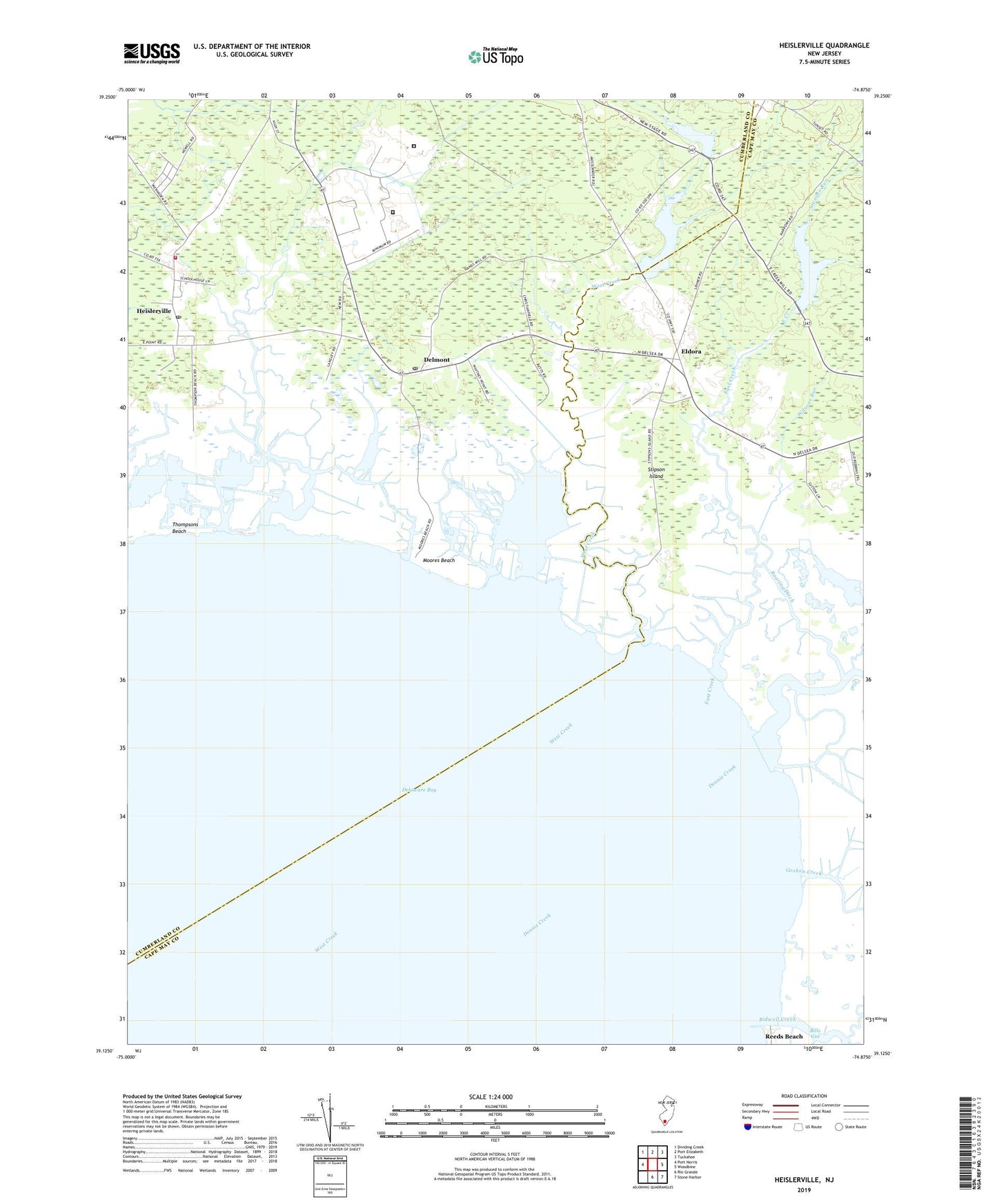
2019 topographic map quadrangle Heislerville in the state of New Jersey. Scale: 1:24000. Based on the newly updated USGS 7.5' US Topo map series, this map is in the following counties: Cumberland, Cape May. The map contains contour data, water features, and other items you are used to seeing on USGS maps, but also has updated roads and other features. This is the next generation of topographic maps. Printed on high-quality waterproof paper with UV fade-resistant inks.
Quads adjacent to this one:
West: Port Norris
Northwest: Dividing Creek
North: Port Elizabeth
Northeast: Tuckahoe
East: Woodbine
Southeast: Stone Harbor
South: Rio Grande
Contains the following named places: Bayside State Prison, Bidwell Creek, Bills Gut, Delmont, Delmont Census Designated Place, Delmont Post Office, Dennis Creek, East Creek, East Creek Pond, East Creek Pond Dam, Eldora, Eldora School, Goshen Creek, Hands Mill Pond, Hands Mill Pond Dam, Heislerville, Heislerville Census Designated Place, Heislerville Post Office, Heislerville Volunteer Fire Company, Moores Beach, New Jersey State Prison Farm, Old Robins Branch, Pickle Factory Pond, Riggin Ditch, Roaring Ditch, Savages Run, Southern State Correctional Facility, Stipson Island, Thompsons Beach, Victory Lakes Dam Number One, West Creek, Wilsons Run, ZIP Codes: 08314, 08324