MyTopo
Tuckahoe New Jersey US Topo Map
Couldn't load pickup availability
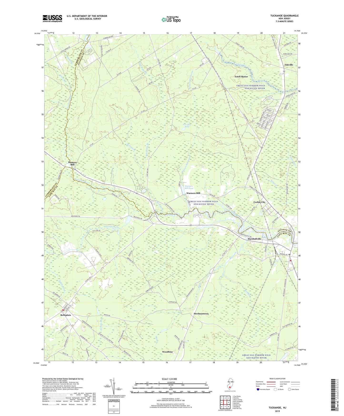
2023 topographic map quadrangle Tuckahoe in the state of New Jersey. Scale: 1:24000. Based on the newly updated USGS 7.5' US Topo map series, this map is in the following counties: Atlantic, Cape May, Cumberland. The map contains contour data, water features, and other items you are used to seeing on USGS maps, but also has updated roads and other features. This is the next generation of topographic maps. Printed on high-quality waterproof paper with UV fade-resistant inks.
Quads adjacent to this one:
West: Port Elizabeth
Northwest: Five Points
North: Dorothy
Northeast: Mays Landing
East: Marmora
Southeast: Sea Isle City
South: Woodbine
Southwest: Heislerville
This map covers the same area as the classic USGS quad with code o39074c7.
Contains the following named places: Back Run, Belleplain, Belleplain Census Designated Place, Belleplain Emergency Corps Medical Transport, Belleplain State Forest, Belleplain Volunteer Fire Company, Buck Hill Station, City of Estell Manor, Corbin City, Five Acre Pond, Green Branch, Head of River, Hunters Mill, Marshallville, Marshallville Census Designated Place, McNeals Branch, Mill Creek, Oakville, Pole Bridge Branch, Sharps Branch, Steelmantown, Tarkiln Brook, Tuckahoe, Tuckahoe Post Office, Tuckahoe Volunteer Fire Company, Warners Mill, Warners Mill Pond, Warners Mill Stream, WBSS-FM (Millville), ZIP Codes: 08270, 08319