MyTopo
Rio Grande New Jersey US Topo Map
Couldn't load pickup availability
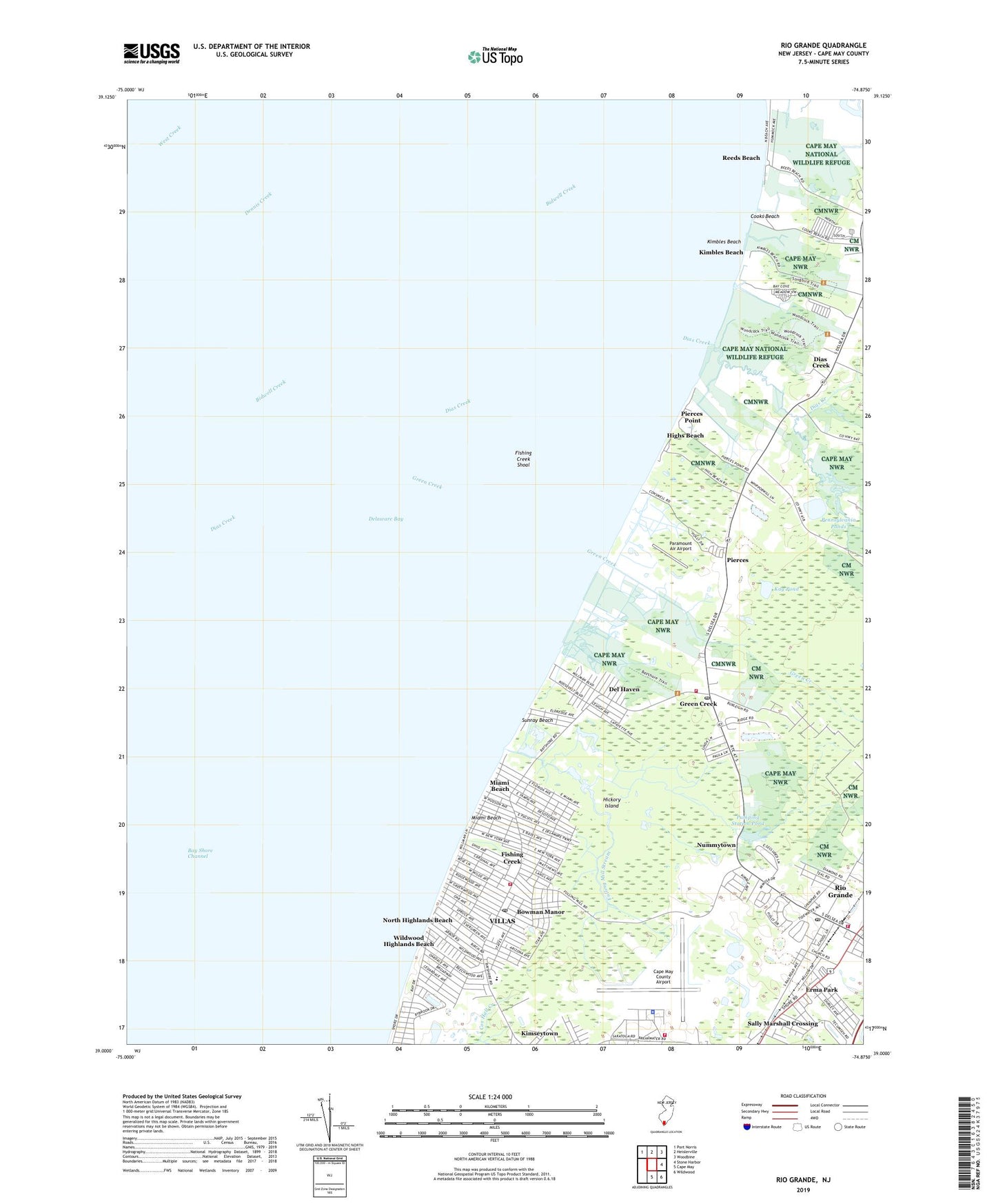
2023 topographic map quadrangle Rio Grande in the state of New Jersey. Scale: 1:24000. Based on the newly updated USGS 7.5' US Topo map series, this map is in the following counties: Cape May. The map contains contour data, water features, and other items you are used to seeing on USGS maps, but also has updated roads and other features. This is the next generation of topographic maps. Printed on high-quality waterproof paper with UV fade-resistant inks.
Quads adjacent to this one:
Northwest: Port Norris
North: Heislerville
Northeast: Woodbine
East: Stone Harbor
Southeast: Wildwood
South: Cape May
This map covers the same area as the classic USGS quad with code o39074a8.
Contains the following named places: Bowman Manor, Cape May County Airport, Cooks Beach, Del Haven, Dias Creek, Erma Park, Erma Volunteer Fire Company, Fishing Creek, Fishing Creek School, Fishing Creek Shoal, Fulling Mill Stream, Green Creek, Green Creek Post Office, Green Creek Volunteer Fire Company 3, Hickory Island, Highs Beach, Kay Pond, Kimbles Beach, Kimseytown, King Crab Landing, Lower Township Bureau of Fire Safety, Lower Township Police Department, Lower Township Rescue Squad, Marcy Landing, Memorial Elementary School, Miami Beach, Naval Air Station Wildwood, Norburys Landing, North Highlands Beach, Nummytown, Paramount Air Airport, Pennsylvania Ponds, Pierces, Pierces Point, Pierces Point Pond, Potato Island, Pumping Station Pond, Reeds Beach, Rio Grand Volunteer Fire Station 72, Rio Grande, Rio Grande Census Designated Place, Rio Grande Post Office, Saint Raymond Regional Elementary School, Sally Marshall Crossing, Sunray Beach, Villas, Villas Census Designated Place, Villas Post Office, Villas Volunteer Fire Company, Wildwood Highlands Beach, Wuerkers New Acres Farm Heliport, ZIP Codes: 08242, 08251