MyTopo
Port Norris New Jersey US Topo Map
Couldn't load pickup availability
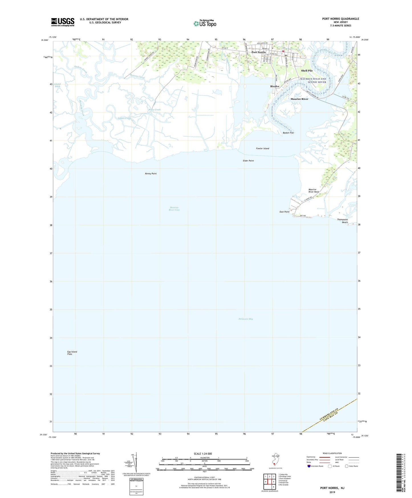
2023 topographic map quadrangle Port Norris in the state of New Jersey. Scale: 1:24000. Based on the newly updated USGS 7.5' US Topo map series, this map is in the following counties: Cumberland, Cape May. The map contains contour data, water features, and other items you are used to seeing on USGS maps, but also has updated roads and other features. This is the next generation of topographic maps. Printed on high-quality waterproof paper with UV fade-resistant inks.
Quads adjacent to this one:
West: Fortescue
Northwest: Cedarville
North: Dividing Creek
Northeast: Port Elizabeth
East: Heislerville
Southeast: Rio Grande
This map covers the same area as the classic USGS quad with code o39075b1.
Contains the following named places: Andrews Ditch, Basket Flat, Bay Ponds, Bivalve, Bowkers Run, Brown School, Dickeys Ditch, Dividing Creek, East Branch Pond, East Point, Elder Point, Fowler Island, Hansey Creek, Heislerville Fish and Wildlife Management Area, Indian Creek, Island Ditch, Kenny Point, Matts Landing, Maurice River, Maurice River Cove, Maurice River Neck, New England Creek, Ogdens Creek, Oranoaken Creek, Port Norris, Port Norris Fire Company 1, Port Norris Middle School, Port Norris Post Office, Round Pond, Saint Anthonys Church, Shell Pile, Shiloh Church, Ware Creek, Wave Creek, Wesley Church