MyTopo
Hopewell New Jersey US Topo Map
Couldn't load pickup availability
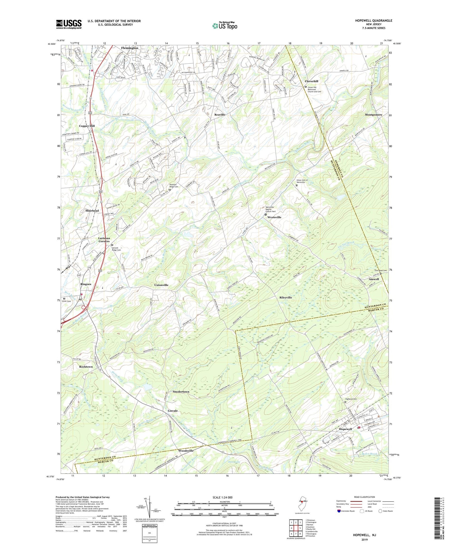
2019 topographic map quadrangle Hopewell in the state of New Jersey. Scale: 1:24000. Based on the newly updated USGS 7.5' US Topo map series, this map is in the following counties: Hunterdon, Mercer, Somerset. The map contains contour data, water features, and other items you are used to seeing on USGS maps, but also has updated roads and other features. This is the next generation of topographic maps. Printed on high-quality waterproof paper with UV fade-resistant inks.
Quads adjacent to this one:
West: Stockton
Northwest: Pittstown
North: Flemington
Northeast: Raritan
East: Rocky Hill
Southeast: Princeton
South: Pennington
Southwest: Lambertville
Contains the following named places: Amwell, Amwell First Presbyterian Church, Amwell Lake Wildlife Management Area, Amwell Ridge Cemetery, Amwell School, Amwell Valley Ambulance, Amwell Valley Fire Company, Back Brook, Barley Sheaf Elementary School, Borough of Hopewell, Branch Back Brook, Buttonwood Corners, Calvary Baptist Church, Calvary Presbyterian Church of Amwell, Camp Harmony, Clover Hill Reformed Church, Clover Hill Reformed Church and Cemetery, Clover Hill School, Cloverhill, Copper Hill, Copper Hill Country Club, Copper Hill School, East Amwell Township Elementary School, First Neshanic River, Flemington Montessori School, Furmans Corner, Highland Cemetery, Hillsborough Country Club, Hillside Farm Heliport, Hopewell, Hopewell Boro Park, Hopewell Borough Building, Hopewell Church, Hopewell Elementary School, Hopewell Fire Department and Emergency Medical Unit, Hopewell Post Office, Hopewell United Methodist Church, Hunt Lake, Kirkpatrick Presbyterian Church, Larisons Corners, Linvale, Linvale United Methodist Church, Montgomery, Muirhead, O'Dwyer Airport, Peters Brook, Pleasant Ridge Cemetery, Raritan Township Fire Company Station 21, Reaville, Reaville School, Rileyville, Ringoes, Ringoes Census Designated Place, Ringoes Post Office, Rocktown, Rocktown School, Saint Alphonsus Church, Second Neshanic River, Snydertown, Third Neshanic River, Thompson Landing, Township of East Amwell, Union Cemetery, Union Cemetery of Wertsville, Unionville, United First Presbyterian Church, Vanlieu Corners, Walnut Brook, Wertsville, Wertsville Baptist Church Yard, Woodfern Elementary School, Woodsville, Woodsville Brook, Zion Road Cemetery, ZIP Codes: 08525, 08551