MyTopo
Pittstown New Jersey US Topo Map
Couldn't load pickup availability
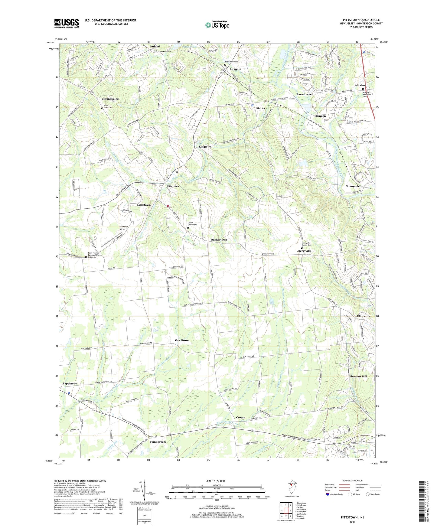
2023 topographic map quadrangle Pittstown in the state of New Jersey. Scale: 1:24000. Based on the newly updated USGS 7.5' US Topo map series, this map is in the following counties: Hunterdon. The map contains contour data, water features, and other items you are used to seeing on USGS maps, but also has updated roads and other features. This is the next generation of topographic maps. Printed on high-quality waterproof paper with UV fade-resistant inks.
Quads adjacent to this one:
West: Frenchtown
Northwest: Bloomsbury
North: High Bridge
Northeast: Califon
East: Flemington
Southeast: Hopewell
South: Stockton
Southwest: Lumberville
This map covers the same area as the classic USGS quad with code o40074e8.
Contains the following named places: Allens Corner, Allerton, Allerton Creek, Allerton Methodist Cemetery, Allerton United Methodist Church, Alvater Corner, Atlantic Ambulance Corps, Augie's Tree Farm, Bethlehem Cemetery, Bethlehem Church, Bradford Field, Cakepoulin Creek, Calvary Church, Capoolong Wildlife Management Area, Cherryville, Cherryville Baptist Cemetery, Cherryville Baptist Church, Clinton Township Police Department, Copper Penny, Cramers Creek, Croton, Echo Lake, Formica, Franklin Township Elementary School, Franklin Township Police Department Pittstown, Gary Corner, Grandin, Hamden, Hunterdon County, Independence School, Jutland, Jutland Lake, Jutland School, Kingtown, Klinesville, Klinesville School, Lansdowne, Littletown, Locust Grove Cemetery, Mechlings Corner, Mock Airport, Mount Salem, Mount Salem Cemetery, New Jersey State Police Troop C Kingwood Station, Oak Grove, Oakgrove Grange Hall, Patrick McGaheran Elementary School, Peaceful Valley Orchards, Pittstown, Pittstown Post Office, Point Breeze, Quakertown, Quakertown Fire Company Station 91, Quakertown Post Office, Quakertown United Methodist Church, Quakertown Volunteer Emergency Medical Services, Robert Hunter Elementary School, Saint Thomas Episcopal Church, Saint Thomas Episcopal Church Graveyard, Sidney, Sky Manor Airport, Summit School, Sunnyside, Teeny Weeny Acres Airport, Thachers Hill, Township of Franklin, Township of Raritan, WCVH-FM (Flemington), WDVR-FM (Delaware Township), WJHR-AM (Flemington), ZIP Codes: 08801, 08867