MyTopo
West Creek New Jersey US Topo Map
Couldn't load pickup availability
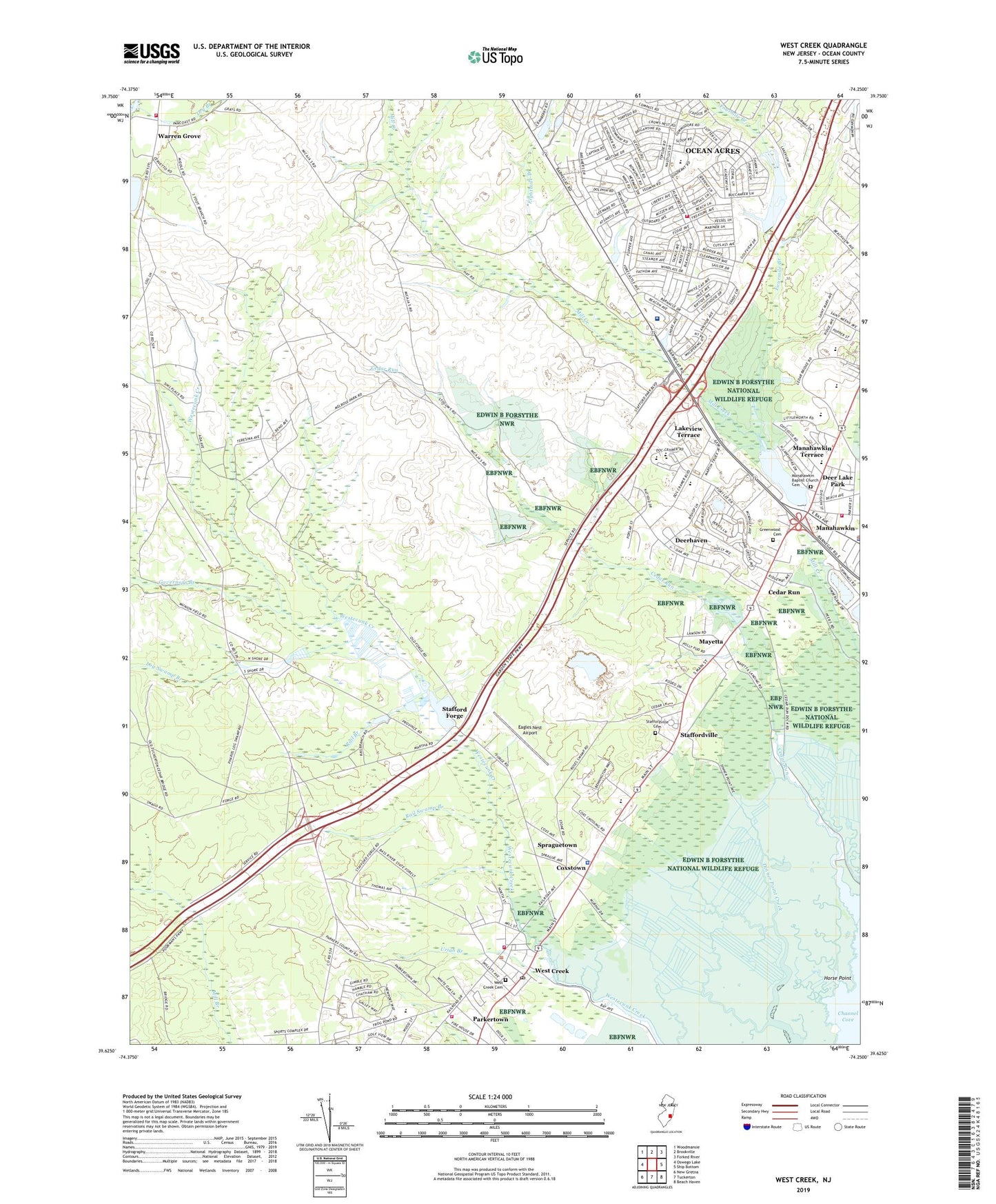
2019 topographic map quadrangle West Creek in the state of New Jersey. Scale: 1:24000. Based on the newly updated USGS 7.5' US Topo map series, this map is in the following counties: Ocean. The map contains contour data, water features, and other items you are used to seeing on USGS maps, but also has updated roads and other features. This is the next generation of topographic maps. Printed on high-quality waterproof paper with UV fade-resistant inks.
Quads adjacent to this one:
West: Oswego Lake
Northwest: Woodmansie
North: Brookville
Northeast: Forked River
East: Ship Bottom
Southeast: Beach Haven
South: Tuckerton
Southwest: New Gretna
Contains the following named places: All Saints Regional Catholic School, Beachview, Cedar Run, Channel Cove, Channel Creek, Coxstown, Deer Lake Park, Deerhaven, Eagles Nest Airport, Eagleswood Township Elementary School, Eagleswood Village, Eagleswood Volunteer Fire Company Station 52, Eightmile Branch, Fourmile Branch, Governors Branch, Greenwood Cemetery, Heritage Park Cultural Center, Holiday Lake, Holiday Lake Dam, Horse Point, Lakeside Speedway, Lakeview Terrace, Little Egg Harbor Township Intermediate School, Log Swamp Branch, Manahawkin, Manahawkin Baptist Church Cemetery, Manahawkin Lake, Manahawkin Lake Dam, Mayetta, Mckinley Avenue Elementary School, Meinders Primary Learning Center School, New Jersey State Police Troop C Tuckerton Station, Northeast Metro Ambulance, Ocean Acres, Ocean Acres Census Designated Place, Ocean Acres Elementary School, Ocean Acres Golf Course, Ocean County Vocational Technical School Marine Academy of Technology, Old Manahawkin Baptist Church, Oxycocus Elementary School, Parkertown, Parkertown Volunteer Fire Company Station 70, Rail Branch, Rail Swamp Branch, Southern Ocean County Hospital Heliport, Southern Ocean Medical Center, Southern Regional Adult Evening High School, Southern Regional High School, Southern Regional Middle School, Southern Water Pollution Control Facility, Spraguetown, Stafford Forge, Stafford Forge Dam, Stafford Forge Wildlife Management Area, Stafford Intermediate School, Stafford Township Emergency Medical Services Station 2, Stafford Township Police Department, Stafford Township Volunteer Fire Company, Stafford Township Volunteer Fire Company Station 1, Staffordville, Staffordville Cemetery, Staffordville Public Landing, Township of Eagleswood, Township of Stafford, Uriah Branch, Warren Grove, Warren Grove Volunteer Fire Company, West Creek, West Creek Cemetery, West Creek Post Office, ZIP Code: 08092