MyTopo
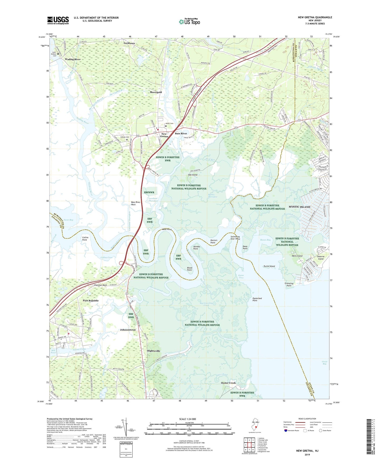
New Gretna New Jersey US Topo Map
Couldn't load pickup availability
2023 topographic map quadrangle New Gretna in the state of New Jersey. Scale: 1:24000. Based on the newly updated USGS 7.5' US Topo map series, this map is in the following counties: Burlington, Atlantic, Ocean. The map contains contour data, water features, and other items you are used to seeing on USGS maps, but also has updated roads and other features. This is the next generation of topographic maps. Printed on high-quality waterproof paper with UV fade-resistant inks.
Quads adjacent to this one:
West: Green Bank
Northwest: Jenkins
North: Oswego Lake
Northeast: West Creek
East: Tuckerton
Southeast: Brigantine Inlet
South: Oceanville
Southwest: Pleasantville
This map covers the same area as the classic USGS quad with code o39074e4.
Contains the following named places: Adams - Leek - McKeen Cemetery, Akimbo Point, Ballinger Creek, Bass River, Bass River Neck, Bass River Township Elementary School, Basses Bay, Big Creek, Big Graveling Creek, Blood Ditch, Blood Point, Bogans Cove, Brigantine National Wildlife Refuge, Brigantine Wilderness, Broad Creek, Bubs Creek, Chestnut Neck, Chestnut Neck Battle Monument, City of Port Republic, Collins Cove, Collins Point, Cramer Creek, Deep Point, Doctors Point, East Branch Bass River, First Presbyterian Church, Fish Creek, Goose Cove, Graveling Point, Great Bay, Higbeeville, Hillside Cemetery, Ives Branch, Jobs Creek, Johnsontown, Judies Creek, Landing Creek, Leektown, Loveland Thorofare, Lower Pasture Creek, Mathis Thorofare, Mattix Run, Merrygold, Merrygold Branch, Miller Cemetery, Moss Point, Mott Creek, Mullica River, Mystic Island, Mystic Island Census Designated Place, Nacote Creek, New Gretna, New Gretna Census Designated Place, New Gretna Post Office, New Gretna Volunteer Fire Company, New Jersey State Police Troop E Bass River Station, Oak Island, Osborne Island, Oyster Creek, Oysterbed Point, Pollys Ditch, Port Republic, Port Republic Elementary School, Port Republic Volunteer Fire Company, Port Republic Wildlife Management Area, Quaker Ditch, Roundabout Creek, Saint Pauls Methodist Church, Saint Pauls United Methodist Church, Swan Bay, Swimming Over Point, Turtle Island, Wading River, Wells Island, West Branch Bass River, Wigwam Creek, Winter Creek, Wolf Run, Worlds End Creek, ZIP Codes: 08087, 08224, 08241