MyTopo
Alps Mesa New Mexico US Topo Map
Couldn't load pickup availability
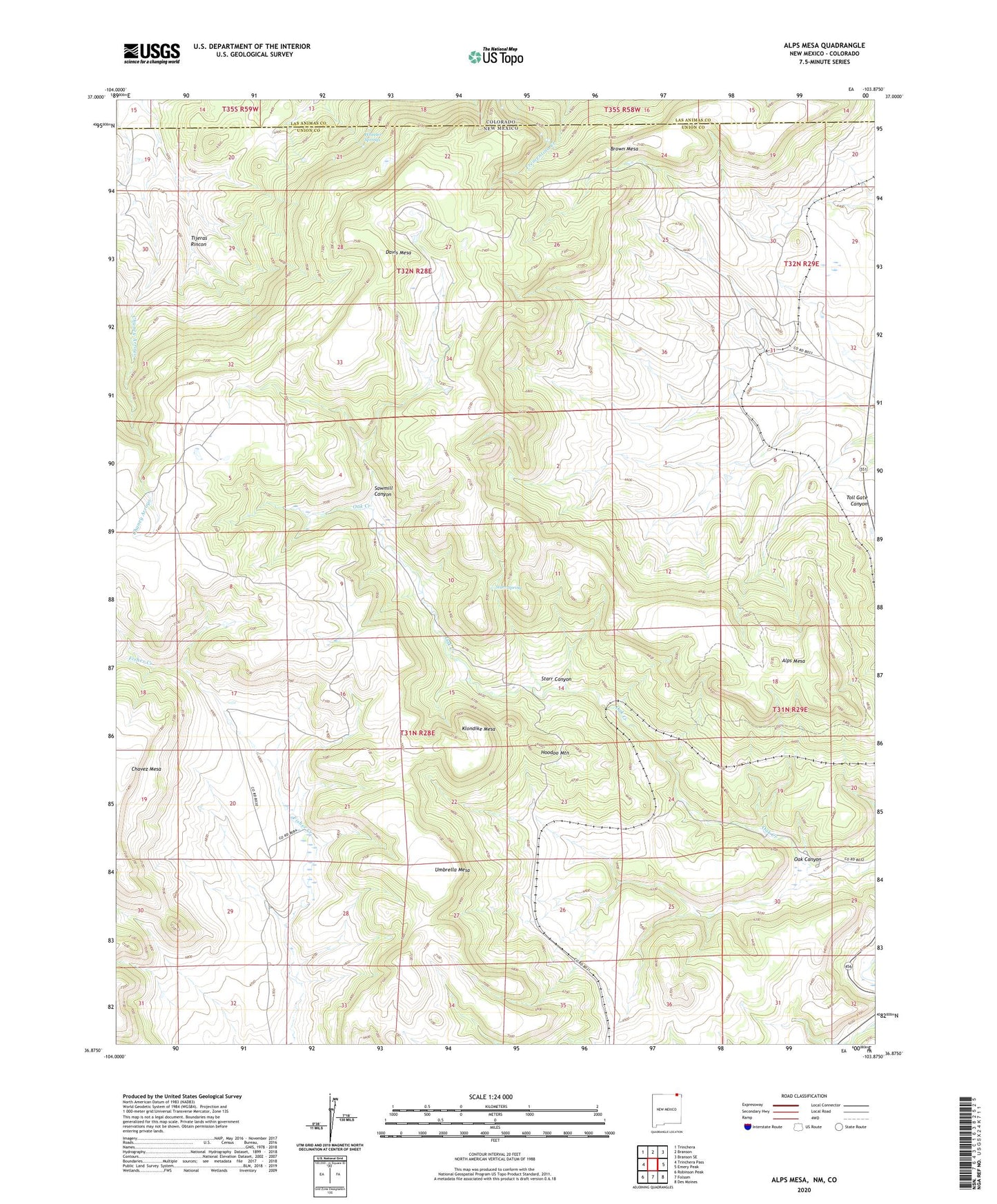
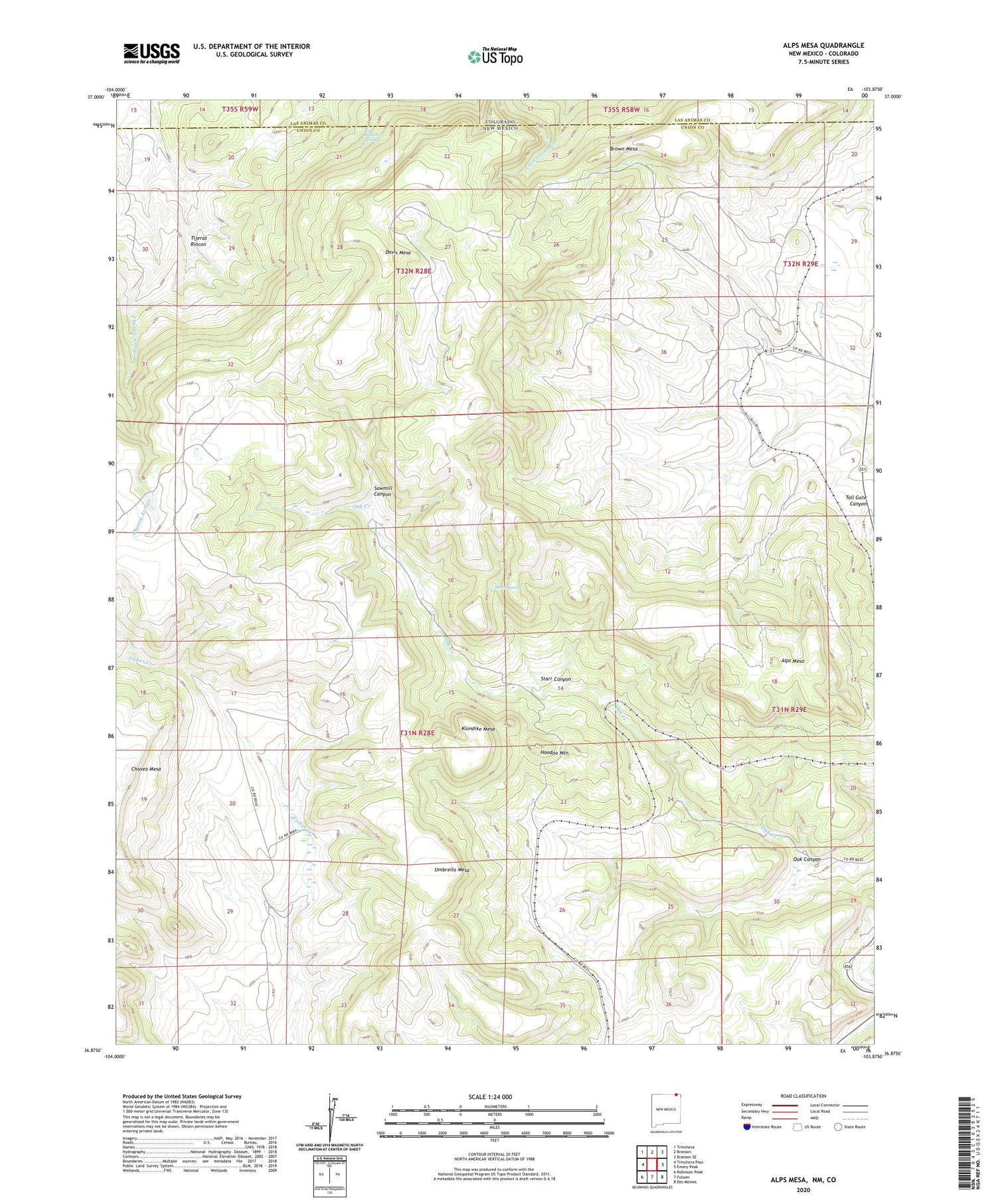
2020 topographic map quadrangle Alps Mesa in the states of New Mexico, Colorado. Scale: 1:24000. Based on the newly updated USGS 7.5' US Topo map series, this map is in the following counties: Union, Las Animas. The map contains contour data, water features, and other items you are used to seeing on USGS maps, but also has updated roads and other features. This is the next generation of topographic maps. Printed on high-quality waterproof paper with UV fade-resistant inks.
Quads adjacent to this one:
West: Trinchera Pass
Northwest: Trinchera
North: Branson
Northeast: Branson SE
East: Emery Peak
Southeast: Des Moines
South: Folsom
Southwest: Robinson Peak
Contains the following named places: 10137 Water Well, Alps Mesa, Brown Mesa, Brown Spring, Chavez Mesa, Davis Mesa, Dougherty, Emery Gap Cemetery, Fisher Park, Hoodoo Mountain, Klondike Mesa, Oak Canyon, San Miguel Mine, Sawmill Canyon, Starr Canyon, Starr Spring, Tijeras Rincon, Umbrella Mesa, Wheeler Springs