MyTopo
Trinchera Colorado US Topo Map
Couldn't load pickup availability
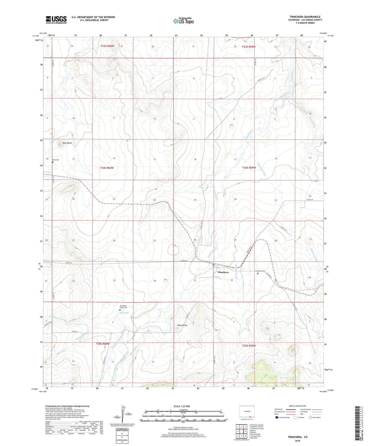
2022 topographic map quadrangle Trinchera in the state of Colorado. Scale: 1:24000. Based on the newly updated USGS 7.5' US Topo map series, this map is in the following counties: Las Animas. The map contains contour data, water features, and other items you are used to seeing on USGS maps, but also has updated roads and other features. This is the next generation of topographic maps. Printed on high-quality waterproof paper with UV fade-resistant inks.
Quads adjacent to this one:
West: Abeyta
Northwest: Patterson Crossing
North: Purgatoire Canyon
Northeast: Trementina Canyon
East: Branson
Southeast: Alps Mesa
South: Trinchera Pass
Southwest: Dale Mountain
This map covers the same area as the classic USGS quad with code o37104a1.
Contains the following named places: Border Ditch, Cadilloso Arroyo, Chaney Arroyo, Doss Arroyo, Hart Ditch, Newcomb Ditch, Nola Butte, Nola Cemetery, Plaza Butte, Rito Azul, Salazar Arroyo, Trinchera, Trinchera Cemetery, Trinchera Company Ditch, Trinchera Plaza, Trinchera Plaza Cemetery, Trinchera Post Office