MyTopo
Trinchera Pass New Mexico US Topo Map
Couldn't load pickup availability
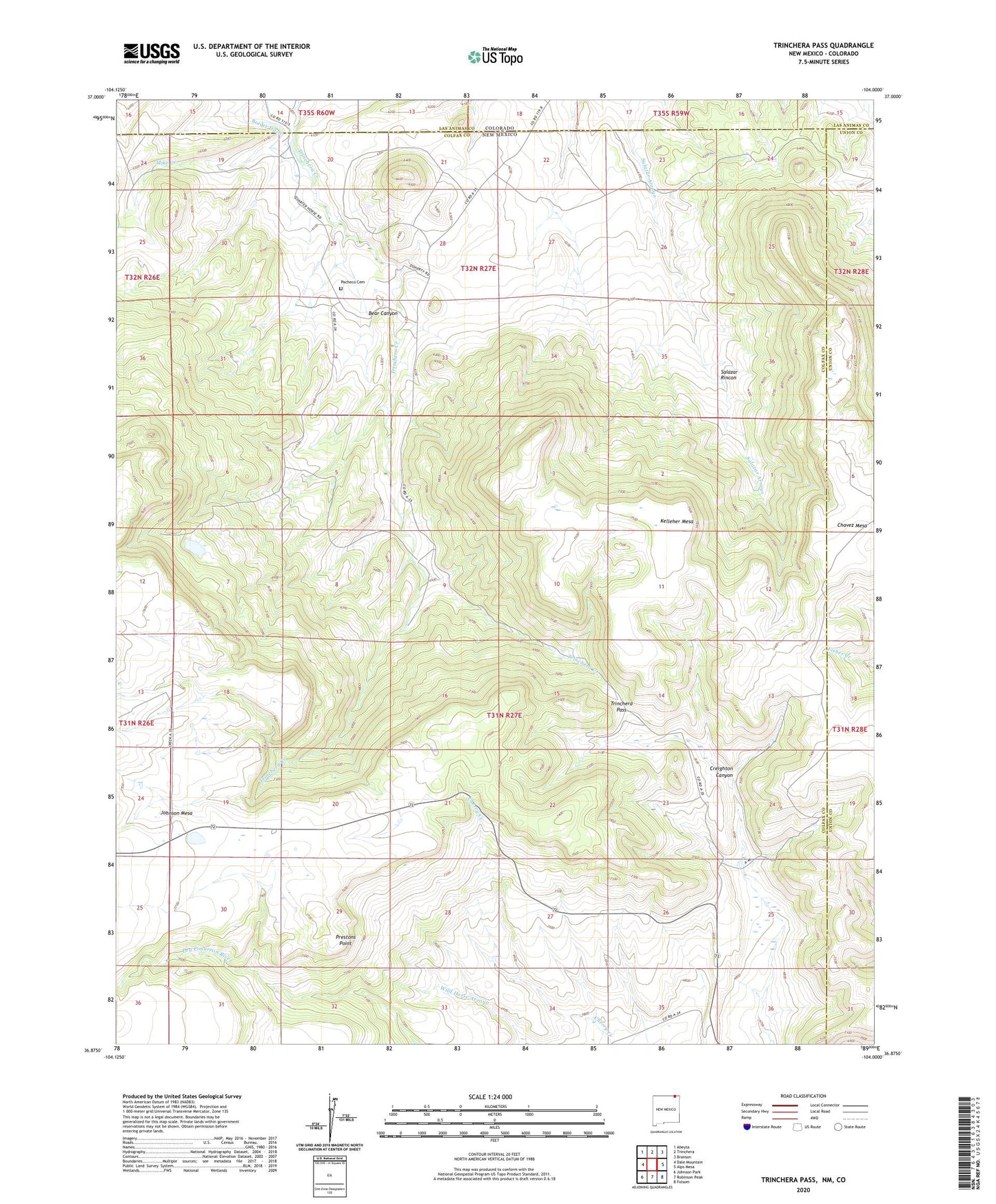
2023 topographic map quadrangle Trinchera Pass in the state of New Mexico. Scale: 1:24000. Based on the newly updated USGS 7.5' US Topo map series, this map is in the following counties: Colfax, Union, Las Animas. The map contains contour data, water features, and other items you are used to seeing on USGS maps, but also has updated roads and other features. This is the next generation of topographic maps. Printed on high-quality waterproof paper with UV fade-resistant inks.
Quads adjacent to this one:
West: Dale Mountain
Northwest: Abeyta
North: Trinchera
Northeast: Branson
East: Alps Mesa
Southeast: Folsom
South: Robinson Peak
Southwest: Johnson Park
This map covers the same area as the classic USGS quad with code o36104h1.
Contains the following named places: Bear Canyon, Border Ditch, Brannon, Creighton Canyon, Doherty, Folsom Archaeological Site Historical Marker, Folsom State Monument, Kelleher Mesa, Mike Creek, Morrow, Ortiz, Pacheco Cemetery, Prestons Point, Salazar Rincon, Trinchera Pass