MyTopo
Antelope Lookout Mesa New Mexico US Topo Map
Couldn't load pickup availability
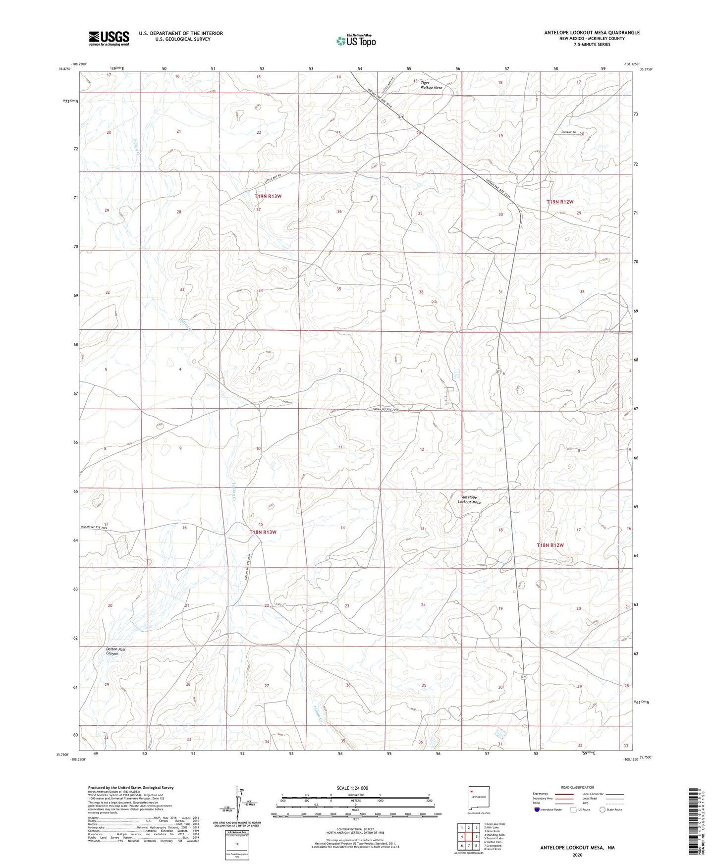
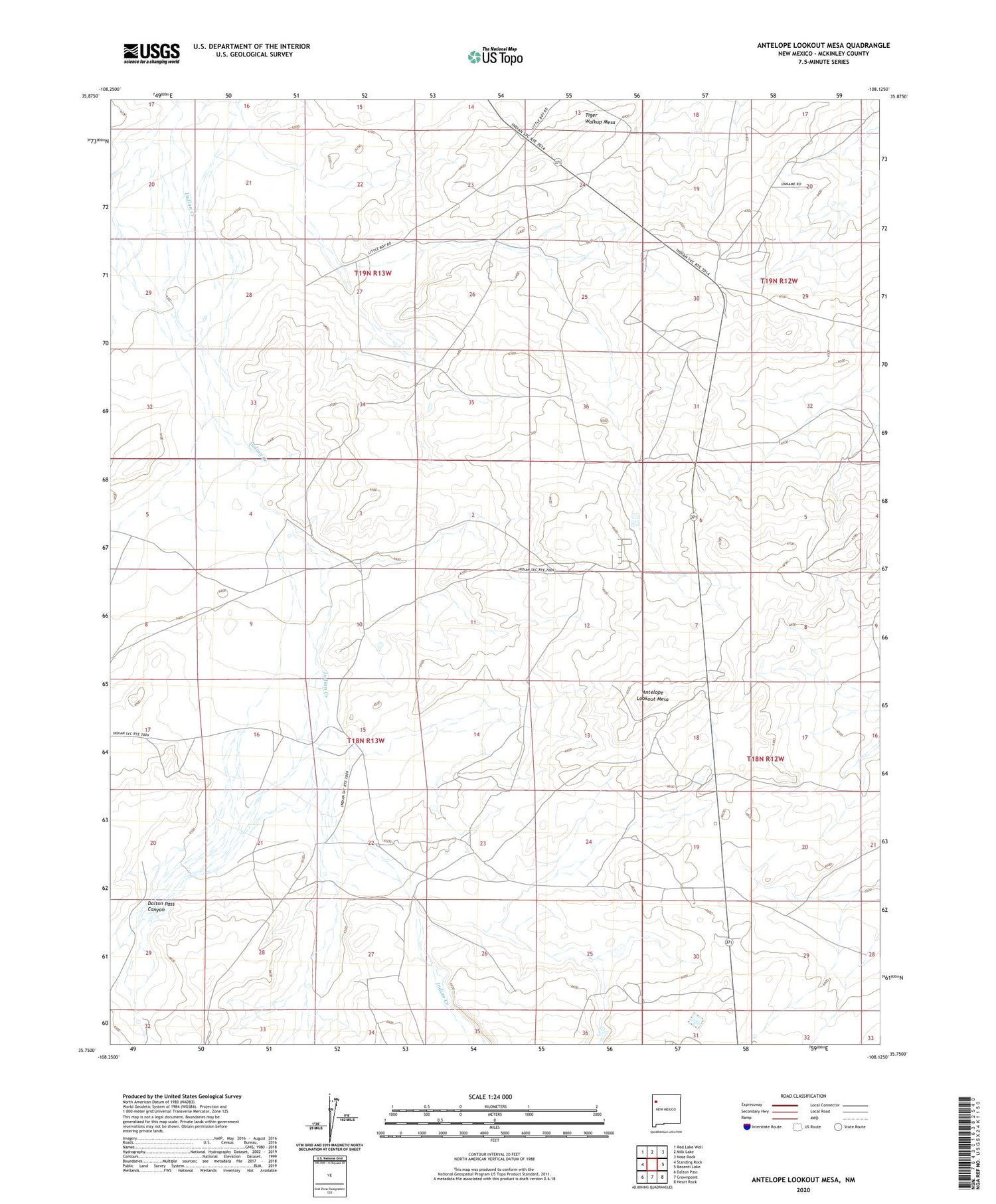
2020 topographic map quadrangle Antelope Lookout Mesa in the state of New Mexico. Scale: 1:24000. Based on the newly updated USGS 7.5' US Topo map series, this map is in the following counties: McKinley. The map contains contour data, water features, and other items you are used to seeing on USGS maps, but also has updated roads and other features. This is the next generation of topographic maps. Printed on high-quality waterproof paper with UV fade-resistant inks.
Quads adjacent to this one:
West: Standing Rock
Northwest: Red Lake Well
North: Milk Lake
Northeast: Nose Rock
East: Becenti Lake
Southeast: Heart Rock
South: Crownpoint
Southwest: Dalton Pass
Contains the following named places: 15K-336 Water Well, 15T-516 Water Well, 15T-544 Water Well, 19-12-32-W3 Water Well, Antelope Lookout Mesa, Becenti Census Designated Place, Becenti Chapter House, Dalton Pass Canyon, SJ-109-S-11 Water Well, SJ-109-S-12 Water Well, SJ-109-S-12-0 Water Well, SJ-109-S-12-0-3 Water Well, SJ-109-S-12-0-4 Water Well, SJ-109-S-3 Water Well, SJ-109-S-9 Water Well, SJ-772 Water Well, SJ-902-0-1 Water Well, SJ-902-0-2 Water Well, SJ-902-0-3 Water Well, Tiger Walkup Mesa