MyTopo
Crownpoint New Mexico US Topo Map
Couldn't load pickup availability
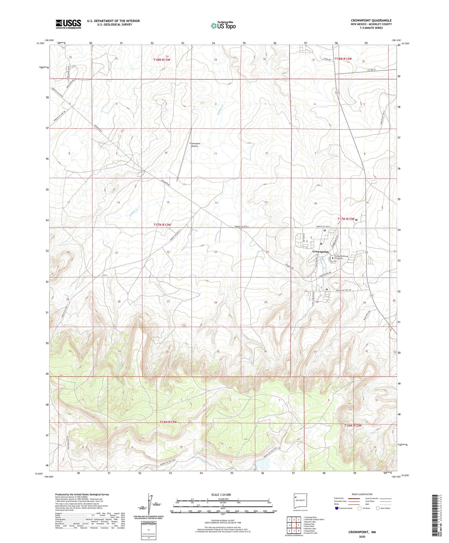
2023 topographic map quadrangle Crownpoint in the state of New Mexico. Scale: 1:24000. Based on the newly updated USGS 7.5' US Topo map series, this map is in the following counties: McKinley. The map contains contour data, water features, and other items you are used to seeing on USGS maps, but also has updated roads and other features. This is the next generation of topographic maps. Printed on high-quality waterproof paper with UV fade-resistant inks.
Quads adjacent to this one:
West: Dalton Pass
Northwest: Standing Rock
North: Antelope Lookout Mesa
Northeast: Becenti Lake
East: Heart Rock
Southeast: Casamero Lake
South: Hosta Butte
Southwest: Mariano Lake
This map covers the same area as the classic USGS quad with code o35108f2.
Contains the following named places: 15R-318A Water Well, 16K-332 Water Well, 320 Water Well, 94-202 Water Well, 9U-279 Water Well, Begay Water Well, BIA PM-5 Water Well, Bible Baptist School, Borrega Pass, Casa de Estrella Site Historic Site, Crownpoint, Crownpoint Airport, Crownpoint Boarding School, Crownpoint Census Designated Place, Crownpoint Chapter, Crownpoint Elementary School, Crownpoint Health Care Facility Hospital, Crownpoint High School, Crownpoint Institute of Technology, Crownpoint Institute of Technology Library, Crownpoint Police Department, Crownpoint Post Office, Crownpoint Volunteer Fire and Rescue, Lake Valley Navajo School, Navajo Nation Emergency Medical Services - Crownpoint Field Office, NTUA 1 Water Well, NTUA Number 2 Water Well, PM-3 Water Well, Pueblo Pintado City Ambulance Service, Saint Paul Church, SJ-1361 Water Well, SJ-823 Water Well, SJ-936 Water Well, Tsc'ii'ahi Community School, United States Public Health Science Indian Hospital Library