MyTopo
Dalton Pass New Mexico US Topo Map
Couldn't load pickup availability
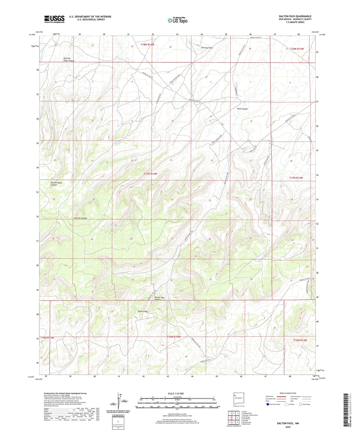
2023 topographic map quadrangle Dalton Pass in the state of New Mexico. Scale: 1:24000. Based on the newly updated USGS 7.5' US Topo map series, this map is in the following counties: McKinley. The map contains contour data, water features, and other items you are used to seeing on USGS maps, but also has updated roads and other features. This is the next generation of topographic maps. Printed on high-quality waterproof paper with UV fade-resistant inks.
Quads adjacent to this one:
West: Oak Spring
Northwest: Toyee
North: Standing Rock
Northeast: Antelope Lookout Mesa
East: Crownpoint
Southeast: Hosta Butte
South: Mariano Lake
Southwest: Pinedale
This map covers the same area as the classic USGS quad with code o35108f3.
Contains the following named places: 12T-538 Water Well, 15B-2 Water Well, 15T-545 Water Well, 16T-592 Water Well, Burned Water Well, Dalton Pass, Dalton Pass Chapter House, Dalton Pass Historic Site, Dalton Pass Spring, Dalton Pass Trading Post, Flat Top Hill, JWC-2 Water Well, KD-3 Water Well, Nahodishgish Chapter, Nahodishgish Chapter House, NR 105.034X0150 Water Well, Rock Canyon, Shillingburg, Shillingburg Mine, Tol Dohn Spring, Tol-Dohn Spring