MyTopo
Bellview New Mexico US Topo Map
Couldn't load pickup availability
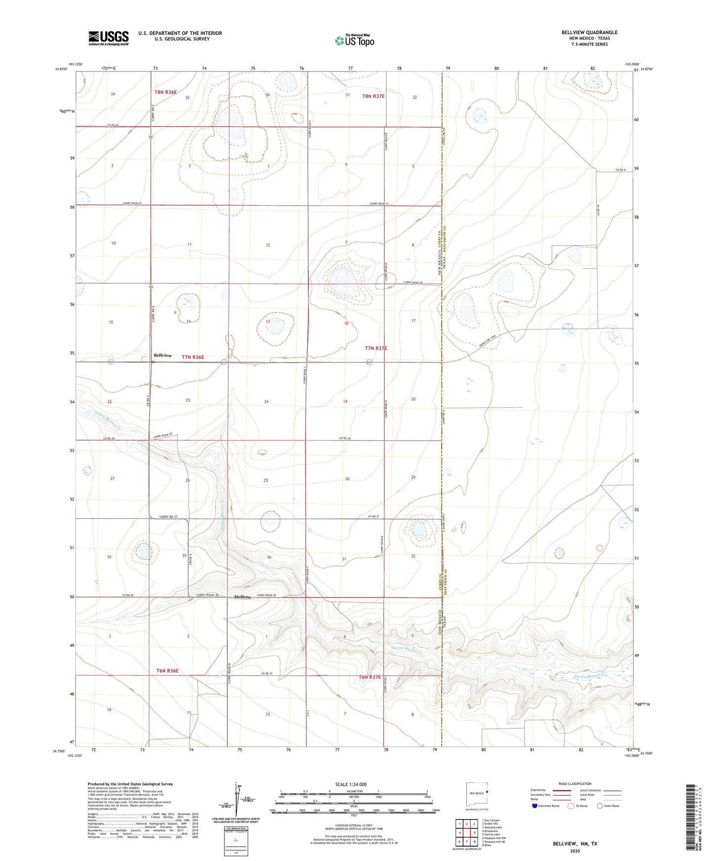
2023 topographic map quadrangle Bellview in the state of New Mexico. Scale: 1:24000. Based on the newly updated USGS 7.5' US Topo map series, this map is in the following counties: Curry, Deaf Smith. The map contains contour data, water features, and other items you are used to seeing on USGS maps, but also has updated roads and other features. This is the next generation of topographic maps. Printed on high-quality waterproof paper with UV fade-resistant inks.
Quads adjacent to this one:
West: Broadview
Northwest: Day Canyon
North: Endee Hill
Northeast: Mustang Lake
East: Garcia Lake
Southeast: Rhea
South: Pleasant Hill NE
Southwest: Pleasant Hill NW
Contains the following named places: 10102 Water Well, 10103 Water Well, 10211 Water Well, 10228 Water Well, 10229 Water Well, 10231 Water Well, 10232 Water Well, 10233 Water Well, 10234 Water Well, 10252 Water Well, 10755 Water Well, 10912 Water Well, 10927 Water Well, 10929 Water Well, 10930 Water Well, 10932 Water Well, 10933 Water Well, 10934 Water Well, 10935 Water Well, 11450 Water Well, 11451 Water Well, 11452 Water Well, 11463 Water Well, 11464 Water Well, 11479 Water Well, 11489 Water Well, 11547 Water Well, 11548 Water Well, Bellview, Bellview Post Office, Hollene, Hollene Post Office, Mitchell Farms Airport, Tierra Blanca Creek