MyTopo
Fort Sumner East New Mexico US Topo Map
Couldn't load pickup availability
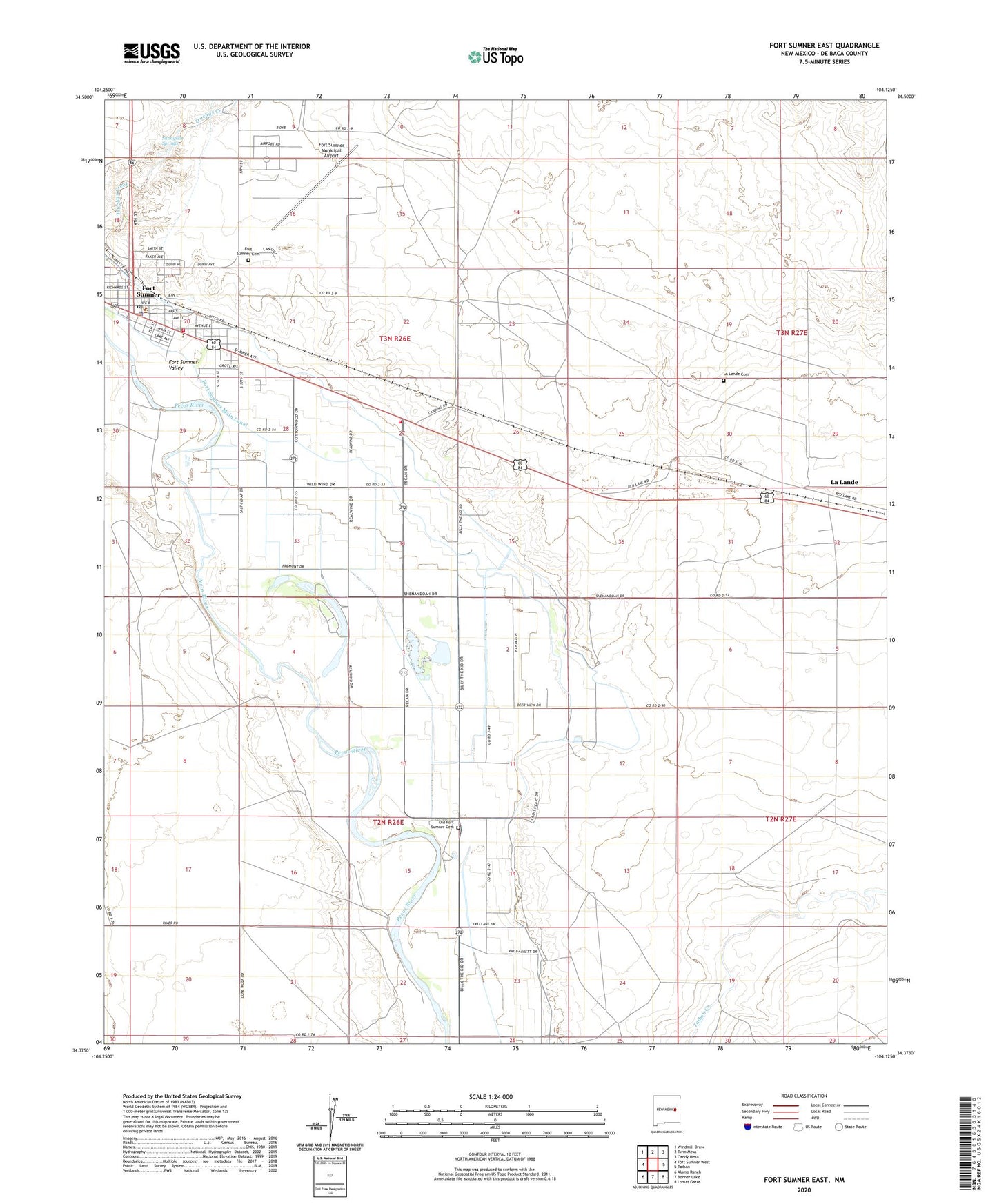
2023 topographic map quadrangle Fort Sumner East in the state of New Mexico. Scale: 1:24000. Based on the newly updated USGS 7.5' US Topo map series, this map is in the following counties: De Baca. The map contains contour data, water features, and other items you are used to seeing on USGS maps, but also has updated roads and other features. This is the next generation of topographic maps. Printed on high-quality waterproof paper with UV fade-resistant inks.
Quads adjacent to this one:
West: Fort Sumner West
Northwest: Windmill Draw
North: Twin Mesa
Northeast: Candy Mesa
East: Taiban
Southeast: Lomas Gatos
South: Bonner Lake
Southwest: Alamo Ranch
This map covers the same area as the classic USGS quad with code o34104d2.
Contains the following named places: Billy the Kid Museum, Christ Full Gospel Church, Church of Christ, De Baca County Sheriff's Office, De Baca General Hospital, Early Spanish Route Historical Marker, First Assembly of God Church, First Baptist Church, Fort Sumner, Fort Sumner Army Air Field, Fort Sumner Cemetery, Fort Sumner Church of Christ, Fort Sumner Elementary School, Fort Sumner High School, Fort Sumner Historical Marker, Fort Sumner Main Canal, Fort Sumner Middle School, Fort Sumner Municipal Airport, Fort Sumner Pit, Fort Sumner Post Office, Fort Sumner Public Library, Fort Sumner State Monument, Fort Sumner State Monument Historical Marker, Fort Sumner Volunteer Fire Department and Ambulance, Fort Sumner Weather Station, Kingdom Hall, La Lande, La Lande Cemetery, La Lande Post Office, Nazarene Church, Old Fort Sumner Cemetery, Rodrick Drug Store Historic Site, Saint Anthony Catholic Church, Saint Johns Episcopal Church, Sunnyside Springs, Valley Volunteer Fire Department, Village of Fort Sumner