MyTopo
Carracas Canyon New Mexico US Topo Map
Couldn't load pickup availability
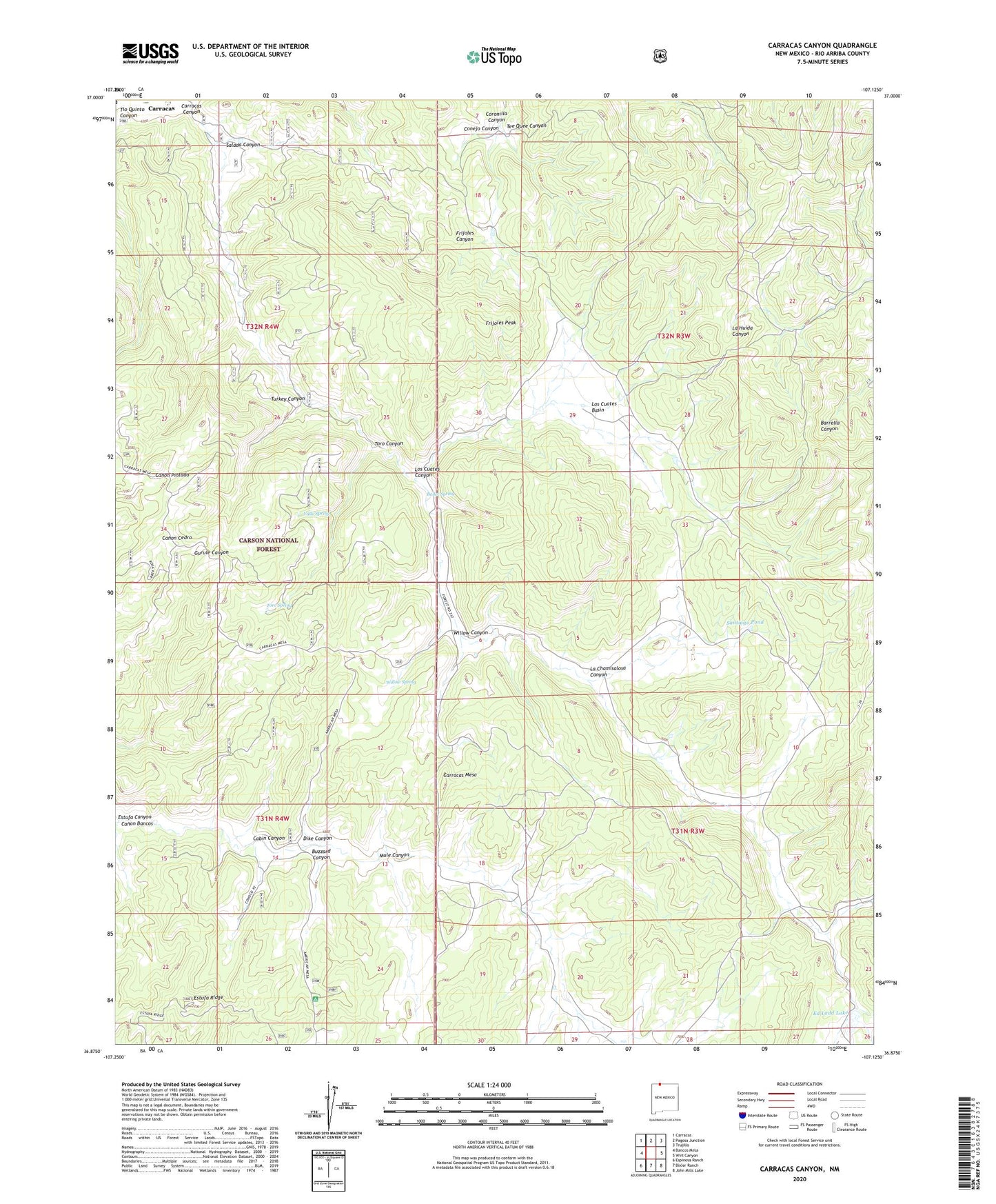
2020 topographic map quadrangle Carracas Canyon in the state of New Mexico. Scale: 1:24000. Based on the newly updated USGS 7.5' US Topo map series, this map is in the following counties: Rio Arriba. The map contains contour data, water features, and other items you are used to seeing on USGS maps, but also has updated roads and other features. This is the next generation of topographic maps. Printed on high-quality waterproof paper with UV fade-resistant inks.
Quads adjacent to this one:
West: Bancos Mesa
Northwest: Carracas
North: Pagosa Junction
Northeast: Trujillo
East: Wirt Canyon
Southeast: John Mills Lake
South: Bixler Ranch
Southwest: Espinosa Ranch
Contains the following named places: Bancos Pits, Boiler Spring, Buzzard Canyon, Buzzard Park Campground, Cabin Canyon, Carracas, Carracas Canyon, Carracas Mesa, Coronilla Canyon, Dike Canyon, Ed Ladd Lake, Estufa Canyon, Estufa Ridge, Frijoles Peak, Grosbeck Tank, La Chamisalosa Canyon, La Huida Canyon, Los Cuates Basin, Los Cuates Canyon, Los Cuates Pond, Mule Canyon, Mule Tank, Salada Canyon, Santiago Pond, Tee Quee Canyon, Toro Canyon, Toro Spring, Turkey Canyon, Vallo Spring, Willow Canyon, Willow Spring