MyTopo
Wirt Canyon New Mexico US Topo Map
Couldn't load pickup availability
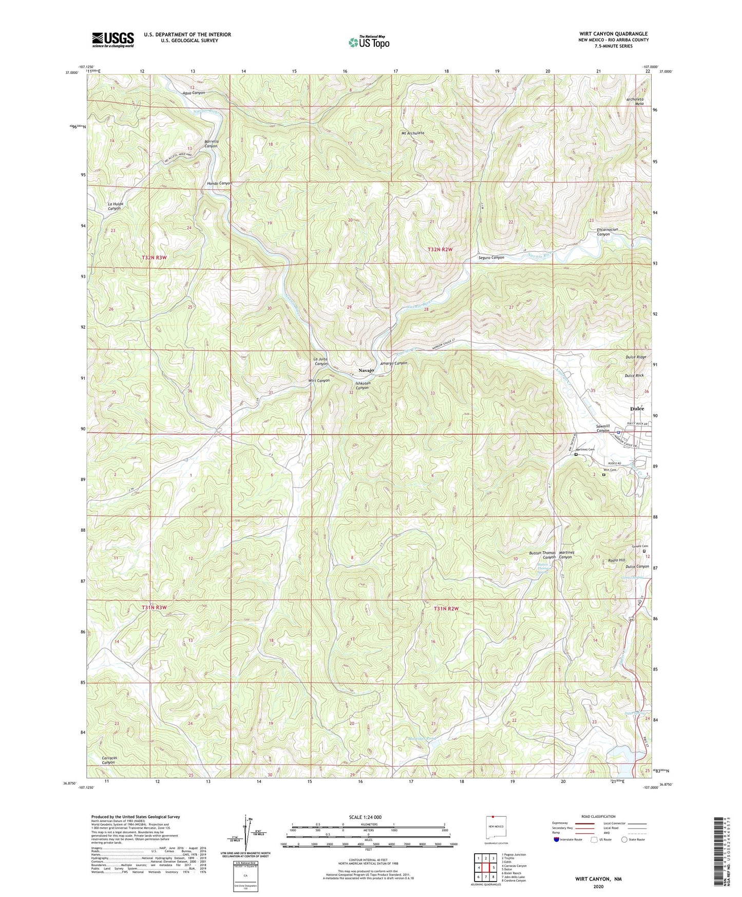
2023 topographic map quadrangle Wirt Canyon in the state of New Mexico. Scale: 1:24000. Based on the newly updated USGS 7.5' US Topo map series, this map is in the following counties: Rio Arriba. The map contains contour data, water features, and other items you are used to seeing on USGS maps, but also has updated roads and other features. This is the next generation of topographic maps. Printed on high-quality waterproof paper with UV fade-resistant inks.
Quads adjacent to this one:
West: Carracas Canyon
Northwest: Pagosa Junction
North: Trujillo
Northeast: Edith
East: Dulce
Southeast: Cordova Canyon
South: John Mills Lake
Southwest: Bixler Ranch
This map covers the same area as the classic USGS quad with code o36107h1.
Contains the following named places: Agua Canyon, Amargo Canyon, Amargo Creek, Barrella Canyon, Button Thomas Canyon, Button Thomas Spring, Dulce Census Designated Place, Dulce Creek, Dulce Lake Dam, Dulce Ridge, Dulce Rock, Dulce Spring, Encarnacion Canyon, Gomez Cemetery, Gomez Spring, Hondo Canyon, Ishkoten Canyon, Jicarilla Apache Nation Police Department, Jicarilla Emergency Medical Services, La Juita Canyon, Martinez Canyon, Martinez Cemetery, Martinez Pond, Mount Archuleta, Navajo, Navajo Pine High School, Radio Hill, Saint Berard Parish, Sawmill Canyon, Seguro Canyon, Wirt Canyon, Wirt Cemetery