MyTopo
Carson New Mexico US Topo Map
Couldn't load pickup availability
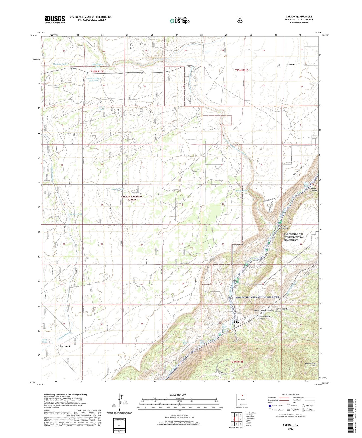
2020 topographic map quadrangle Carson in the state of New Mexico. Scale: 1:24000. Based on the newly updated USGS 7.5' US Topo map series, this map is in the following counties: Taos. The map contains contour data, water features, and other items you are used to seeing on USGS maps, but also has updated roads and other features. This is the next generation of topographic maps. Printed on high-quality waterproof paper with UV fade-resistant inks.
Quads adjacent to this one:
West: Taos Junction
Northwest: Servilleta Plaza
North: Tres Orejas
Northeast: Los Cordovas
East: Taos SW
Southeast: Penasco
South: Trampas
Southwest: Velarde
Contains the following named places: 10046 Water Well, Agua Caliente Canyon, Alberts Falls Rapid, Arroyo Aguaje de la Petaca, Arroyo Hondo, Arroyo Noria, Ashbury Arroyo, Barnett Well, Barranca, Bismuth Prospect, Blue Feather Claims, Bryd Tank, Carson, Carson Post Office, Carson School Historic Site, Clarkson Tank, Drake Ranch, Gaging Station Rapid, Hartig Tank, Mondragon Tank, Montosa Tank, Piedra Lumbre Canyon, Pilar, Pilar Historical Marker, Pilar Post Office, Pillar Prospects, Pueblo Revolt Tricentennial Historical Marker, Rio Grande Gorge State Park, Rito Cieneguilla, Sandy Tank, Scott Arroyo, Section Thirty-five Tank, The Karmic Wave Rapid, The Narrows Rapid, Tierra Amarilla Canyon, Vasquez de Coronados Route Historical Marker