MyTopo
Los Cordovas New Mexico US Topo Map
Couldn't load pickup availability
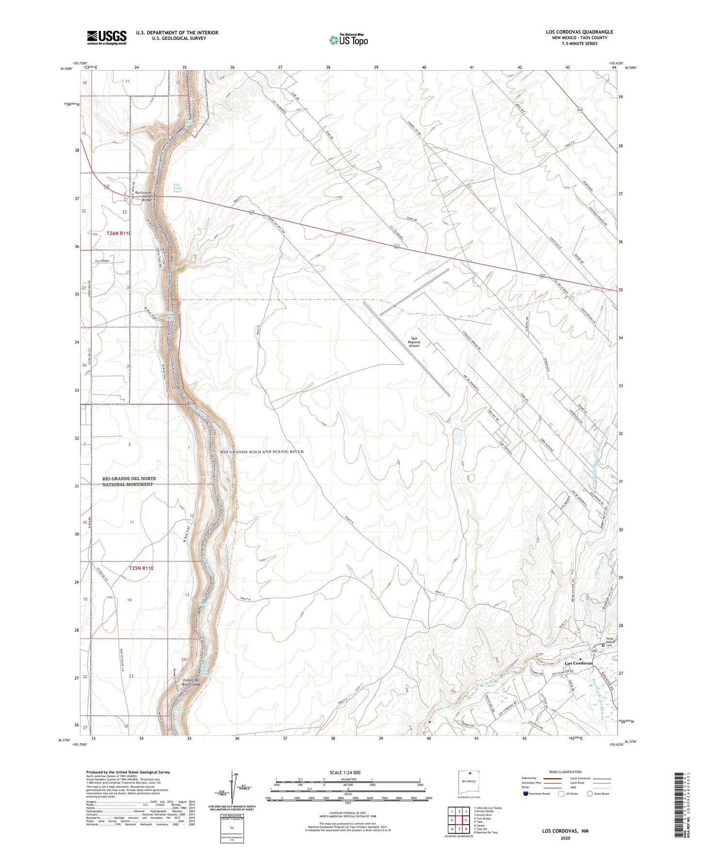
2023 topographic map quadrangle Los Cordovas in the state of New Mexico. Scale: 1:24000. Based on the newly updated USGS 7.5' US Topo map series, this map is in the following counties: Taos. The map contains contour data, water features, and other items you are used to seeing on USGS maps, but also has updated roads and other features. This is the next generation of topographic maps. Printed on high-quality waterproof paper with UV fade-resistant inks.
Quads adjacent to this one:
West: Tres Orejas
Northwest: Cerro De Los Taoses
North: Arroyo Hondo
Northeast: Arroyo Seco
East: Taos
Southeast: Ranchos De Taos
South: Taos SW
Southwest: Carson
This map covers the same area as the classic USGS quad with code o36105d6.
Contains the following named places: Airport Water Well, Arroyo Seco, Dead Car Rapid, High Bridge Rapid, Los Cordovas, Penas Negras Cemetery, Power Line Falls Rapid, RG-35518 Water Well, Rio Gorge Water Well, Rio Grande del Rancho, Rio Grande Gorge Bridge, Rio Grande Gorge Historical Marker, Rio Grande Placer District, Rock Garden, San Ysidro Oratorio, Ski Jump Rapid, Taos Regional Airport, Tract A Taos Pueblo, Tract B Taos Pueblo, Yellow Bank Rapid